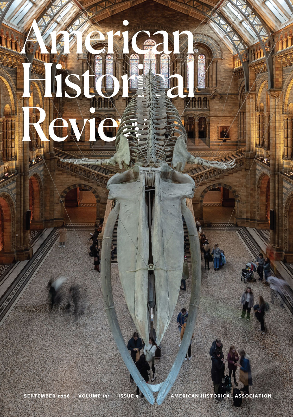
I am delighted to see published my edited collection of essays, “Reading Nature’s Archives” in the September 2026 issue of the American Historical Review, for U.S.-based historians this is one of our oldest and top journals. I’m especially delighted with their use of the cover image that I found with help from Ryan Tucker-Jones who has co-authored a piece in the collection.
This collection started from an invitation from AHR Editor and fellow Vietnamologist Mark Bradley, who invited me to pitch an idea for a HistoryLab project. It took me about five seconds to pitch Reading Nature’s Archives which pretty much sums up my main interest and passion in academia: green thought. What is green thought? That’s a long one, but a short explanation is what Latour and Haraway describe as “material-semiotics” — in general, a greater awareness for the ways human life, dreams, politics and projects are interconnected with the material world–from quantum interactions to cellular metabolism, to ecosystem inter-relationships to cosmic relations.
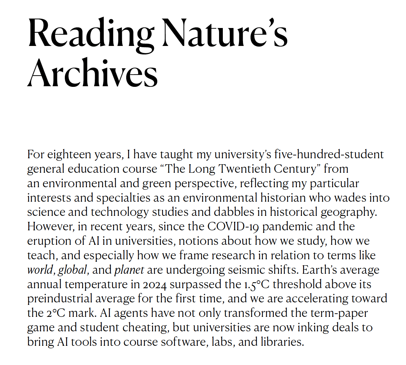
There are a couple of things I’d like to highlight from the piece before getting to my contribution on intervisuality and reading conflict landscapes. First, I think the opening to the collection worked out well so I’ll include it here — why a new sort of history research, new kinds of archives?
And I continue: “Many may be rightly concerned that the present moment is a crisis of colliding phenomena with long histories entangled in colonialism, revolutions, wars, and social movements; but the present moment is also a profound opportunity. Historians, students, and teachers alike are taking deep dives into questions like “What’s special about the human experience?” and “With all the recent scientific discoveries showing how our genes, our biology, and our futures are connected with industrial, geologic, and biological processes, how do we understand the human experience as it’s embedded in so many natural and industrial processes ranging from subatomic planes to the cosmos?” This spring, I took a di!erent tack with my gen-ed class. I renamed it “Planetary Consciousness,” and after raising big questions about planetary entanglement and showing clips of debates like Joe Rogan’s interview with Jensen Huang on AI and consciousness, I introduced into our coursework five-minute meditations, journaling, a collective read-in, and other experiential encounters that challenge students to roam the boundaries between what’s human—experience, feeling, consciousness—and what’s AI, digital, or even “planetary.” We tackled snippets of philosophy, and after the midterm, students wrote their own “planetary family histories” with a little help from novelist Imbolo Mbue, whose novel about multiple generations coping with tragedy in an oil-polluted African river delta is a planetary tragedy of operatic proportions.“
In short, I think what we need, as humans who are story-telling animals who use past experiences to make sense of the present and prepare for the future, are new stories that will inevitably draw from new archives.
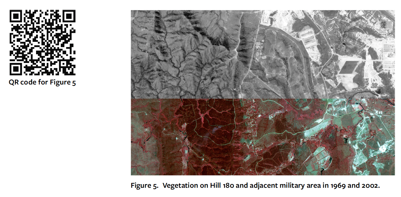
I am also very happy with my piece in the collection “Reading Conflict Landscapes: Aerial Imagery, Ground-Truthing, and Intervisuality in Vietnam.” One thing I struggled with in my book Footprints of War was finding a way to show imagery — maps, air photos, etc. — in it’s full-resolution glory. Print books typically work wth images in the 10x15cm range at 600 dpi. It is very difficult to give readers access to a full-resolution, full-scale image. However, by using qr codes linked to images stored on this website, I am able to maintain the full-resolution images while the online and print versions of the journal use down-sampled images.
I am also able to include widgets like sliders that allow active intervisual comparisons! Academics: your personal website can directly support traditional print publications. This was a revelation to me.
The whole collection is fantastic, and I encourage visitors to this site to download the pdf and read them. It was tremendously fun coordinating and working with the contributors, and we had a great two-panel series at the recent AHA meeting in Chicago.
Historians and history journals love anniversaries, and for those born in my gen (X), we’re approaching 50 years since the fall of Phnom Penh (April 17) and Saigon (April 30) — the end of the Vietnam War. The American Historical Review has just published its March 2025 issue (possibly behind their paywall–subscribe!), with a stunning cover featuring an animated photo restoration of a northern Vietnamese soldier’s portrait and an amazing HistoryLab collection with essays on Teaching the Vietnam War and this incredible playlist of Vietnamese pop music from the war by Jason Gibbs, a music historian of Vietnam and a librarian at San Francisco Public Library. I attach my piece “The Kaleidoscopic Approach: Researching and Writing Full-Spectrum Experiences of War with Texas Tech’s Virtual Vietnam Archives.”
Growing up as kids, we never really question how history made the circumstances of war or shaped the social landscapes of childhood — playing war in dirt lots, shooting guns made of sticks, being “good guys” and figuring out who were the “bad guys;” only decades later, reflecting back, do I think about those childhood friends, and also strangers from Asia, new kids on the bus, who later showed up in college classrooms at the University of North Carolina, also new streams of Amerasians, Hmong and other refugees that via help from church groups like Lutheran Family Services settled around Raleigh, Durham and Fayetteville (Fayette-nam) when I was in college. My own family, a Go Navy! family, was only minimally impacted by the war in Vietnam, an uncle who served in Vung Tau, Dad served on boats offshore with transits through Yokosuska and photoslides from a brief shore leave in Bangkok — all happened when I was a wee baby. I volunteered to teach English in Vietnam with the amazing nonprofit Volunteers in Asia in 1993 with the same general enthusiasm most of my gen had for exploring the now-open Socialist bloc — how exciting, and how wonderful that we were in our 20s, young, and had not been incinerated in a nuclear war. The world, at least for us in that moment, seemed to be coming together and opening to new possibilities. Then came 9/11, wars in the Middle East, and … well, we got older, and the world ground on.
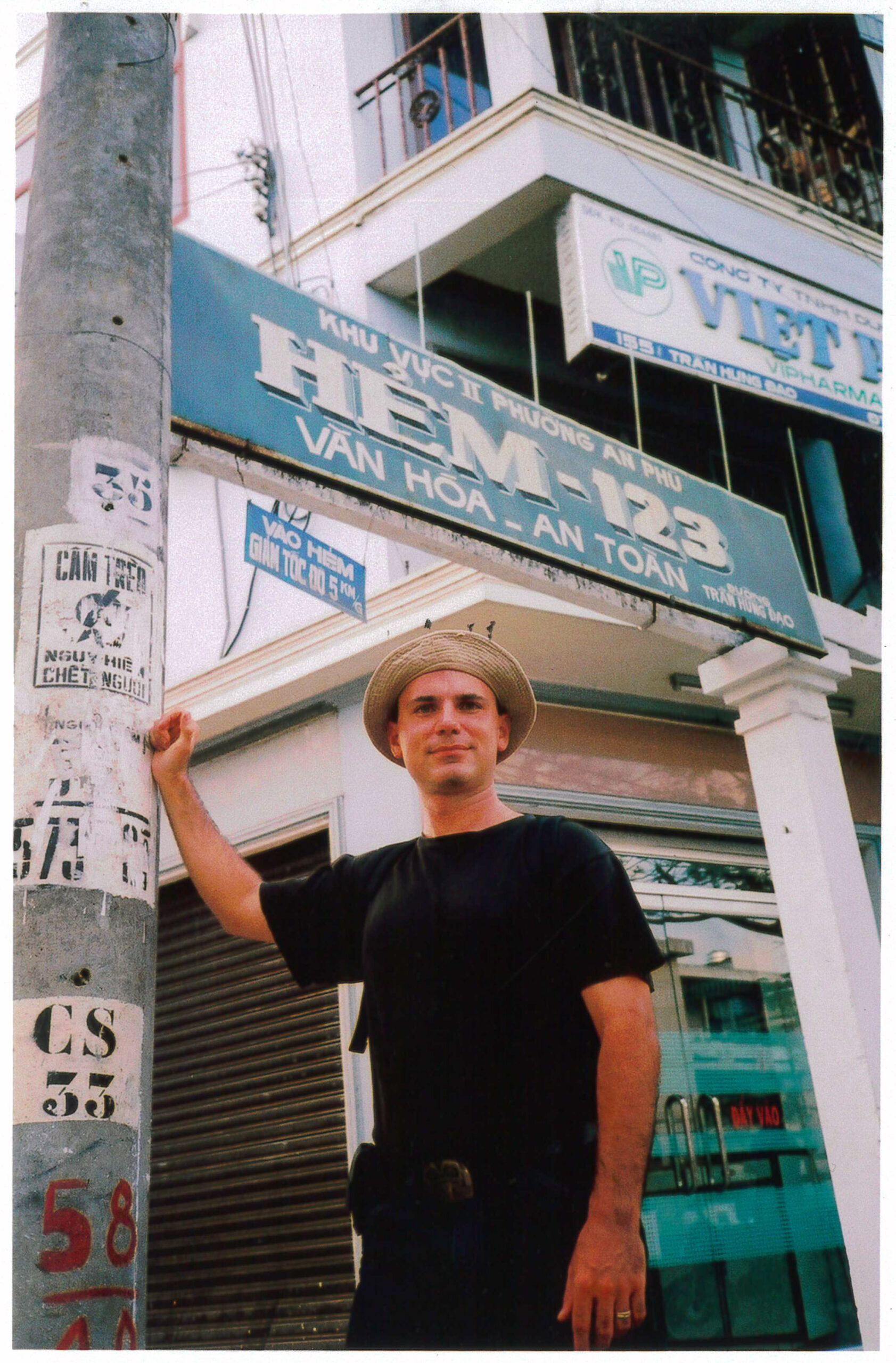
Alley 123 in Can Tho, 2001, “Cultured – Safe” – I rented a little house here with Hong Anh while doing dissertation research 2001-02.
Since 2004, I’ve had the privilege of teaching students in Riverside, CA, and every other year I teach “The Vietnam Wars” where I encounter so many children whose lives, many more directly than mine, were touched by the war. It’s not unusual for a 40-student class to have students of Vietnamese, Cambodian, Lao, Hmong, Chinese-Vietnamese, Chinese-Cambodian, Chinese, Russian, Filipino and other backgrounds with parents (and now grandparents) who experienced the Vietnam War. UC Riverside is one of the most ethnically diverse campuses in the U.S., and we’re a 30-minute drive from Little Saigon.
Respect to the military and diplomatic historians out there who parse the “lessons” of the war in these specific terms, but I tell my students at the outset I really don’t know how to teach “war.” Instead, the course deals with exploring Vietnamese experiences under colonial rule, post-1945 decolonization, and in the civil conflicts and differing ideas of an independent Vietnam that led to the fighting in the 1960s and have had repercussions ever since. I’m also interested in students, especially those with connections, explore the war in connection to their elders’ lived experiences. This might include the war’s impacts in Laos and Cambodia, the bases in Thailand, Korean forces in Vietnam or any number of other projects. And one online archive, Texas Tech’s Virtual Vietnam Archives, is a treasure trove of materials. The Kaleidoscope piece explains how I do it.
I’m wrapping up a six month Fulbright Scholar Fellowship in Penang where I have been hosted by the History Section at Universiti Sains Malaysia. Upon settling in, a staffer in the dean’s office told me I was in the very same office they gave to Professor Barbara Andaya, author of many books including a famous one on Perak and one of my all time professor-heroes; so from the beginning things got off to a great start. My project here is a departure of sorts from a career spent studying environmental history in Vietnam: undertaking a comparative study of urban waterfronts in Southeast Asia. The thing about doing this sort of “nerd” (academic) research — and what I deeply respect and love — is that it requires the researcher to go deep, visiting unusual places, listening to stories, reading unusual stuff.
Studying a new place in this way means learning new languages (Malay, also Chinese), building new institutional partnerships, and being the naive grad student again — thinking you know something only to be completely bewildered (or amazed) (or both) by what you find. Very briefly, I’m interested in Southeast Asia’s urban waterfronts because they are vital to the economic future of the region, most were just swamps 150 years ago, and today most are threatened by increasing sea levels. Several scientific (but alarmist) studies show that Southeast Asian cities will face the greatest challenge in terms of land loss and relocating millions.
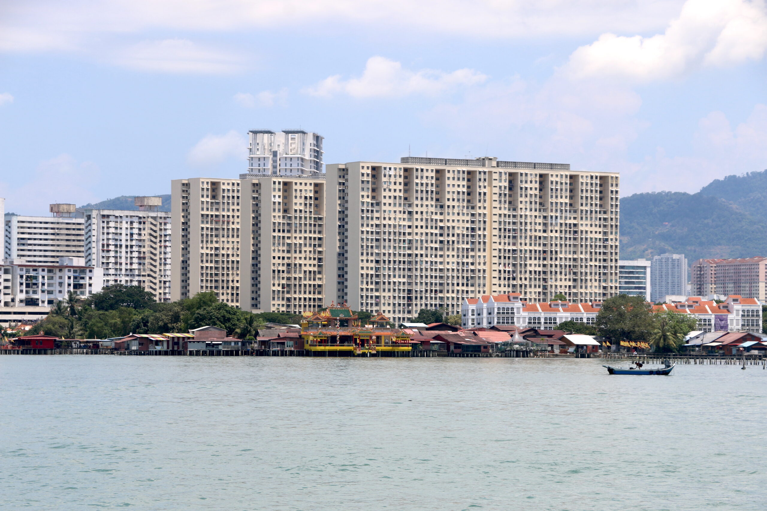
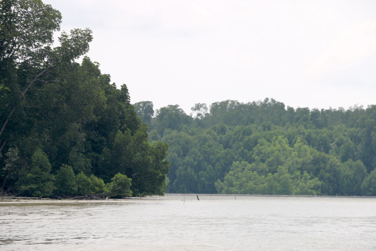
It’s true there is concern in the region about rising sea levels, but I think what people far off (including me) forget about places like Vietnam and Malaysia is that millions of people have been living on the water’s edge — and I mean living in homes on piers just above the high tide mark — for centuries. Here’s a view of one such waterfront in George Town (Penang) with it’s fringe of jetties and behind them are some of the first public housing tenements built on reclaimed mangrove forest.
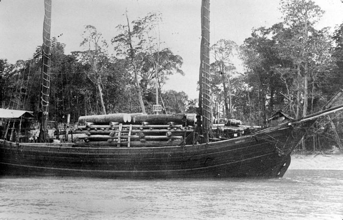
Another thing that’s important when we think about “shorelines” is that for centuries these have been subject to modification; and for people with in-between legal status or limited job prospects, frequently these movable shorelines are the only place one can call home. This particular stretch of George Town’s waterfront is called Weld Quay and it was the industrial/business end of the waterfront. This is where thousands of mostly Chinese and Indian migrant shore laborers lived in the early 1900s as George Town was booming with the tin trade. Larger cargo ships anchored offshore while hundreds of “tongkang” boats carried raw materials like iron or tin ore, charcoal, food and timber in and processed goods out. (This historical image is courtesy of the Tropenmuseum in Amsterdam.)
While many of these vessels around Penang were crewed by Chinese sailors, the origin of the name is not Chinese but Malay and the boat style dates back several centuries, as a bělongkang. In English they were called “lighters” and their job was to “light” the cargo from docs to ships or vice versa.
I’m interested in waterfronts like Weld Quay because they represent the major center where carbon fuels (charcoal, later coal and petroleum but also food to energize thousands of laborers) entered the city.
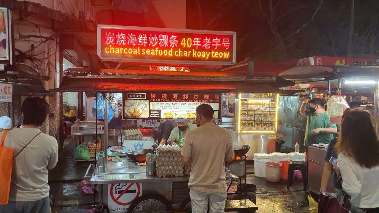
Even today, in the Weld Quay area, some of the most delicious street food, like charcoal cooked Char Koay Teow is served. Penang is a food mecca on Earth!
So my research around Penang has taken me to sources of the city’s carbon — until as late as 1950, it was NOT coal, NOT petroleum but mainly CHARCOAL – specifically pyrolized mangrove trees. How did a city of 500,000 in the mid-20th century get by without gasoline? Of course they had it, but personal motorbikes and cars were rare. There was abundant petroleum in Penang because it sits across the Straits of Malacca from major offshore oilfields in Medan and Pekanbaru (Sumatra). But the city’s largest industries — tin smelters — didn’t use petroleum or coal (too much sulfur) but charcoal for their blast furnaces. So my study in Penang has been focused on charcoal and more generally on biofuels in SE Asia.
And it turns out a lot of early Southeast Asian cities used charcoal because it was easily floated to port and came from a convenient coastal wood source: mangroves.
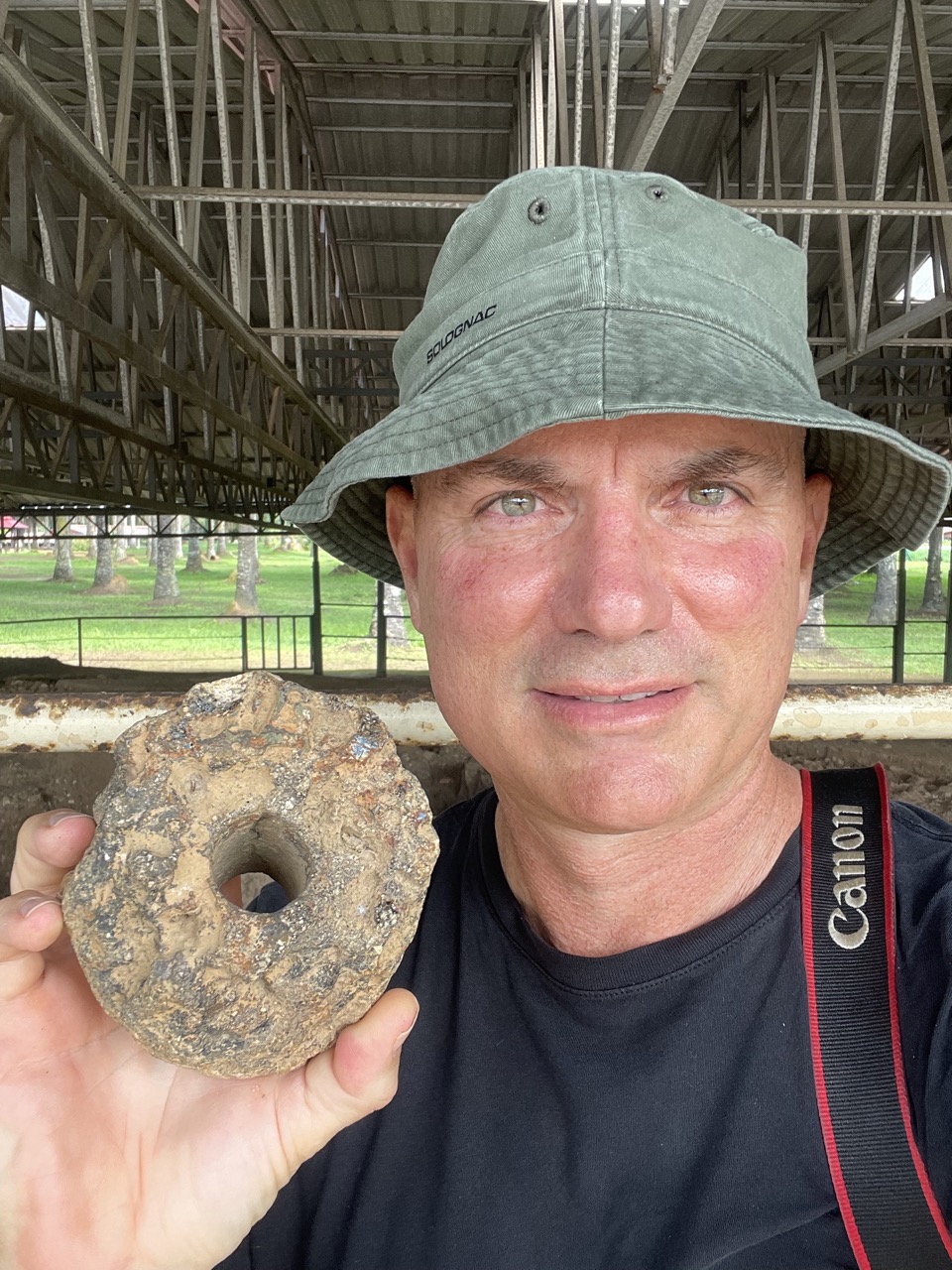
Making charcoal from “bakau” is actually a very ancient practice. On the Malay Peninsula just north of Penang is an archeological site “Sungan Batu” where brick jetties stretched out into a mangrove area and furnaces smelted iron into ingots for export. This is an ancient tuyere – an air pipe that funneled air into an ancient furnace heated by hot charcoal to keep the temperature high enough for smelting.
Archeologists debate when people here were smelting iron, but a safe guess is about the 5th century CE, and the people here exported iron ingots (used by blacksmiths to make tools) along with other stuff – glass beads, ceramics, probably aromatic woods like agarwood – in the ancient India – China sea trades. When we look at the brick terraces and jetties from then, we can see, all around them, are mangrove trees. This association of coastal cities in Southeast Asia with these incredibly vibrant, tropical coastal ecosystems has continued from the earliest historic era right down to the present.
When we think about modern cities, their formation, and problems associated with the carbon cycle and climate change today, I think we need to pay more attention to the unique carbon-fuel “mixes” from which they have emerged. Southeast Asia’s coastal cities are tropical with high humidity, high water marks and abundant, fast-growing plant life all around them. Urban life here is different than, say, a temperate great plains city like Beijing or Chicago where rail lines, coal and other fossil fuels are essential for their survival.
Work continues with co-authors on essays — possibly a book down the road — and for those interested in more, I gave a talk last week on August 29th for people at the venerable Penang Institute that is now posted. Note: You may need to scroll forward to the 11 minute mark.)
I’ve just returned to Riverside, super jet lagged but happy with an amazing six-month stay. I could not have done anywhere near as much as I managed to do without the help of my friend and “brother” in Penang, Dr. Tan Chee Seng, and thanks to the help of many other fine people including the Fulbright staff at the Malaysian American Committee for Educational Exchanges (MACEE), USM College of Humanities and the USM History Section.
Thanks to all of my friends for an epic stay! Big hugs!
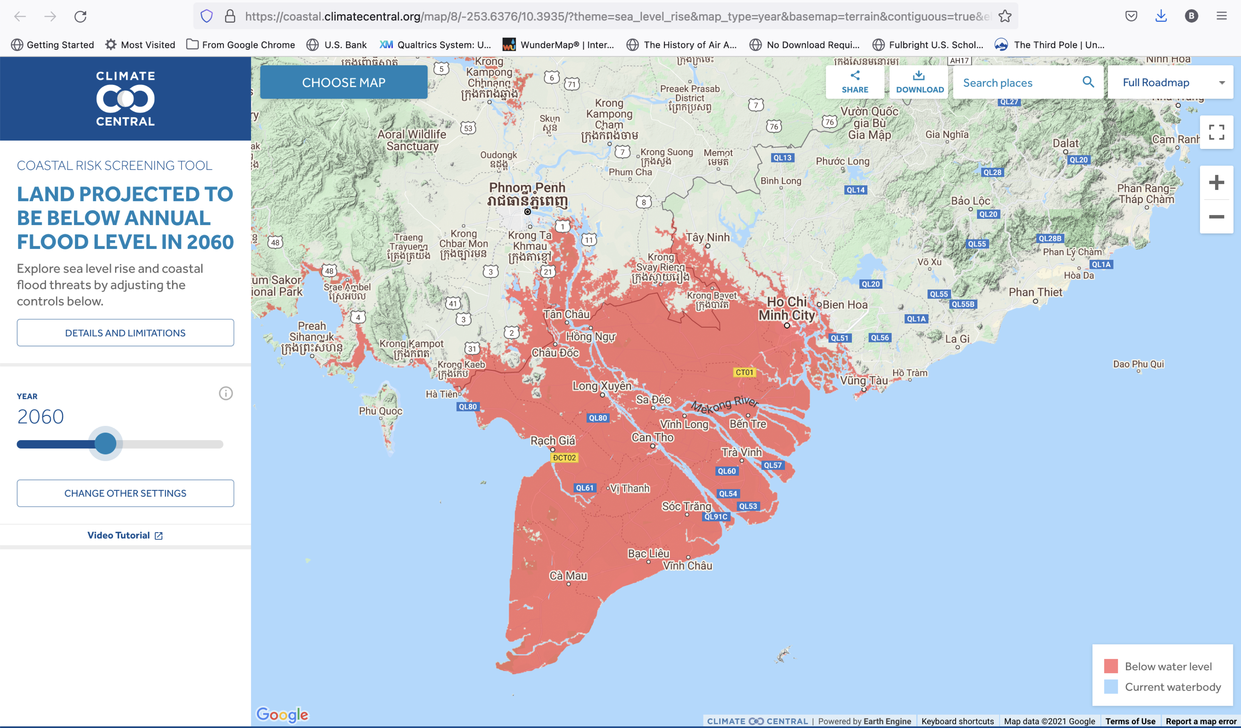
I’m getting prepped for a talk in two weeks called Mangrove and Megacity, part of a new (since 2019) phase of research looking at historical urban shorelines in Southeast Asia with a first focus on my old, favorite city: Thành Phố Hồ Chí Minh. I was first here as a volunteer English teacher in 1993! I had no idea then that, almost 30 years later, I’d still be exploring it’s amazing streets and especially the thousands of incredible restaurants. In 2019, a climate action group of scientists called Climate Central, published this piece to draw attention to cities around the world that are especially vulnerable to the effects of sea level rise from climate change. Here’s what one of their cool, predictive web tools showed for Ho Chi Minh City (aka Saigon) and the Mekong Delta:
Basically, pink means “bad” – underwater – and you can just make out where the city sits in this. As might be expected, local Vietnamese experts and an official government news outlet, VN Express, responded that the report was overly gloom and doom. So there is some tension between official and local views and foreign and diasporic views; but suffice it to say that WATER is on many people’s minds, even more than in the past (which has always been a lot). There are even stories and this 2014 Vietnamese film by Vietnamese-American director Nguyễn Võ Nghiêm Minh that features a noir-future Saigon where all of the pink zone has basically turned to ocean and, in a nod to author Chang Rae Lee’s On Such a Full Sea, the everyday farmers and cityfolk are now displaced and working in floating, factory farms controlled by one, giant corporation. I’m always ready for MORE Vietnamese science fiction, but this one’s a nice down payment:
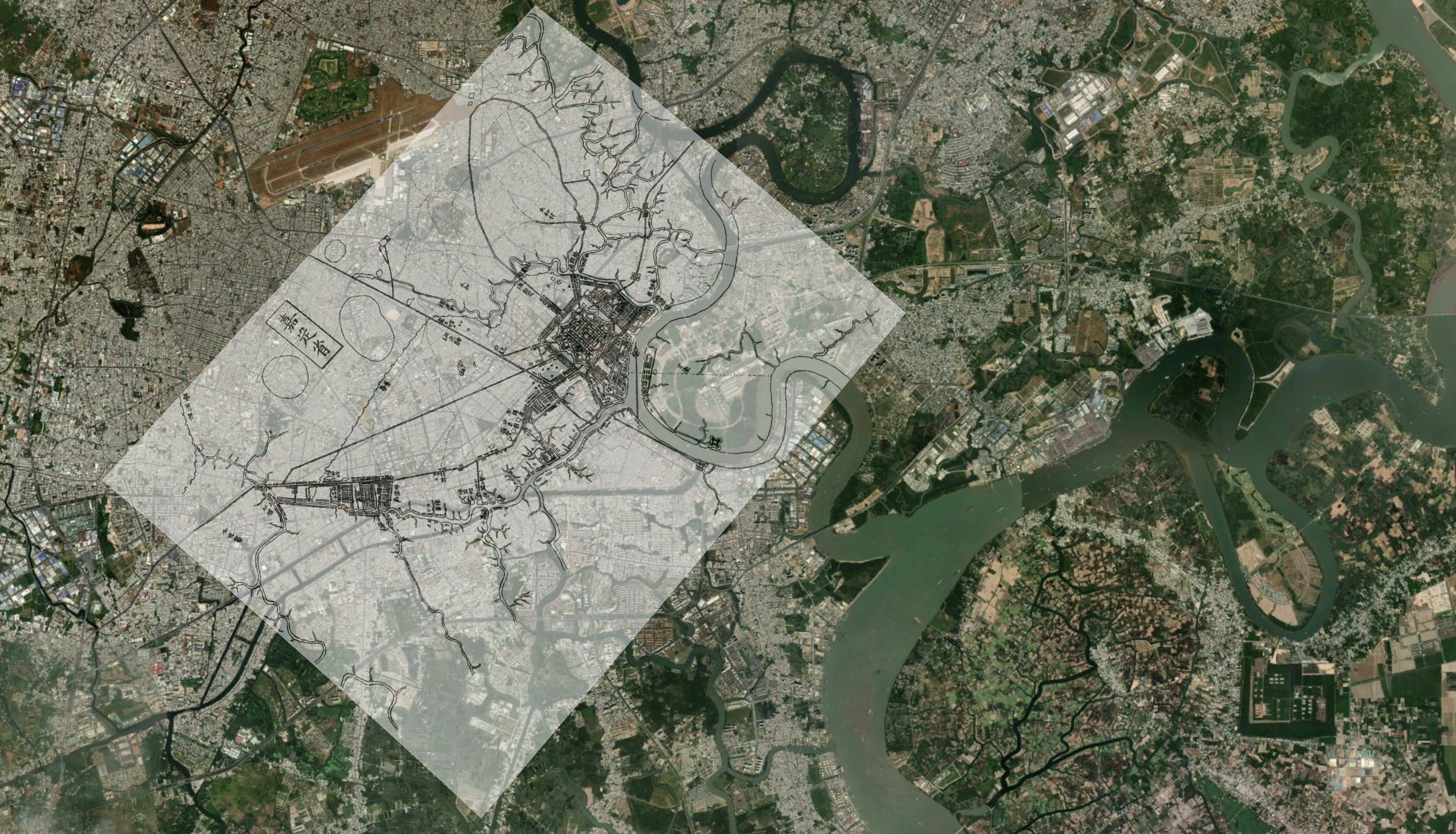
I’m working backward in time, to better explore the history of this “wet city” and it’s coastal periphery, and I had fun georeferencing this 1820 “planimetric” map that a royal cartographer made for the Vietnamese emperor, showing the kingdom’s new, southern citadel, Gia Định (Q1, HCMC – downtown Saigon), and about 5km away the ethnic-Chinese trading area known now as Chợ Lớn. What was especially fun in georeferencing the map to a satellite image was really for the first time seeing the original web of tidal creeks, canals and river meanders connecting across the gridded streets of the modern city. A future tour of the city will take me to these waterways, roughly half of which are open and a quarter of which have been “restored” in terms of reducing waste effluents and clearing dwellings from their embankments.
UCR’s newsroom did an interview with me today on the comparisons between the fall of Kabul and the fall of Saigon. That interview is visible here.
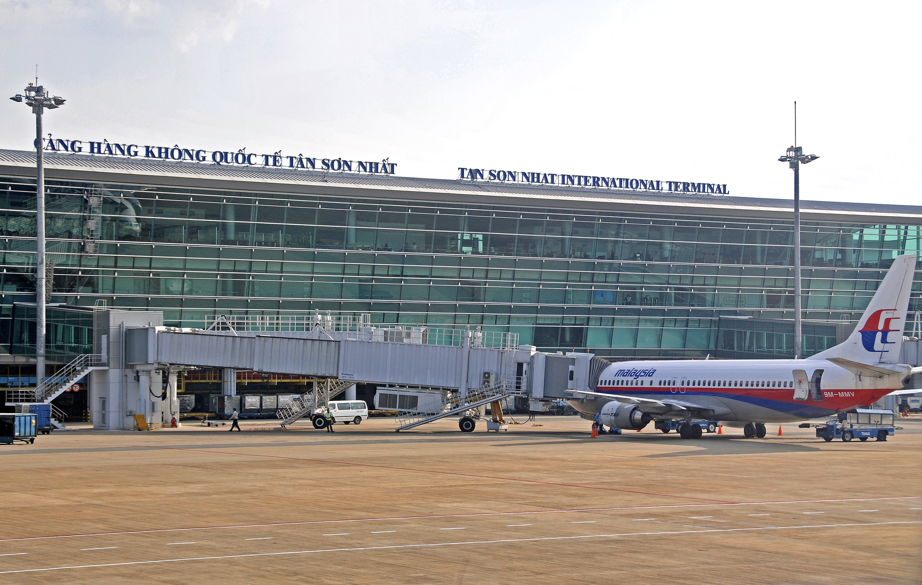
Two things jumped out to me in the process. First, when the reporter scrolled through images of Kabul’s airport, I was briefly transported to the old days in front of HCM City’s Tan Son Nhat Airport in the mid-1990s before the government built a new terminal. The old Saigon (SGN) airport terminal, the terminal that was shot up in 1975 and then lightly repaired afterwards, was to me like a ghost space. I could almost hear the military traffic on the tarmac, and I imagined the crowds of people rushing the gates before a barrage of North Vietnamese rockets closed the runways.
HCM City’s new international terminal has been in operation since 2007, but passengers on domestic flights still pass through the old airport.
Why do I wax on about airports? I think partly it has to do with the covid lockdown, but also airports symbolize the possibilities for real, global connectivity. For years when I landed at Tan Son Nhat, I was thronged by a crowd of relatives and taxi drivers, literally hundreds of people, even at 2am in the morning, waiting beyond the airport’s barriers to meet their overseas relatives. The ability to cross that threshold and FLY in or out of Vietnam was highly prized. Now Vietnamese people fly all over, so the “magic” of the airport space has faded just like ghost stories and ghosts in villages now blazing at night with electric lights.
Seeing pictures of Kabul Airport this week reminded me of those early (not always so good) days.
The second thing that jumped out during the interview was the reporter’s last question. “Did we lose the war in Vietnam?” That one threw me for a loop. I think anyone who knows about the American evacuation can surmise that we definitely lost something. Pushing helicopters off the deck of an aircraft carrier or permanently disabling them is a pretty good sign that a military in tactical terms has lost control. I was tempted to use that lame Neville Chamberlain quote about there being no winners in war, but instead I just thought about what “winning” means in such conflicts? The United States definitely did not succeed in its objectives of nation-building in either South Vietnam or Afghanistan; I think everyone agrees on that. But historians over the last fifty years have nevertheless produced piles of books in response to this question. Perhaps one of the most interesting is a 2012 book about “the winners” in Vietnam, a book that has yet to appear in English and isn’t available in Vietnam, Bên Thắng Quốc (The Winning Side) by Huy Đức. It has naturally drawn a lot of criticism from Vietnam-based writers, but at least it highlights the challenges that immediately face the “winners” once the old regime’s flags are lowered and the last American aircraft leaves. That’s what the Q&A is about.
The New York Times last Thursday reported on the closure of Bagram Airbase, the center of the U.S. military’s operations in Afghanistan; and similar to base closures in Vietnam, they did it quickly and without consultation. Even the Afghan military forces guarding the base had no idea until the perimeter lighting went dark, a few hours after the last American personnel left under cover of night. Aside from some eyewitness reports, we may not know much about the process for twenty or thirty years before the U.S. government makes military records available.
The best historical sources we have to study the impacts of base closures are in Vietnam where there are copious records and we have almost fifty years of post-war peace in Vietnam to study the legacies of the conflict. I recently wrote a piece for the Vietnam Veterans of America’s magazine, VVA Veteran, titled “After the Bases Closed” that draws on these declassified documents and field studies to consider the afterlives of old bases. Briefly here are some lessons learned:
Always a Messy Divorce – The Army’s Real Estate Lawyers
In 1972 when the U.S. Army closed one of its largest bases near Huế called Camp Eagle, it evacuated 15,000 troops, all of their gear, and basically anything not bolted down in about three weeks. The Army’s estate lawyers, the Real Property Division of the Inspector General’s office, itemized every plywood hut, flamethrower and truck that was either to be carted off or left behind. It estimated approximate values for everything left behind as an “improvement” to the land. Military contractors, companies like AECOM and KBR that operated power plants, water treatment centers and other services on the bases removed their privately owned centers with no obligations to keep these “guts” of the base working post-handover.
So what happened? Publicly in 1972, a brief (daylight) ceremony with military bands playing songs was followed by generals exchanging handshakes and the South Vietnamese flag raising up over the base. Privately, South Vietnam’s military commanders were hopping mad! They were given a base without electricity, water, or perimeter lighting. Instead of supporting local operations, it was a tactical liability, a giant footprint of indefensible hills ten kilometers south of Huế. And fitting for a messy divorce, there was a huge bill to be settled. Those U.S. Army lawyers itemized the real estate on the base in order to charge the Saigon regime a bill for these “improvements” to the land. The bill for Camp Eagle topped 4 million dollars! South Vietnam’s generals got so mad they held a press conference to publicize it.
Of course we don’t know the still-classified events surrounding the closure of bases like Bagram AFB in Afghanistan, but news of the lights going out, looting and talk of foreign loans to cover “improvements” suggest some striking parallels. As with South Vietnam, the U.S. relationship to the government in Kabul is a highly unequal one; so at least for the Afghan allies we might expect they’ll see the closures as a messy divorce.
Toxic Waste – No Charge…Yet
Against the balance sheet of improvements, one might expect the U.S. military’s lawyers to also itemize liabilities or damages to the land, things like landfills leaching toxic waste or buried caches of unexploded ordnance. In Vietnam, any volatile materials that could not be repurposed were pushed into ravines and covered with dirt. This included lead-based paints, solvents and caches of 55-gallon drums containing CS (2-chlorobenzylidene malononitrile), the highly caustic powder base used to produce tear gas. Granted there were far fewer U.S. military regulations then for disposal of these materials. The EPA was formed in 1970 and remediation of toxic waste sites did not figure in to estimates of land value. However, one has to hope that today at least the U.S. military has managed to at least estimate the costs for cleaning up burn pits, spent uranium and fire retardants and other chemicals. In Vietnam, local governments must contend with multi-million dollar bills to clean up such hazards; and in many cases cash-strapped districts must opt for a more affordable option. Leaving toxics in the ground and capping sites with asphalt.
A Possible Bright Side – Footprints for an Industrial Future
Generally, the postwar cleanup of American bases in Vietnam was an extremely painful and expensive undertaking. Vietnamese sources are still silent on the numbers of youth volunteers who lost limbs or lives salvaging metal from unexploded bombs and abandoned vehicles. In the short term, for roughly twenty years after the war’s end, most old bases were eyesores, and air bases like Danang Tan Son Nhat carried on as airports but running a tiny fraction of traffic and the former U.S. military cantonment surviving on as a concrete ghost town of revetments and hangars. Until very recent airport expansions demolished these structures, passengers on taxiing aircraft glimpsed the airport’s wartime history as a center for U.S. operations.
Now more than forty years later, Vietnam has emerged as an industrial powerhouse in Southeast Asia. The legacy of closed bases, even Camp Eagle, is changing rapidly. Since the ruling Communist Party reconfirmed it’s commitment to “market-oriented Socialism” in 2000, local leaders have quietly turned the closed bases into centers for industrial parks, air cargo terminals and new urban quarters. Former American bases are the backbone of southern Vietnam’s booming manufacturing industry. After the last fifty years of military and state ownership, the base footprints are free of contesting land claims, and long-abandoned base street grids come complete with utility easements. In some cases, American contractors that initially installed equipment submitted bids for new jobs since they possessed unique expertise. I once met a veteran on a flight into Saigon who worked on airport beacons during the war and in 2000 represented Motorola in that company’s bid to outfit Saigon’s new airport with radio equipment.
If Vietnam is any gauge for Afghanistan and if Kabul falls like Saigon, admittedly two big if’s, we should expect a long period of radio silence as a new regime takes hold and seeks to erase any vestige of American presence. We might expect the messiest of divorces with Afghanistan’s government and long-simmering claims coming from the postwar government if Kabul falls. It might take a decade or more before we know the extent of toxic and other wastes left behind as well as their long-term effects on Afghan and American veterans.
But perhaps, if we take a longer view, the experience in Vietnam suggests a possibility for postwar development, especially around the larger American bases. Despite deeply opposed ideologies between the United States and Vietnam, communist leaders did their homework on the infrastructure they were to inherit after capturing Saigon. Pham Xuan An, a communist super spy who famously worked at the Time magazine bureau and reported up to the day of Saigon’s fall, once told me years later that just before Saigon’s imminent collapse, he learned that the US Agency for International Development sent a truckload of plans and documents outlining future projects like hydropower dams and land reclamation schemes to the Presidential Palace so that conquering troops could preserve this work. Today, many of these plans, for better or worse, have been realized.
If the American experience with postwar Vietnam has taught us anything, it is to expect the unexpected and that with time and reconciliation, hopefully years but probably decades, even the worst of enemies can become friends or, at least, partners in peace.
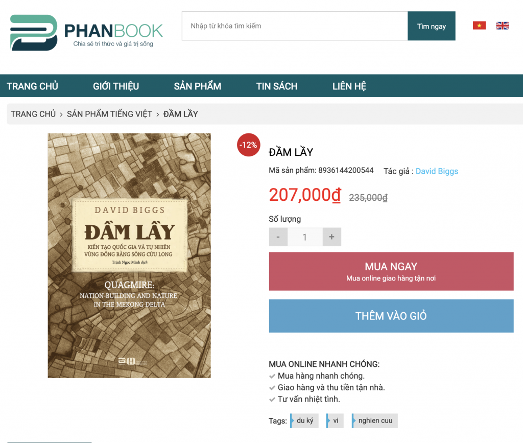
This morning, a friend in Hanoi emailed me a picture of my first book, Quagmire, translated into Vietnamese: Đầm Lầy by David Biggs. I was taken by surprise because my American publisher informed me that they were negotiating to sell translation rights and then … nothing. One and a half years later, voila!
Even funnier than the ease with which this happened, is that the online seller doesn’t ship books outside Vietnam so I can’t even buy a copy!
I had the pleasure of co-leading a group of graduate students to the Mekong Delta after having not been in the region for a good seven years. (My second book is focused on the central coast of Vietnam.) It was fun to revisit old sites and see old friends while traveling with the group. Below are some favorite shots from the trip.
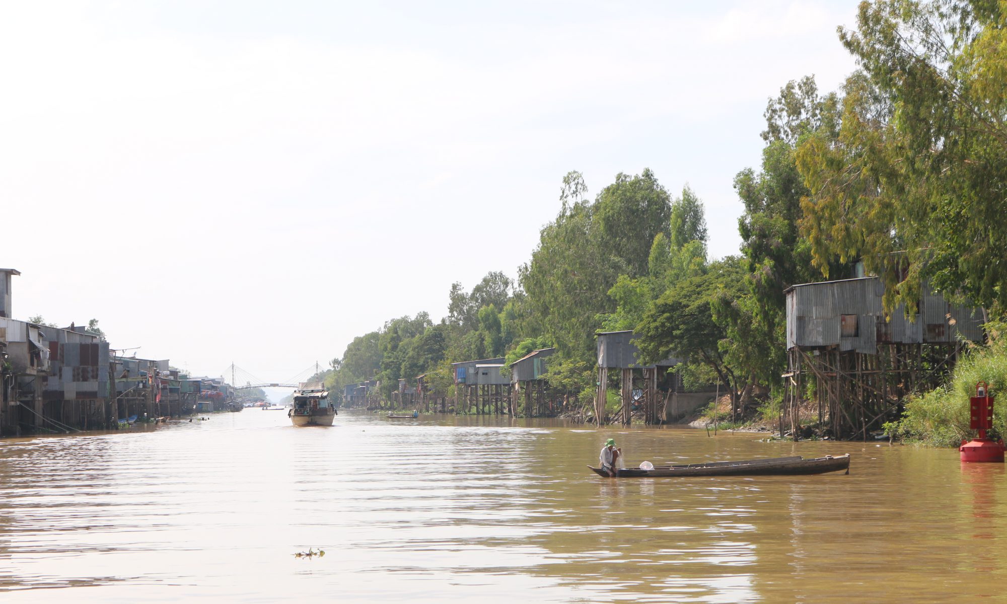
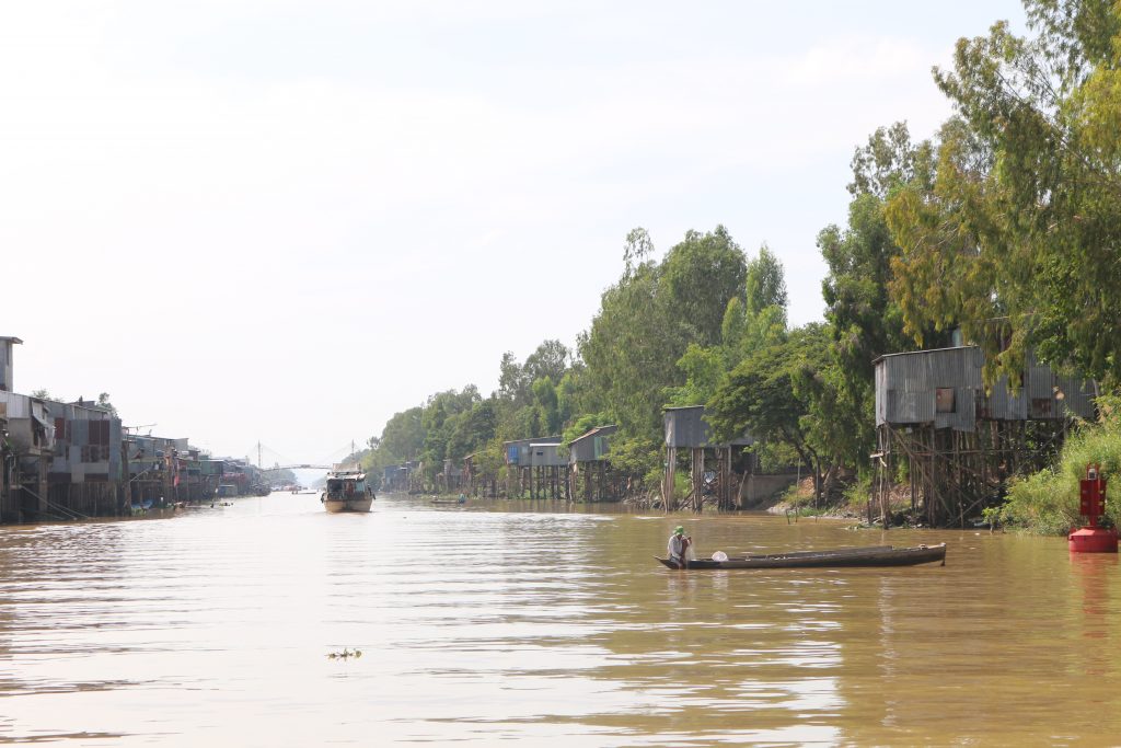
Vinh Te Canal. View looking west from Chau Doc.
I love the above picture for the layers of activity and occupation. Houses on stilts back up into the canal while int he foreground a man fishes from a “ghe tam ban” or three plank canoe. In the distance, a barge approaches us. The water is reddish brown and opaque, almost milky with the fine silt washing down from the Mekong.
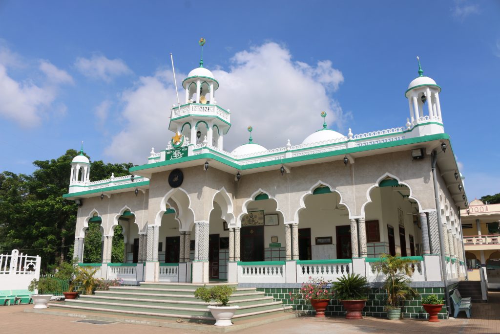
Chau Giang Mosque.
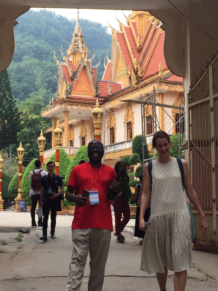
The group visited the Cham muslim community’s central mosque. During the visit, one of the imams received our group, and I learned something new.
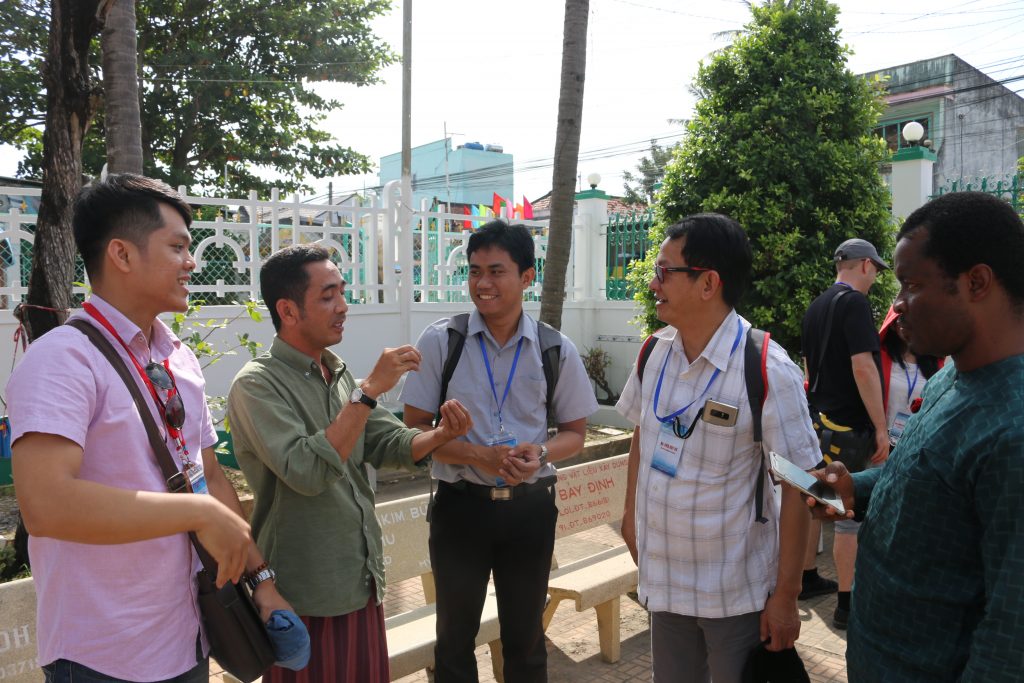
Imam explaining the mosque and community history.
He corrected me on the history of *his* community and ancestors. They were not Chams who migrated west to the region in the 1700s and later converted to Islam but instead Malays who migrated north and east from Terengganu in Malaysia through Cambodia in the 1700s and finally settled here. Because Cham and Malay are distantly related, Austronesian languages, the Viet chroniclers and imperial officials in the area simply classified them as Cham. The post-1975 Socialist Republic of Vietnam likewise recognizes this community as a Cham ethnic group. One of the students, Nurrhoman from Bandung, Indonesia, communicated some basic phrases with the imam in Malay/Bahasa.
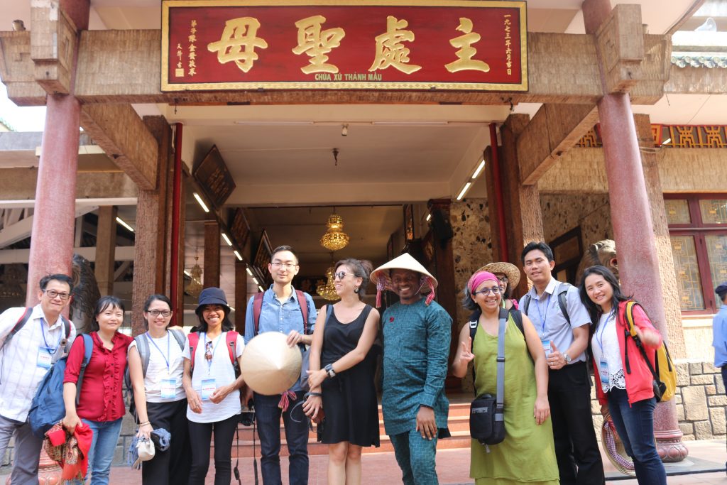
Group at Miếu Bà Chưa Xứ.
We visited a number of important spiritual sites in the region, including this temple dedicated to the Lady of the Realm, a goddess spirit followed especially by ethnic-Chinese inhabitants at a site that, in ancient times (before 6th century CE) was most likely a temple to Siva or Visnu. Allegedly those who pray to the Lady for good fortune who receive it must return to make offerings of thanks. The money from this return traffic then goes to various charities.
Prof. John Agbonifo and Martina van den Haak at Khmer temple, Oc Eo.
One great aspect of the trip was sharing the teaching with two fantastic scholars, John Agbonifo of Osun State in Nigeria and Debjani Bhattacharyya at Drexel University, and the author of the newly published Empire and Ecology in the Mekong Delta. It is a fascinating read!
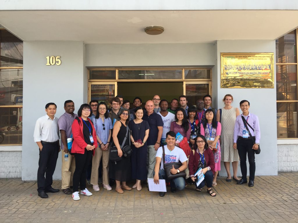
Prof. Debjani w/ a local official in Can Tho, myself and the group.
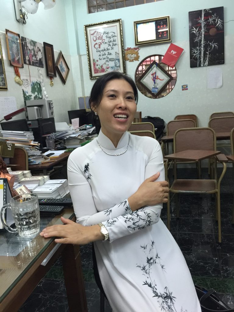
We ended our delta trip in Can Tho with several meetings in this booming city. I left it in 2011 at 500,000 people, and now the city has tripled in area with a population of 1.5 million! My favorite meeting there was with an old friend, Ms. Huynh Le, who visited the group and spoke about life in this boomtown.
Huynh Le at her language school.
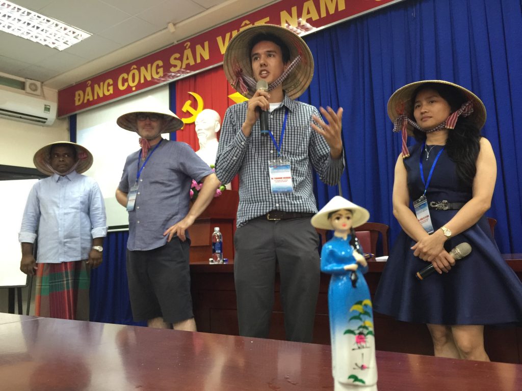
The trip ended in HCM City on Friday and students gave presentations on Saturday. Thanks to Ms. Hoang for the cute little souvenir! Pictured in the background is “Team Non Lá (Conical Hat)”.
Team Conical Hat
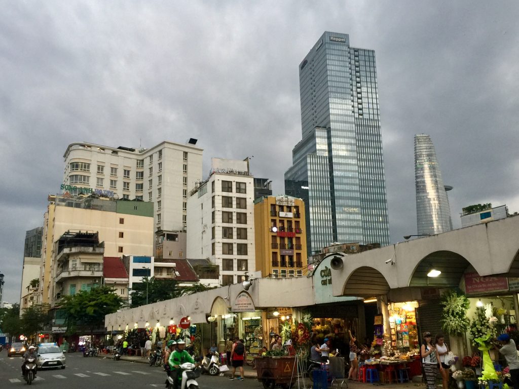
I leave you with a shot from old Saigon, the back of it’s main open air market. I like this shot for the many layers visible here. In the foreground the butcher stalls and flower stands of Ben Thanh. In the background are old facades from the French colonial and post-colonial eras. Then in the way back are the towering spires of recently completed skyscrapers. Farewell until next time, Vietnam!
Last Saturday, I had the good fortune to join a book talk organized by professor of U.S. foreign relations Pierre Asselin for Daniel Ellsberg, the former Rand analyst and Pentagon official responsible for leaking the Pentagon Papers in 1972. Ellsberg has a new book, The Doomsday Machine, published in December 2017. The book is a fascinating-yet-terrifying tour of American nuclear weapons strategies that for most of the fifties and sixties rested on one basic tactic should aggressions break out: total and overwhelming annihilation of the USSR, China and most of Europe. Summing up the book in a nutshell, there was no Plan B; and only after 1961 when American spy satellites confirmed the Soviets had only a handful of missiles did this nuclear planning ratchet down a bit. (See my piece on Corona photography in Vietnam here.) . For those who may not read Doomsday Machine, one other important fact Ellsberg dispels is that of the “football” or what President Trump in his tweets about Kim Jong Un detailed as his bigger “red button.” If readers take nothing else from the book, they should drop this notion that the President of the United States is solely responsible for launching nuclear warheads. Military officials further down the chain of command have had this ability since the early 1950s. Another bit from the book that may surprise some historians of the 1960s and 70s is that when Ellsberg copied the thousands of pages in the Pentagon Papers taken from his Santa Monica office at Rand, he also copied material beyond it including a secret memo, NSSM-1, detailing Nixon’s strategy to expand the American war into Laos and Cambodia.
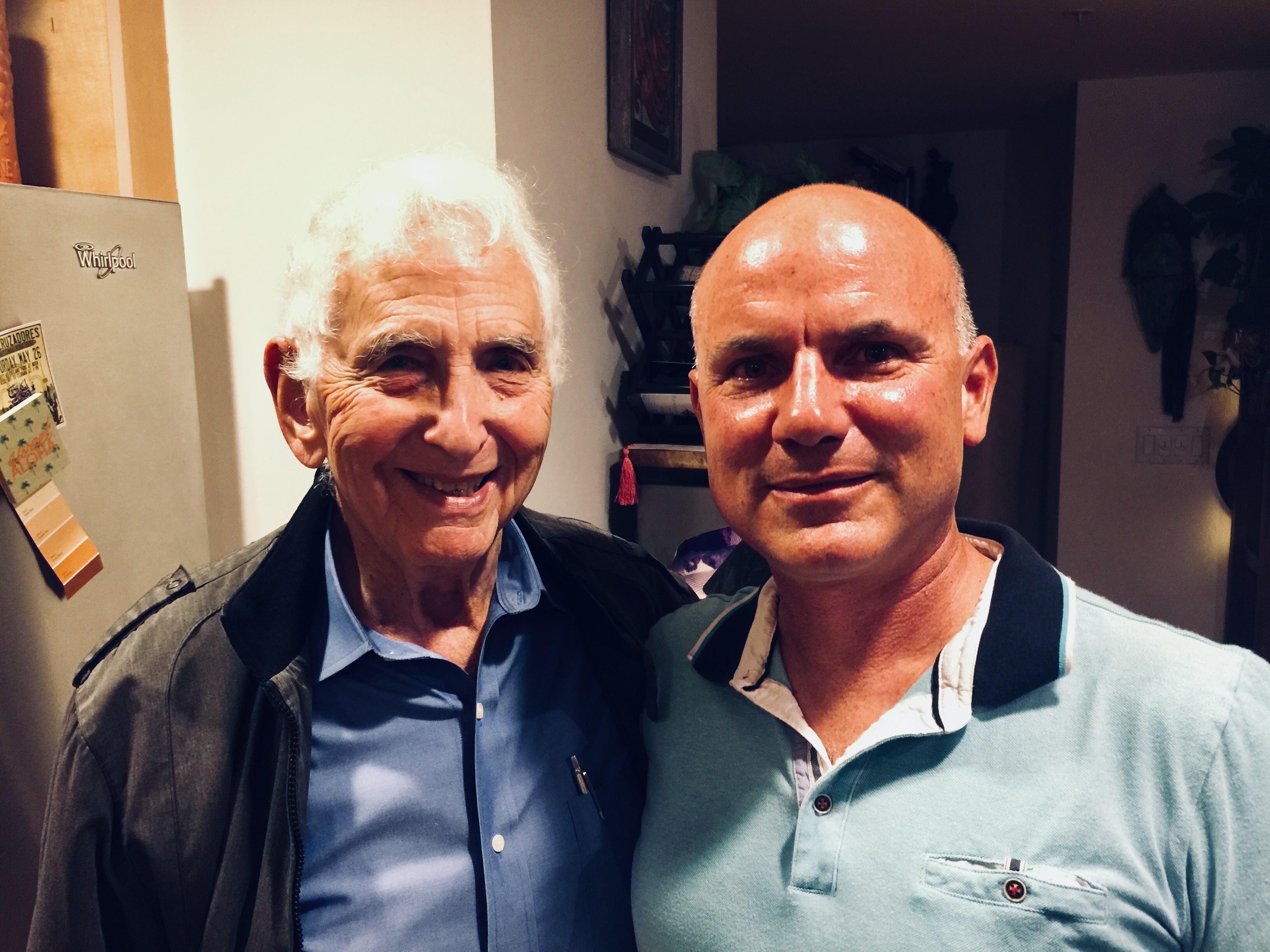
Meeting Dan Ellsberg
As an historian who spends most of my research time in the field, studying the places of the war in Vietnam rather than the halls of power that ordered it, I told Dr. Ellsberg how much I admired his principled stance as well as his incredible writing style–not only in these books but also in his now declassified reports such as “Revolutionary Judo: Working Notes on Vietnam No. 10.” I told him that his insights into the conflict put him right up there with another person I met on several occasions, Phạm Xuân Ẩn, a former Reuters and Time correspondent in Sài Gòn who it later turned out was a spy and general in the NLF. (Historian Larry Berman’s Perfect Spy details Ẩn’s story, at least the story Ẩn wanted told.) Like Ellsberg, Ẩn wrote detailed analyses of the situation in Vietnam and he was routinely consulted at the Time office in Saigon by American military and CIA specialists for his “take” on the insurgency. Ellsberg, like Ẩn, was a man who trafficked in secrets.
I managed to get a copy of my forthcoming book, Footprints, into Ellsberg’s hands, curious to get his take on my reading of many now-declassified reports and my perspective as an historian working on the ground in Vietnam today, exploring the rapidly-disappearing ruins of the American war. This is where the sharp-as-a-tack, 88-yr.-old surprised me. “You know, I was in Vietnam on the ground for two years. Read my other book, Secrets.” Ellsberg’s 2002 memoir of his travels to Vietnam and his eventual decision to leak the Pentagon Papers reveals an unexpectedly wild ride. Here was an analyst who not only synthesized reports but ground truthed them by spending time outside Saigon to see conditions for himself.
His chapters “Travels with Vann” and “Rach Kien” shocked me. Here was a man in his mid-thirties traveling with the arch druids of American counterinsurgency in Vietnam, Edward Lansdale and John Paul Vann. He recounts how Vann insisted on not flying via helicopter like almost every other military and State Department observer in those days. Instead he drove Vietnam’s highways in an International Harvester full tilt with weapons at the ready, to see for himself how things were going on the ground.
“Travels with Vann” describes a series of road trips along highways that just months later would be brimming with deadly ambushes on U.S. soldiers. In “Rach Kien” Ellsberg describes embedding with a U.S. Army infantry unit at a former NLF stronghold in the Mekong Delta south of Sài Gòn. While walking point with the platoon, Ellsberg comes under fire and describes participating in combat despite his official role as a civilian sent down to observe. Here he considers multiple problems in the larger American military strategy called pacification.
What stands out to me as an historian focused on Vietnam was that Ellsberg was one of a very small number of higher-ranking American officials in Saigon who dared to hop in a car, hit the road and talk to people much less participate in such engagements.
One passage in the book, especially, captures the same fascination that I had for the layered, historic landscapes of conflict especially in central Vietnam. Ellsberg describes driving south of Đà Nẵng on Highway 1 in spring 1966 to survey responses to the Buddhist protests. He notes “an unusual succession of abandoned fortifications, of various constructions, that dated from different periods successively further back in time.” (p. 134). His Vietnamese interpreter notes that one is French and then another series of rounded ones were Japanese. When they reach the crest of a hill, the interpreter points out a pile of rubble that is reputed to be a more ancient fort from a period of resistance to Chinese occupation in the 1400s.
I had a very similar experience when a guide pointed out to me beyond the rubble of the former US Army Phú Bài Combat Base were the ruins of French, Japanese and imperial Vietnamese bases. Ellsberg recounts a feeling that I believe many American soldiers felt as they explored this historic conflict zone:
“I knew we were following the French in Vietnam, who for all their colonialism were our allies in two world wars. But as someone who had grown up on movies of the war in the Pacific, and then on war stories in the Marines, I found it eerie to hear I was walking in the footsteps of Japanese invaders.” (Secrets, p. 135)
This perfectly captures the metaphor of footprints that I use in my new book. Footprints of War is my attempt to write the history of a place where so many different soldiers have passed, showing how this more grounded perspective conflicts with and challenges the more common aerial views of war zones favored by generals, high-ranking officials and screen-viewing publics today.
Ground Truthers in Vietnam
Wold Ladejinsky
Of course Ellsberg wasn’t the first to hit the roads of Vietnam and report his findings. Former OSS officers, US development officials and others repeatedly reported disturbing signs from the ground. A decade earlier, another State Department economist, Wolf Ladejinsky, traveled many of the same highways to report on the “rural situation.” (I describe his forays in my book Quagmire.) Ladejinsky was a child of Russian Jews who fled the communist revolution, and he established his reputation developing policies after 1945 designed to ensure the continuation of private rural economies in Japan and Taiwan. However, as a youth in New York who spoke Russian and worked with the Soviet allies in WW2, Ladejinsky was also a target of McCarthy’s red scare. Eisenhower did what he could to vouch for him, but ultimately Ladejinsky was forced out of his secret clearances and high-ranking posts. He was not fired from government service, however, as the McCarthyites had nothing on him; but he was forced to take a transfer…to Saigon in 1956.
What distinguished Ladejinsky from the moment of his arrival, like Ellsberg a decade later, was that he got out and talked to people. Unlike many Americans holed up at the Embassy or in the many coffee shops and bars, Ladejinsky traveled by road to the farthest corners of the delta. He met with former Viet Minh officials and described rampant corruption in the newly formed Republic of Vietnam. Like Ellsberg, Ladejinsky also wrote fantastic reports!
However, Ladejinsky’s reports for unknown reasons went almost a year before being received in Washington. When they landed, they earned him a lot of friction with peers in the Saigon embassy. This time he was forced to retire, tried in an administrative procedure on a weird, conflict of interest charge from his time in Taiwan later found to have no grounds. Remarkably, Ladejinsky stayed on another year in Saigon as an advisor to South Vietnamese President Diem before leaving to work for the World Bank in Nepal. (Robert McNamara suffered a similar, soft fate in 1968 when he left the White House to serve as the Bank’s president.)
Ground Truthing Today
What strikes me most in Ellsberg’s book and with others like Ladejinsky is how comparatively little reporting regarding American wars today in Afghanistan, Iraq, Syria and Africa is coming from the ground. I’m not sure what new rules in the Patriot Act or other conditions have so thoroughly muzzled reporting from these fronts. C.J. Chivers’ recent essay for the Times “War Without End” is a welcome exception though it describes actions from almost a decade ago. What’s vitally missing today in our continuing military conflicts is steady reporting from the ground. Of course, Ellsberg’s reports at the time were classified, so one may at least hope that similar internal reports on these “situations” today will eventually come to light.
This first map contribution is one of my all-time favorites for the artistry of the cartographer and the story associated with it. In 1876, the government of the Third Republic made a sort of peace offering with the emperor of Đại Nam (Annam, Vietnam) in Huế, Tự Đức. The offering consisted of three older, slightly out-of-date warships. The official purpose was to help the struggling Vietnamese kingdom re-establish a small fleet since French ships had devastated Vietnamese naval ships in the conquest of Sài Gòn (1862) and the Lower Mekong (1867). The emperor had also given France port space in present-day Đà Nẵng and Hà Nội. So the French government sent three naval captains on a joint military training mission with Vietnamese sailors and officers. Of course, a hidden agenda was to survey the hard-to-access imperial capital, note the defensive landscape and provide any other details that might be helpful should France need, in the future (1883-84 to be exact) to invade. Enter Jules Léon Dutreuil du Rhins, amateur cartographer and troubled naval captain, age 30.
Dutreuil du Rhins, 1884. Portrait by Eugène Pirot, wikipedia, public domain.
Dutreuil du Rhins was one of a cohort of adventurous, mapmaking Europeans who set out to fulfill his government’s diplomatic and surveillance initiatives while also collecting personal anecdotes sufficient to launch himself through travel books and speaking events as a celebrity adventurer. Like many of his adventurer colleagues, however, Dutreuil du Rhins died young at 48, killed when Golog peoples in southeastern Tibet attacked his survey mission. His last survey mission was published by others, and for the most part his reputation as a cartographer and adventurer faded.
When I encountered his Le royaume d’Annam et Annamites; journal de voyage, (Paris: E. Plon, 1879), I was immediately fascinated by his up-close-and-personal look at life in the beleaguered, war-ravaged imperial capital. The Nguyễn Emperor Minh Mạng had in by the 1830s pretty much banished most Europeans from the capital just as he put the finishing touches on a new Imperial City looking much like the Ming Dynasty city in Beijing. Forty years and several naval battles with France later, the monarchy was eager to get the new vessels and it seemed like maybe there was a possibility for co-existence, at least in the ancient, densely populated Vietnamese coastline stretching from Huế north to Hà Nội.
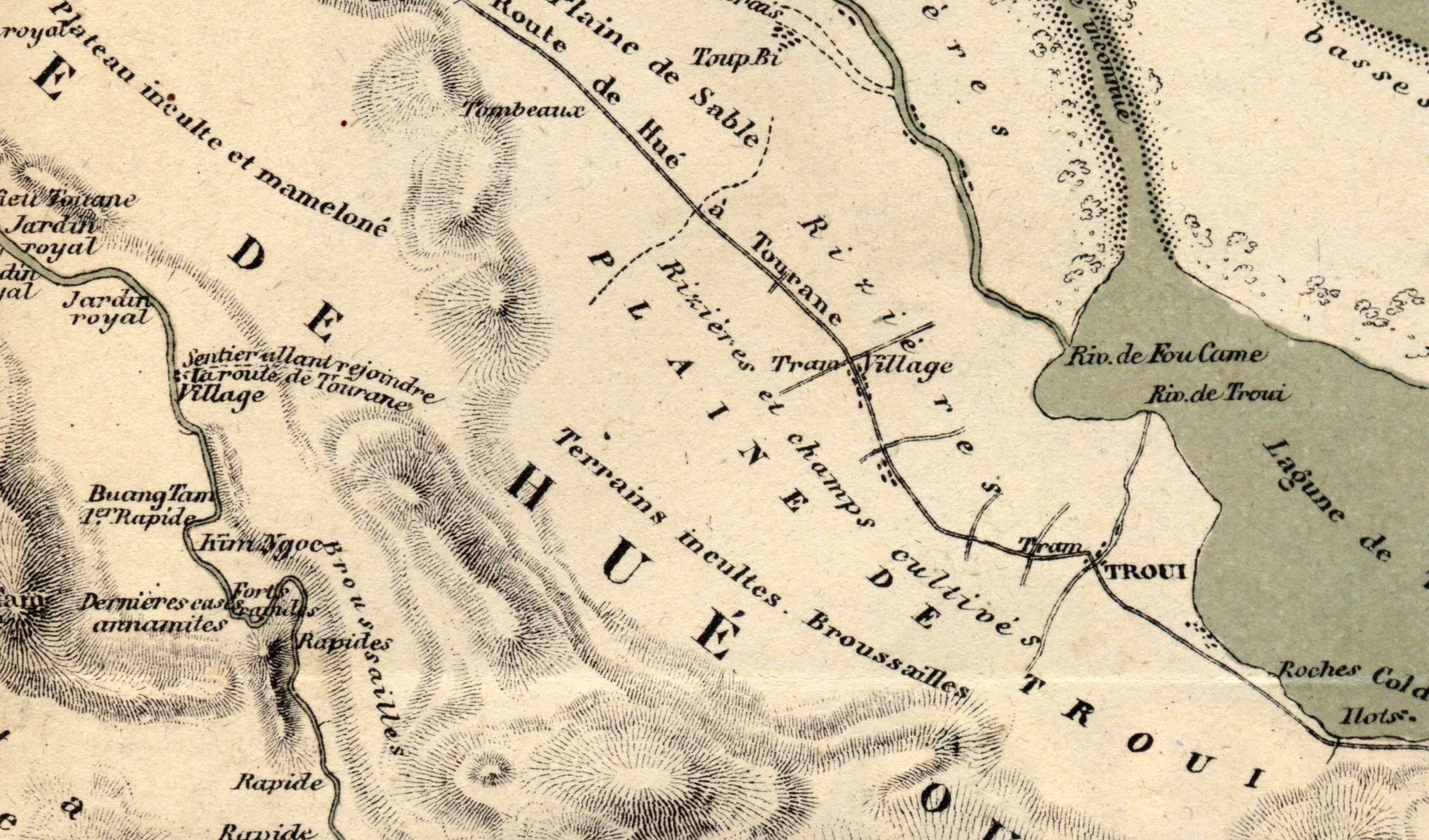
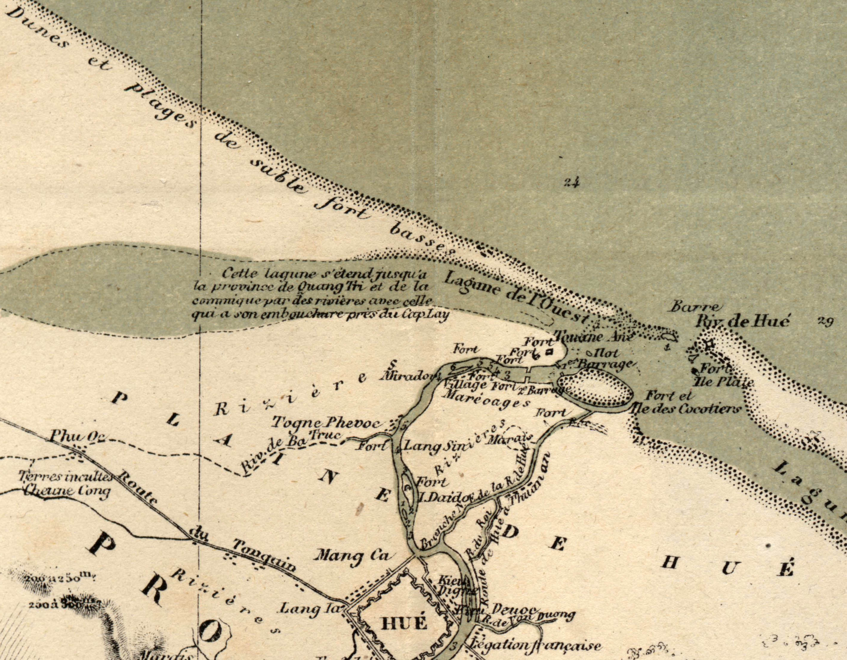
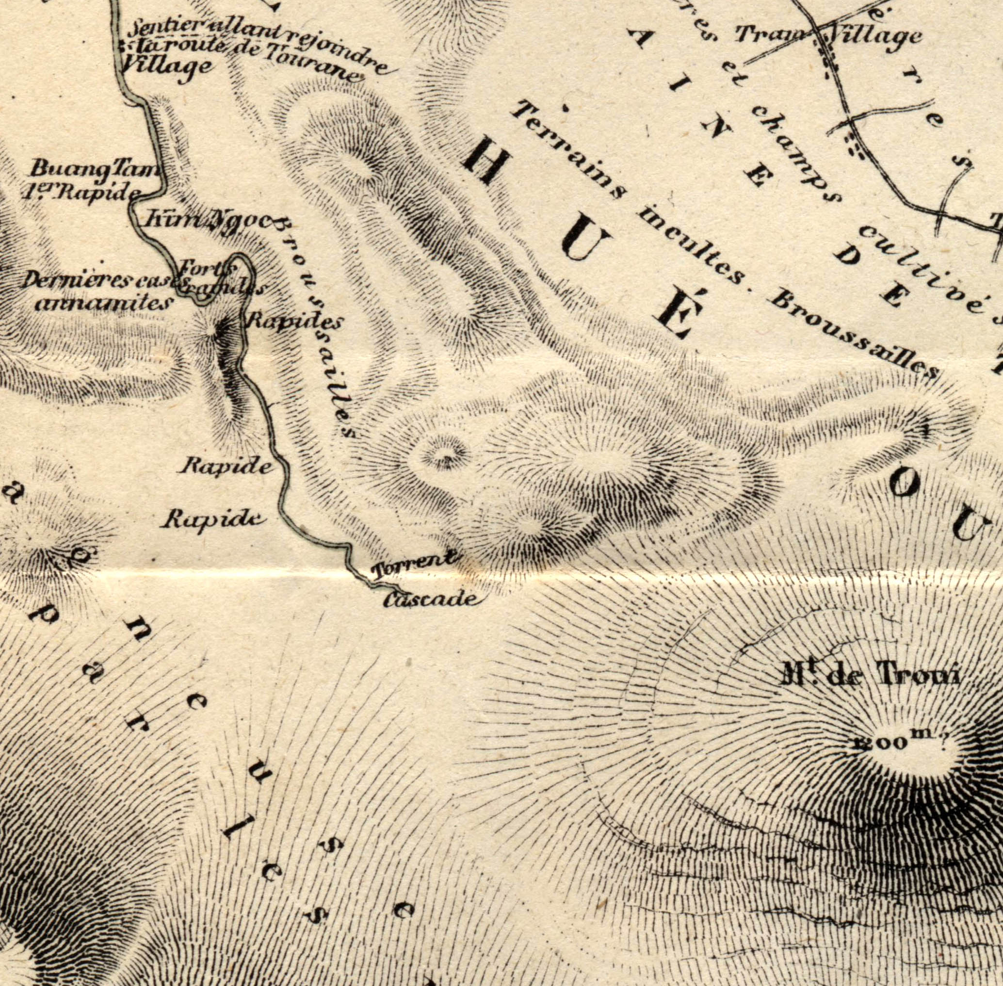
When I pulled an original copy of Detreuil du Rhin’s book, I found these two map gems in the back. They represent one of the earliest public maps available to French reading audiences curious about this far-off kingdom that had recently ceded an area the size of France to Emperor Louis Napoleon in 1867. I discuss the survey mission in detail in my book, Footprints of War, (pp. 41-45) because such mapmaking played an outsized role in shaping French colonial ambitions about the potential productivity of these newly claimed lands. As one might expect, adventurers had a tendency to both minimize the challenge of dealing with unruly natives and maximizing the potential for unclaimed, uncultivated lands to yield profits on valuable industrial or export crops.
Writes Dutreuil du Rhins of the people living around Huế:
More than half of the arable land in the province of Hue is still uncultivated, due to different causes that we have already spoken, mainly the laziness of the Annamese [Vietnamese] and their pitiful government. … The Annamite, for whom foreign trade is prohibited, has no interest in the rich crops which would cost him too much fatigue, and it is not encouraged to produce cereals beyond the needs of his consumption because the mandarins, cowardly and crawling with their superiors and as hard and rapacious with their inferiors, they soon despoil his reserves.Le R oyaume d’Annam et les Annamites, 282-3.
If this kind of insulting-yet-purposeful language wasn’t enough, Detreuil du Rhin’s maps visually advanced this point by visually presenting what were deeply eroded, red-clay ravines carving the hills above Huế as gently sloping hills, allegedly still covered in a layer of topsoil, sure to nourish verdant crops of corn, tobacco, or jute. Meanwhile common features in maps of the day such as village names, fields and cemeteries were almost wholly erased. The following excerpt from the Carte de Hue (full-res version) in multiple senses covered over these facts-on-the-ground and for specific purposes. They provided would-be French readers-turned-colonizers an image of a place where they might pursue their fortunes in these greener, gently sloping pastures. Dutreuil du Rhons was, like many adventurer-cartographers of his day, was like a 19th century real estate agent, shaping both the state’s and the public’s ideas of what such far-off places as Annam might be like.