Reflections: Yogyakarta, Indonesia — 13.Sept.2023

Thanks to support from the University of Washington’s Center for Southeast Asia and its Diasporas, I finally paid a visit to a place I have long read about and dreamed of: Yogyakarta!

UCR colleague Muhamad Ali and his lovely wife Dila helped me network via their family in Jogja who introduced me to the amazing Kemuning A. Adiputri, who worked with me for a few days as expert guide not only familiar with historic sites around Yogyakarta but actively involved with Stuppa Indonesia, a planning and development firm in Jogja, and the Center for Heritage Conservation (CHC) at Gadjah Mada University. Kemuning recently finished her M.Sc. in Historic Preservation from Columbia University, so I was not just lucky to have a great interpreter but really lucky to meet a future leader in Indonesia’s heritage conservation community!

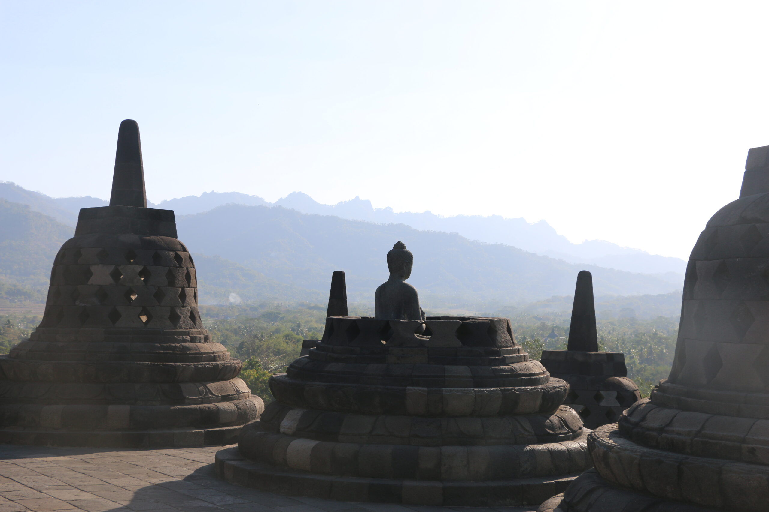
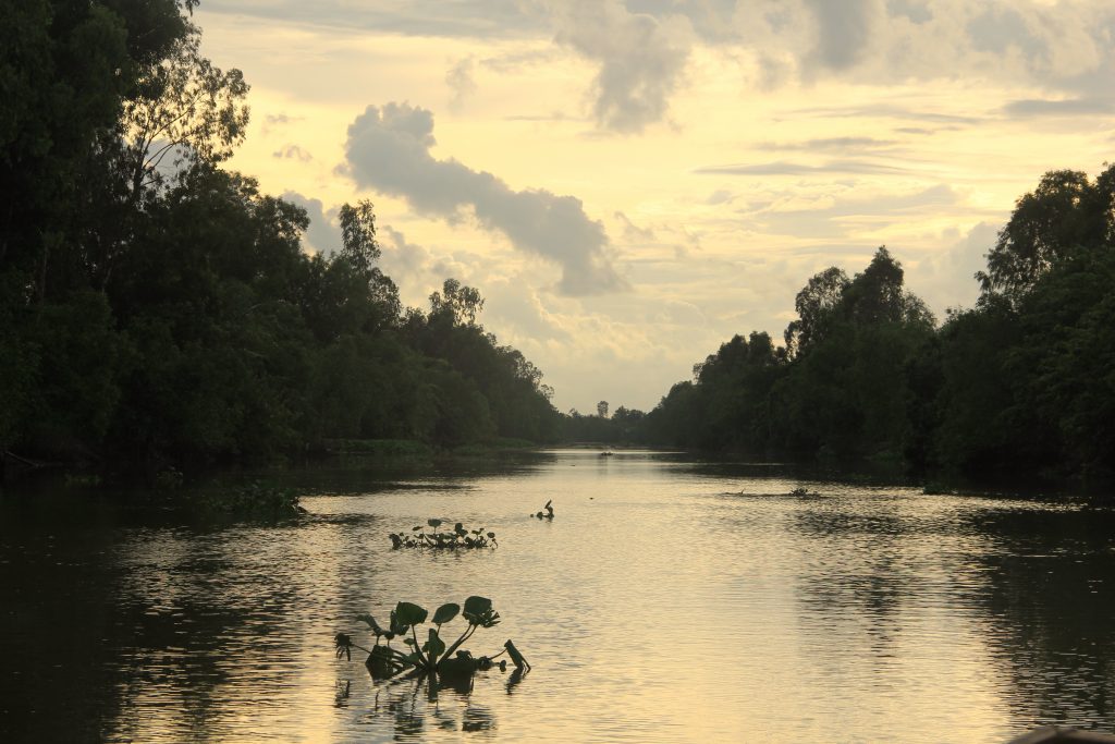
My main purpose in the Jogja trip was relatively simple: to visit and experience firsthand sites I have long lectured on in my Early SE Asia survey course and to photograph them for a textbook I am writing for Cambridge Press titled An Environmental History of SE Asia. Besides visiting Jogja I made trips to the world’s largest Buddhist monument, Borubudur built in the 9th century CE, and the Hindu temples at Prambanan, also 9th century. We had the great good fortune to see Borubudur on a clear day with full views of the eight mountains surrounding the monument on all sides.

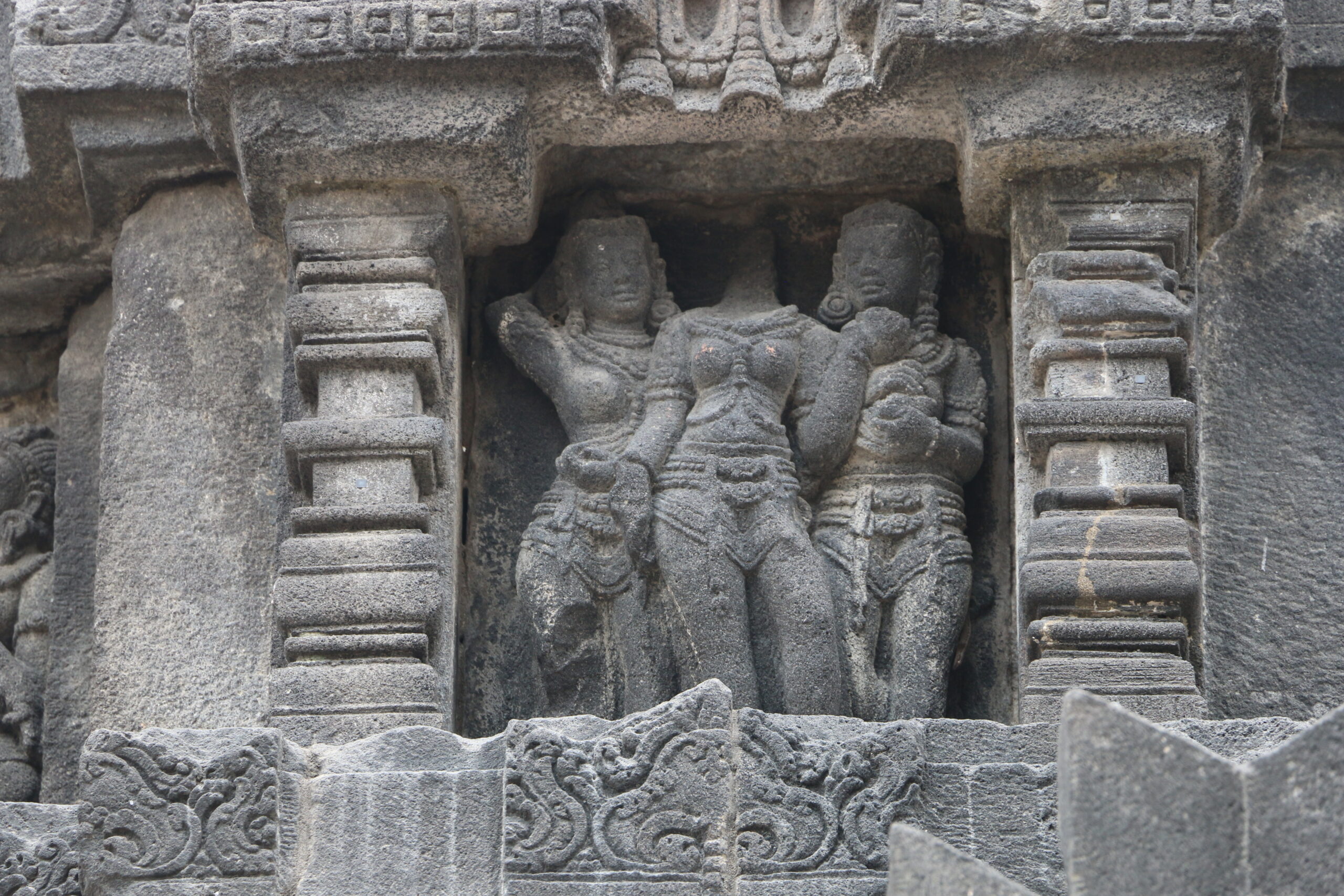
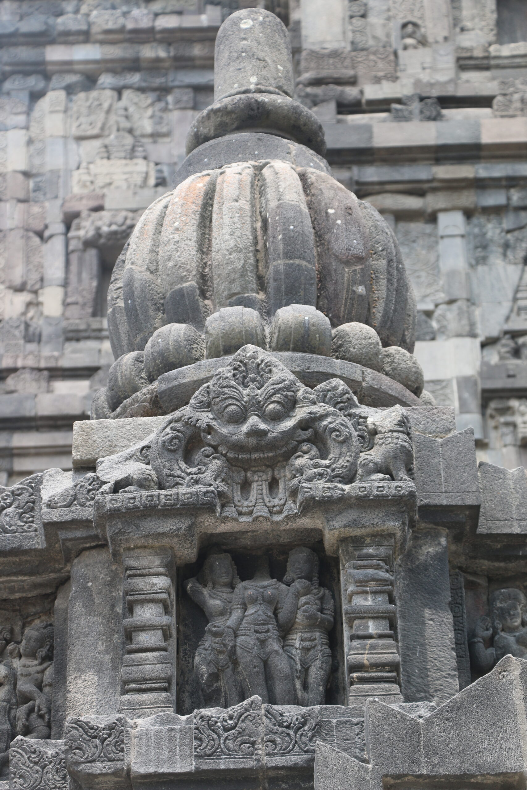
The artistry in the bas-relief carvings along the walls of both monuments is incredible. Here is a detail of three women standing in front of what looks to be a mango tree.

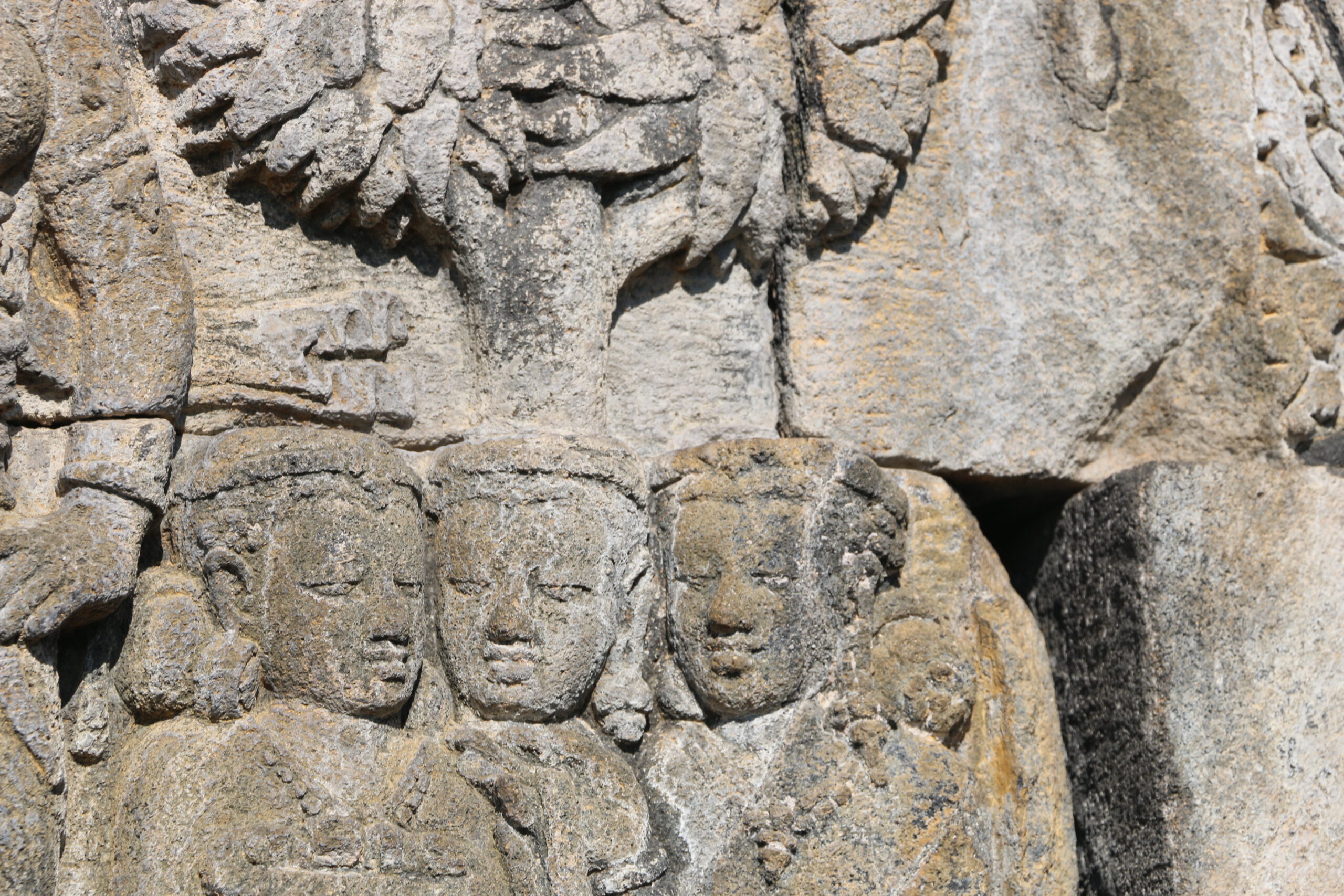
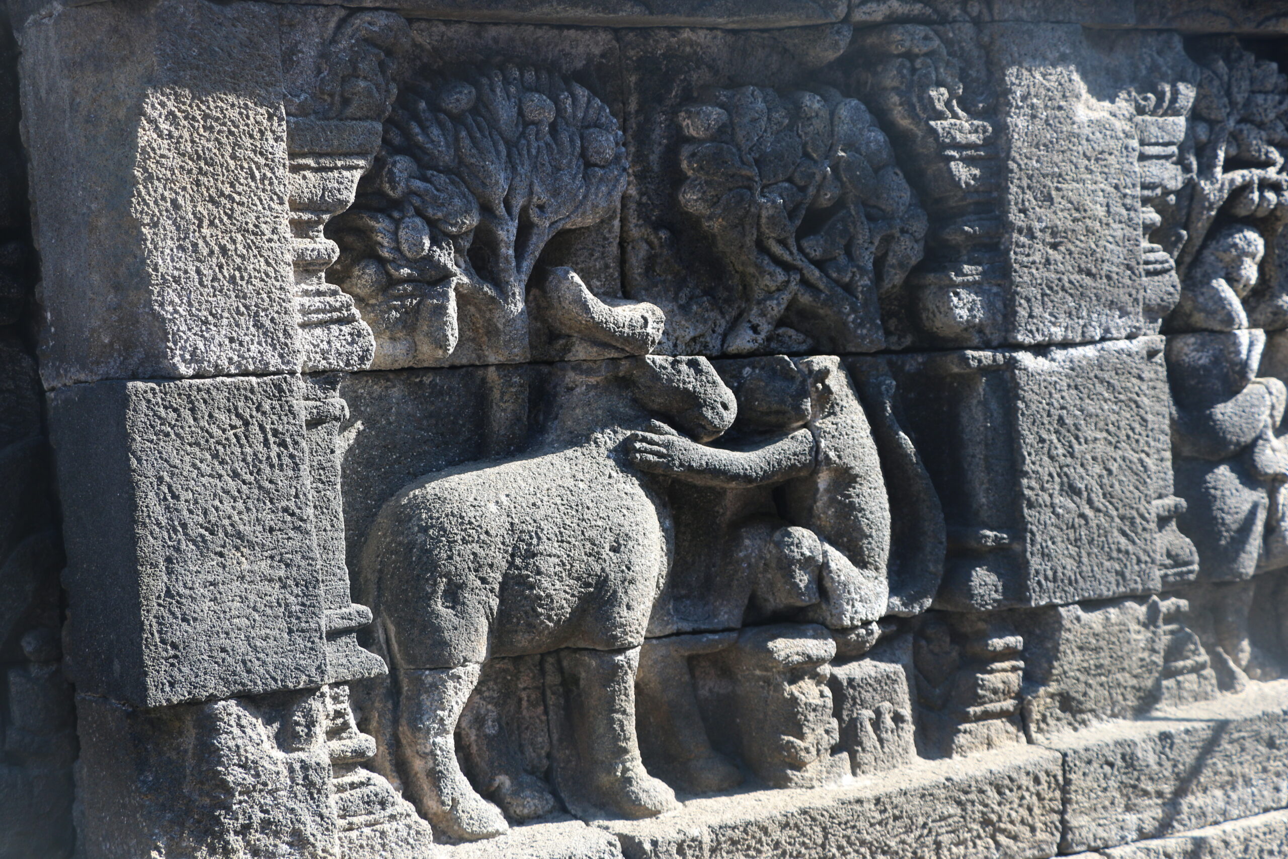
Both Borubudur and Prambanan are built from andesite, a blue-gray volcanic rock. This produced a striking, dark temple which absorbs more heat and which I imagine was likely painted when the temple was in use. Here’s a detail along an outer wall of a monkey with an ox and some mango trees in the background.

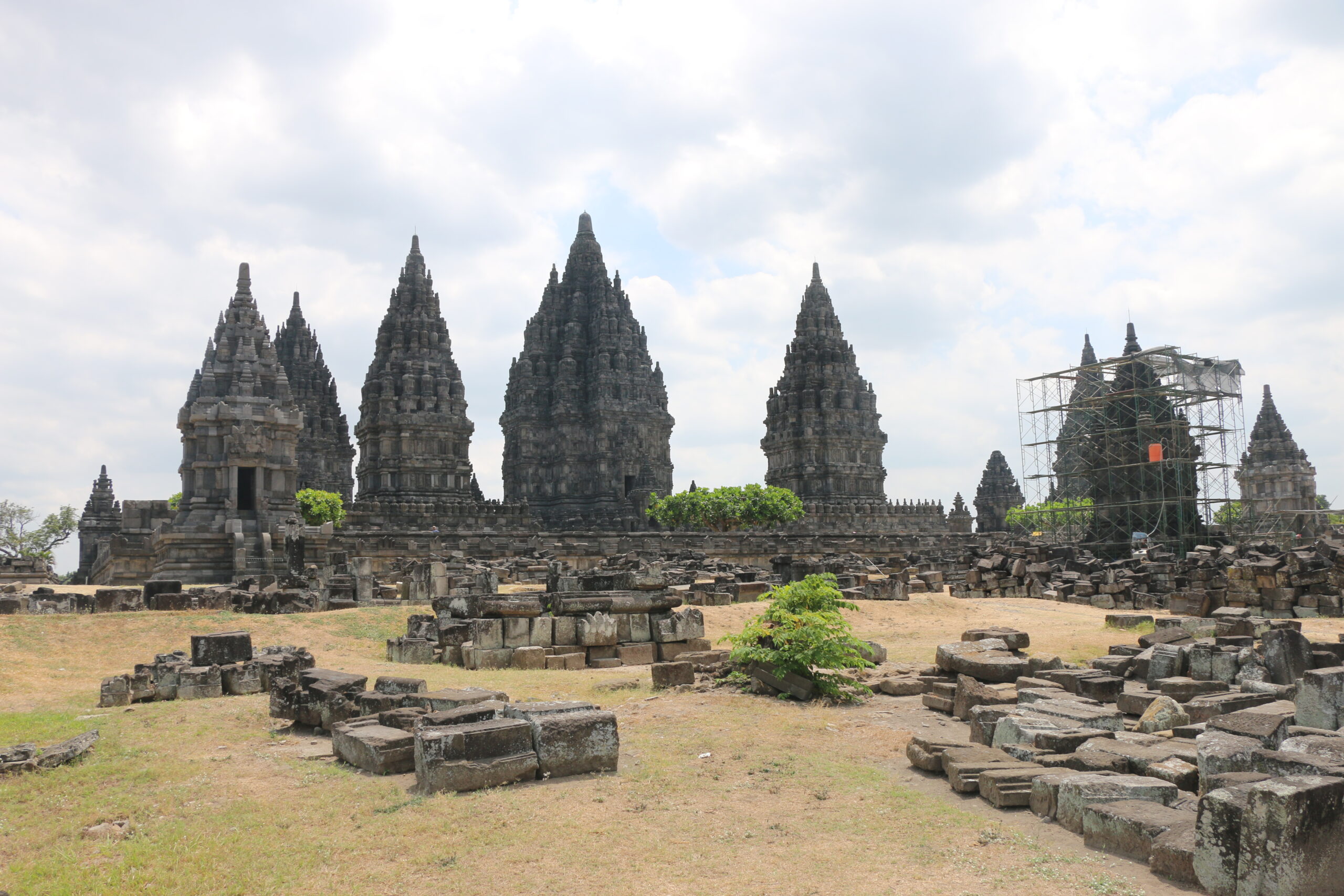
Here are some views at Prambanan.

My general interest in both public and scholarly research these days follows from an intro I wrote to a special issue with the Journal of SE Asian Studies three years ago: “The Greening of SE Asian History.” For so long, SE Asia’s history has been defined by issues of state formation and ethnonational heritage-making, what Ben Anderson provocatively termed the making of “imagined communities.” This “national idea” has been vital to different publics in Southeast Asia since the end of colonial rule and the start of decolonization in 1945, but with greater economic integration and global problems like climate change, I think we’re at a turning point for historians, what historian John Smail called an “historiographical crisis” — in SE Asia and the world — where the nation-state project and more recent post-structuralist debates in the academy are giving way to more “diasporic,” trans-regional and even “multi-species” projects exploring new identity-making projects and forging newer historical and analytical framings. SE Asia’s incredible and biodiverse natures, layered cultural landscapes, agro-ecologies – not to mention so many pockets of its endemic, minority or hybrid cultures – are still absent in anglophone histories of the region and marginal in the region’s national museums and vernacular literatures.

This isn’t unique to SE Asia, either — consider the visibility of African Americans or Native Americans in American history books or the decades-long struggles to build a National Museum of African American History on the National Mall – a monumental space largely built in the 19th century by the hands of free and enslaved African Americans.  But the times, they are a changin’… and that’s why I open my intro essay with these lines from Bob Dylan:

Hey, hey Woody Guthrie, I wrote you a song

‘Bout a funny ol’ world that’s a-comin’ along

Seems sick and it’s hungry, it’s tired and it’s torn

It looks like it’s a-dyin’ and it’s hardly been born

(Bob Dylan, ‘Song to Woody’, recorded 20–22 Nov. 1961)

I think the newspapers and end-times people would have us believe we’re at the precipice of a world ending in chaos, but who are we to judge? 🙂 Scientists globally tell us we’re at least on the verge of a new, warmer world with all of the possibilities and problems that will pose. A sixth mass extinction, mass die-offs of coral, losing much of the world’s biomass of insects, possibly a plethora of micro-organisms and algae species we don’t even know yet.  We’re also in the midst of a mass extinction of thousands of endangered languages. But what about history, especially local history and the history of worlds past? Worlds with more biodiverse forests, more languages, and more natural wonders like the giant stinky flower, Rafflesia arnoldii

There are efforts in many parts of the world, in the face of climate change and recent social movements for more inclusive histories, inclusive of different peoples and natures, to articulate new valuations of nature/ecosystem services, and combined bio- and cultural diversity to effect a kind of green ethics. I discuss this in my intro to the special edition. These efforts at “greening history” are dispersed globally and draw from multiple groundings in different ethical and religious traditions. What particular natures or landscapes mean to the human communities that tend them are (and should be) as biodiverse as the diversity of life itself. That…in a (Canarium) nut shell is my general research aim in current and developing projects.

The Jogja trip was mostly for fun, photographing sites for teaching and my current book project, but through conversations with Kemuning and a chance trip to an orchid nursery halfway up Mt Merapi, I stumbled onto two related ideas/questions that might bear research fruit down the way.

Cultural- and Bio-diversity at Yogyakarta’s “Cosmological Axis”

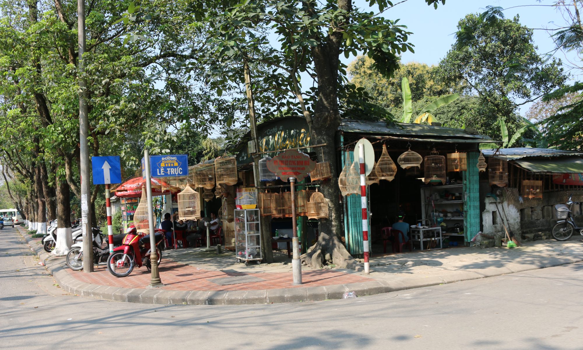
Kemuning shared about one of her current projects – supporting heritage conservation in the historic, sacred center of Yogyakarta, including its famed keraton (royal palace) and the street running north from the palace to the central rail depot. Tourists know this 24-hour, busy shopping street as Malioboro Street, and it is adorned with ornate lamp posts and a mosaic of shopfronts from different eras.

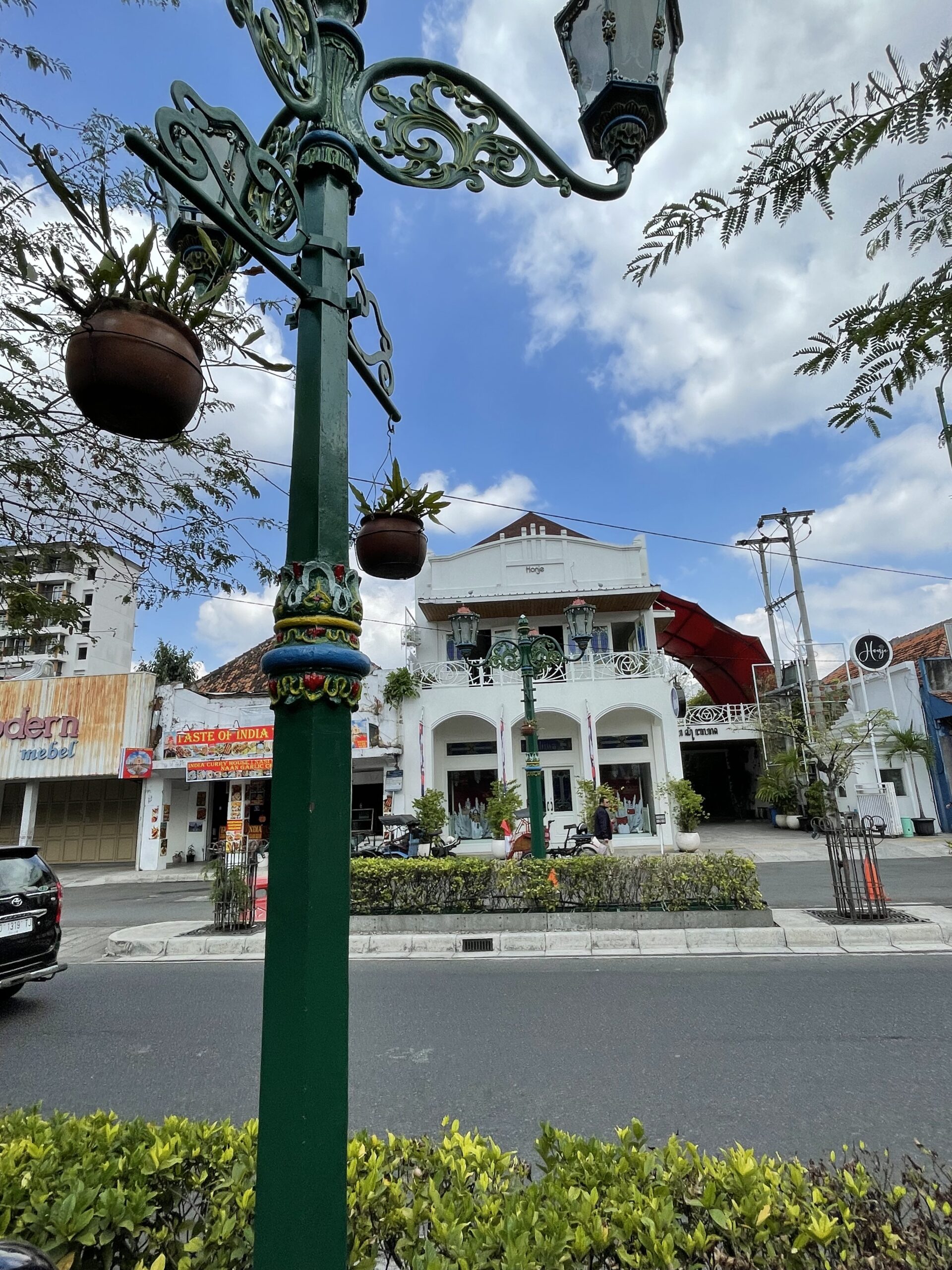
The name Malioboro is a bit of a mystery. Some say that it stuck after “Sir” Thomas Stamford Raffles’ ordered British forces to attack the palace in 1812 and loot its precious objects and documents. Malioboro could be the local pronunciation for the name Marlborough, as in the Duke of Marlborough (who was at the time George Spencer-Churchill, a famed collector of antiquities in the UK who was allegedly deeply in debt.) Or it might have referred to an earlier Marlborough who was a governor and the namesake for a British fort at Bengkulu in Sumatra. Or it might derive from a sankritic term, malya bhara, meaning bearing garlands. Just this year, The Cosmological Axis of Yogyakarta and its Historic Landmarks were listed as a UNESCO World Heritage Site.

It now fits within a class or urban historic districts including the Georgetown District in Penang which I also visited on this trip (a separate Reflection blog will cover that).  As Georgetown-Penang’s Director Ang told me last week, one of the biggest challenges with maintaining an historic district and a buildings-focused approach is attracting new generations of visitors.  The bulk of visitors and community members to these districts are people over 40. No youth!

What some urban districts are doing, and Director Ang is at the forefront, is to place more focus on the living city, arts inside old buildings, new venues for creative expression, and adaptive reuse of old buildings. In New York, there are also efforts to focus on indigenous spaces, place names, plants, and other sites partially buried under concrete. Other conservation projects focus on re-opening creeks from old, concrete storm drains so as to allow migratory birds and other life to return. Seoul is famous for Cheonggyecheon Creek Project, and re-opening it allowed a new shopping district to form along the banks with native and historic trees planted. My hometown of Riverside is similarly planting xeriscape and native sage-scrub in revitalized historic areas with recently restored Japanese American homes, its bid to advance its “arts and culture” mission.

Thinking about these issues in Jogja, two things I noticed immediately were the incredible kampong (alleyway neighborhoods) running off the main streets and the city’s immense banyan trees which are described beautifully by John Ryan in his new work The Mind of Plants!

Here are some shots of one Kampong near the city center at its Tugu Yogya monument:

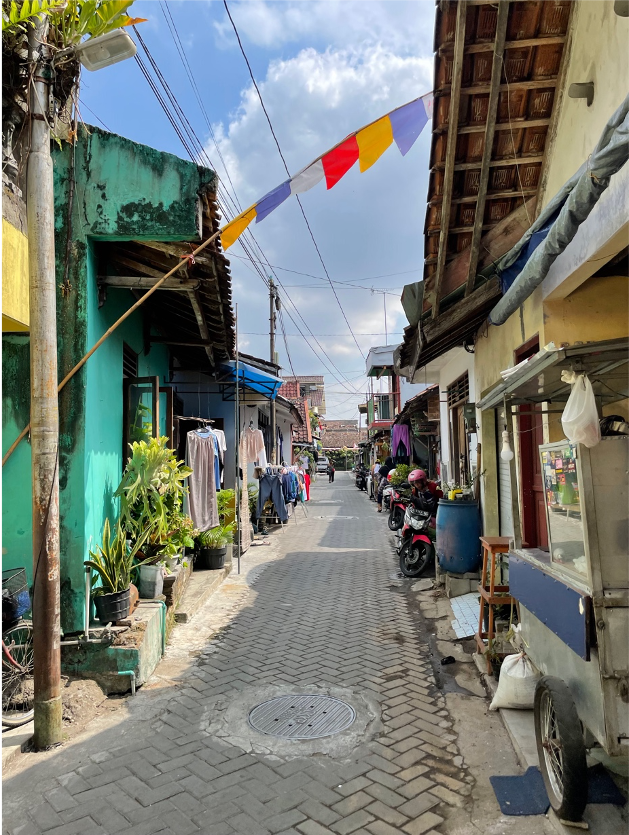
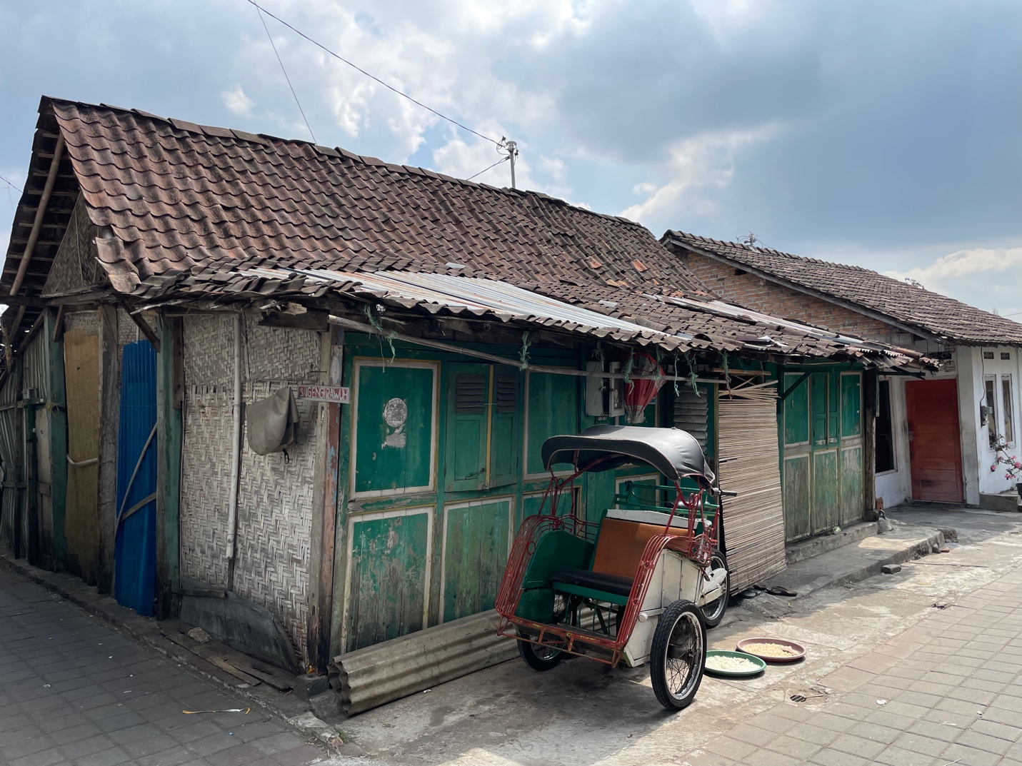
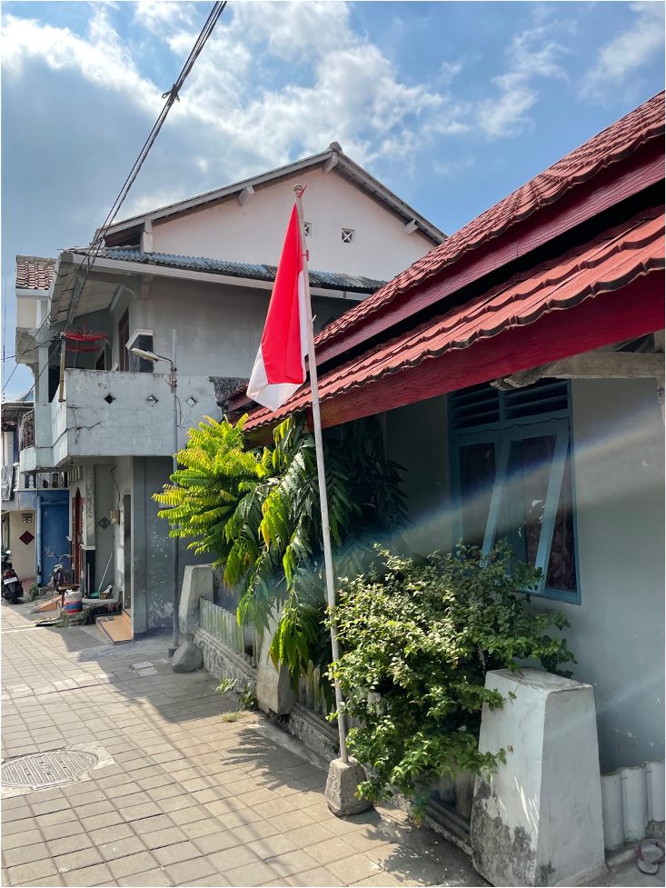
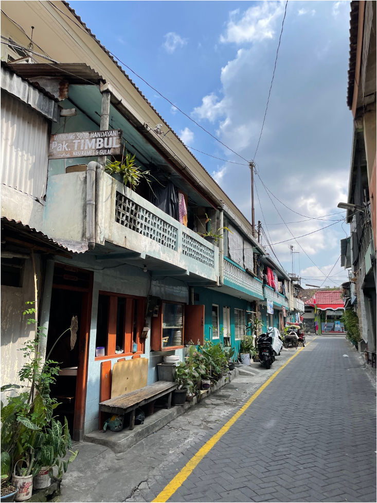
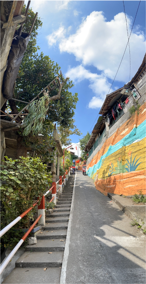
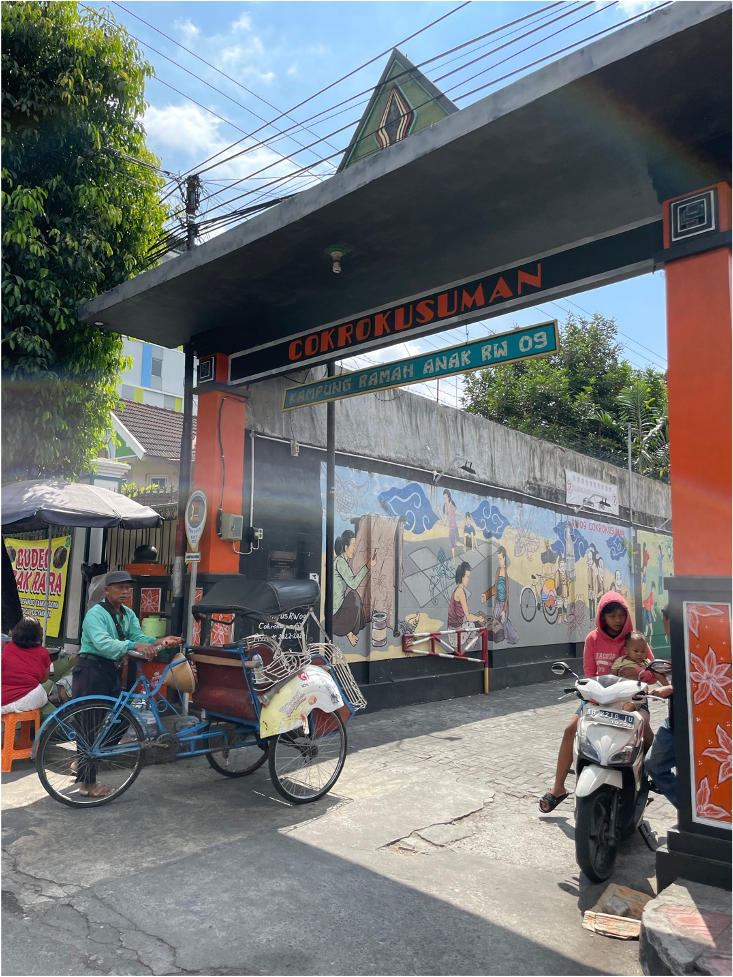
What’s clear from the many architectural styles, the signs, the placement of art personal and communal with plants and other decor … is that this kampong is well organized by community leadership with strong collective participation in neighborhood life! This is rare in many historic districts where working class people are forced out by high rents and tourist industries and  tourists move in. Just blocks off the tourist corridor on Malioboro Street local neighborhoods are still full of everyday, working-people life with beautifully decorated murals around a thriving elementary school, meaning young people, too. That’s a good sign!

Compare this with other historic districts like downtown Amsterdam and you do not see this to the same degree. The streets and pristine historic buildings there are mostly air bnb’s and homes for the global wealthy or inhabited by elderly people who inherited or bought flats in them long ago when they cost normal prices. New York City just passed an ordinance eliminating 67% of its airbnb’s in an effort to hold on to fast-shrinking, “permanent inhabitant” communities.

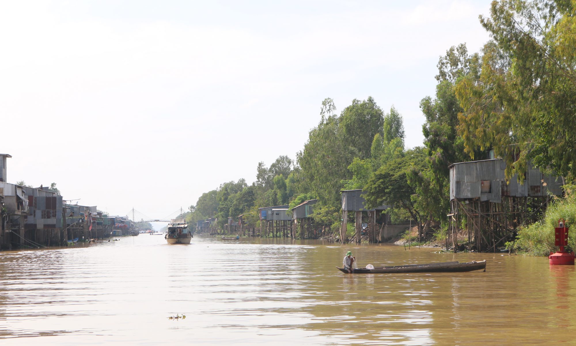
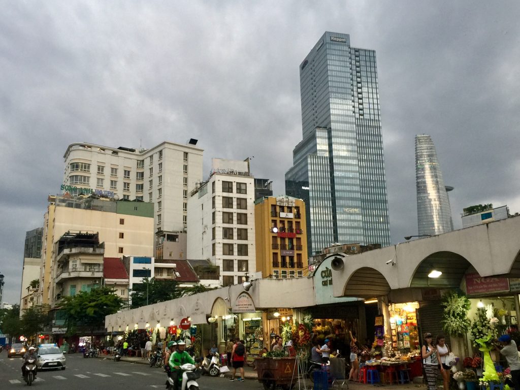
In Vietnam where I have worked off and on for thirty years, similar waves of vernacular erasure have taken place as the country’s economy, especially in its old cities, has boomed. Over the years I watched as national and city governments moved quickly to erase all forms of outdated transport like cyclos, graffiti, and “slums.” Old cities like Saigon mushroomed into megacities with a dozen new districts after a long, postwar-induced sleep. Saigon used to be full of scenes like this:

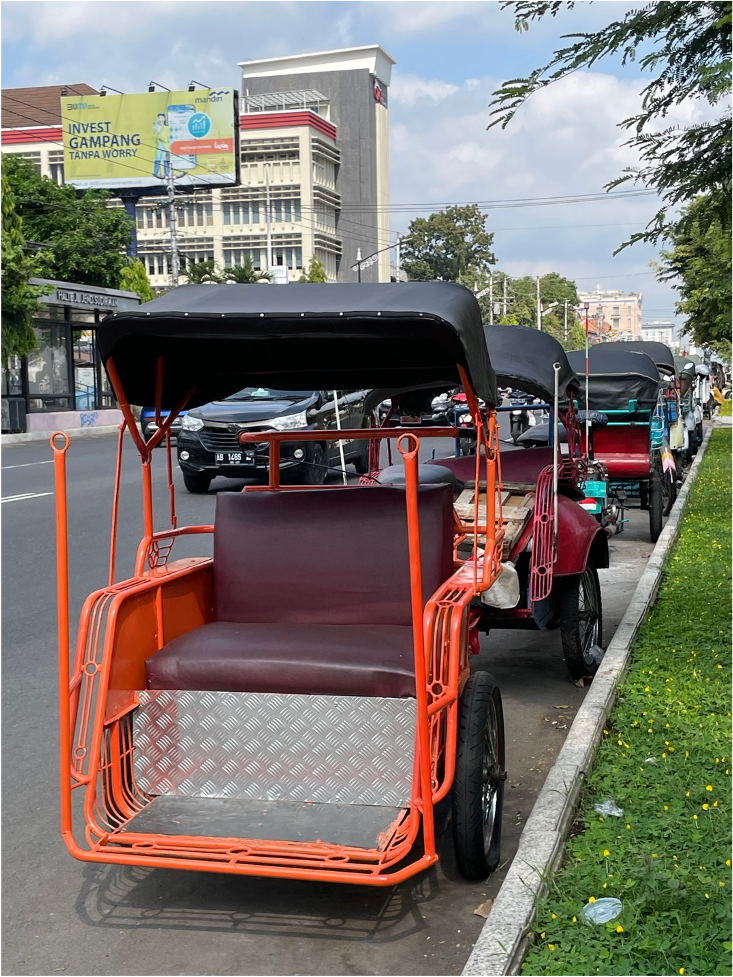
But now, Vietnamese in the urban core who are well off and generally older–average age notching up into the 30s—they have lost this part of the urban fabric of everyday life. They think with nostalgia to the cyclos (pedicabs), the food carts, noodle sellers, and stilt houses from their childhood in the city center.

Bookshops now carry models kids can make of bicycle repair stands, stilt houses, cyclos and noodle shops! But the streets are mostly empty of them.

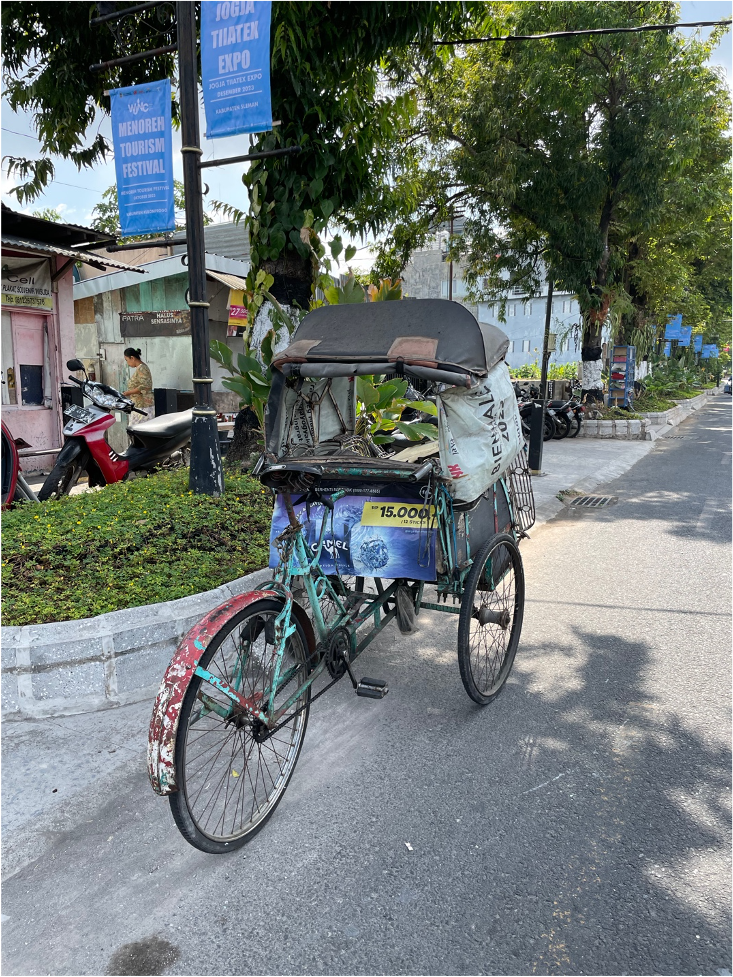
Malioboro still has plenty of examples of vernacular everyday life and I hope preservationists can find ways to include it along with repurposed mid-century “national” buildings, Javanese traditional construction, etc. as things “develop.”

Back to nature in the city, I am amazed by Jogja’s incredible beringin or banyans.

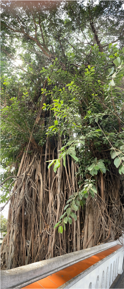
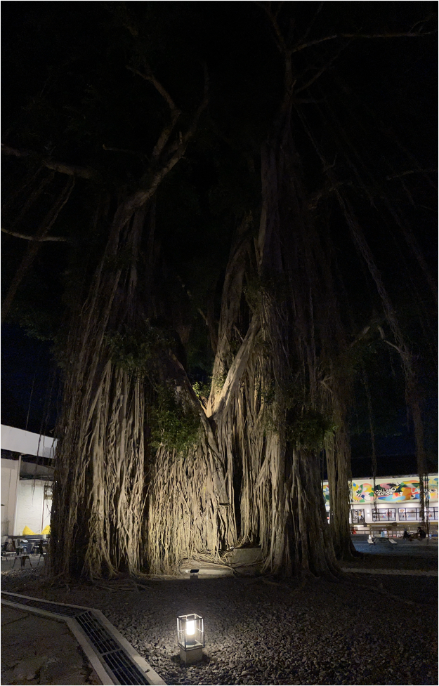
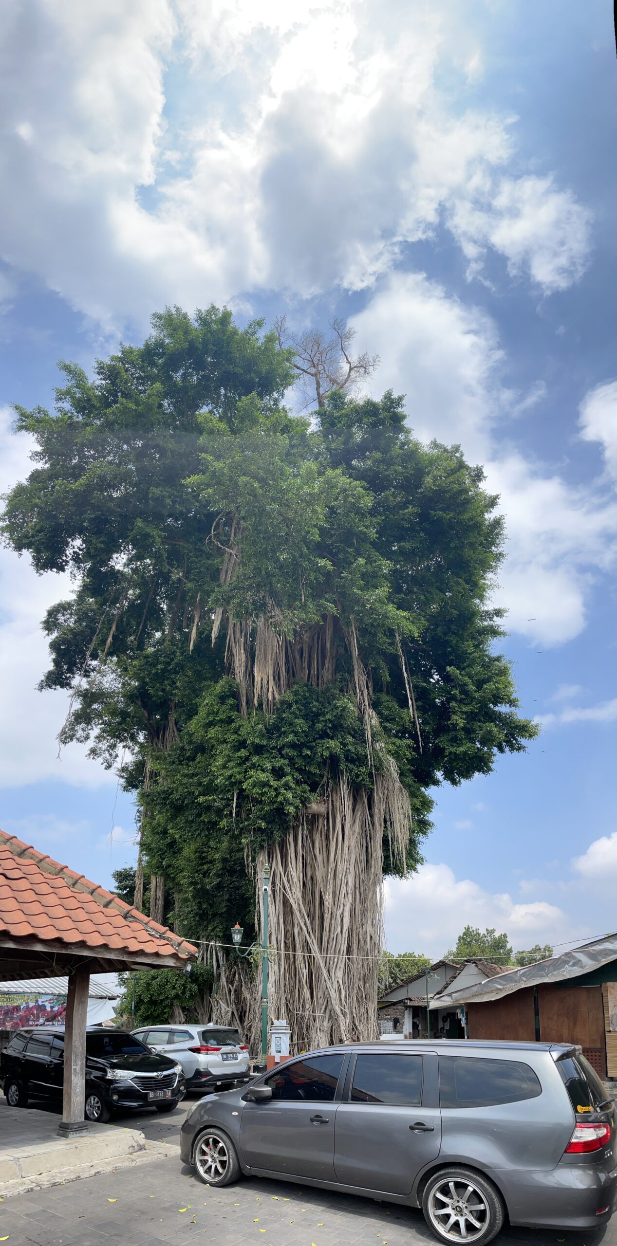
I think Jogja National Museum’s banyan (nighttime pic) should win the blue ribbon, but there are so many to choose from.

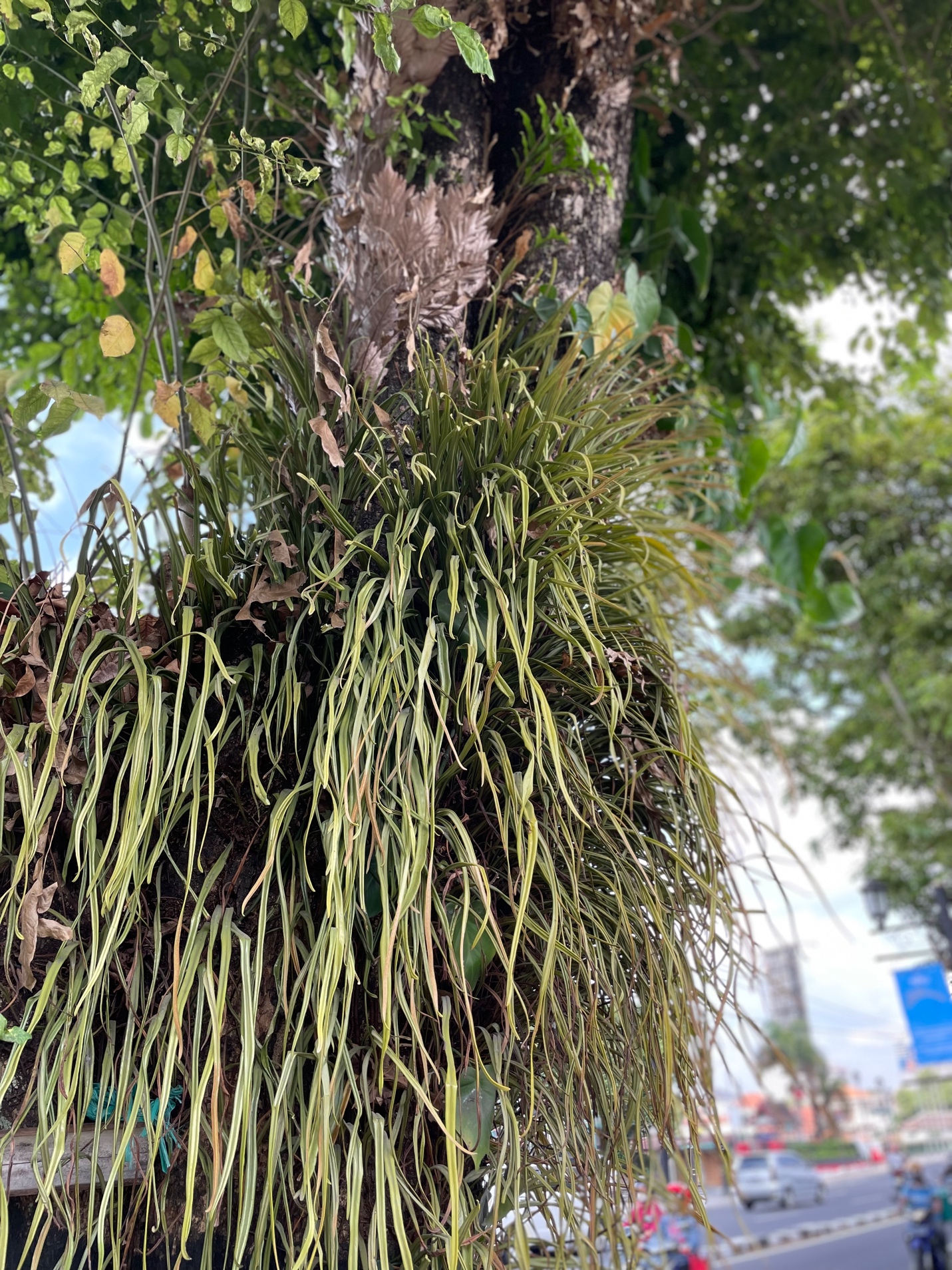
Banyans are planted at sites of worship or reverence, and a quick glance at them shows that the tree is not just a single plant organism but a microcosm! Many other life forms live among it including this swallow (Artamus leucorynchus) and so many epiphytes!

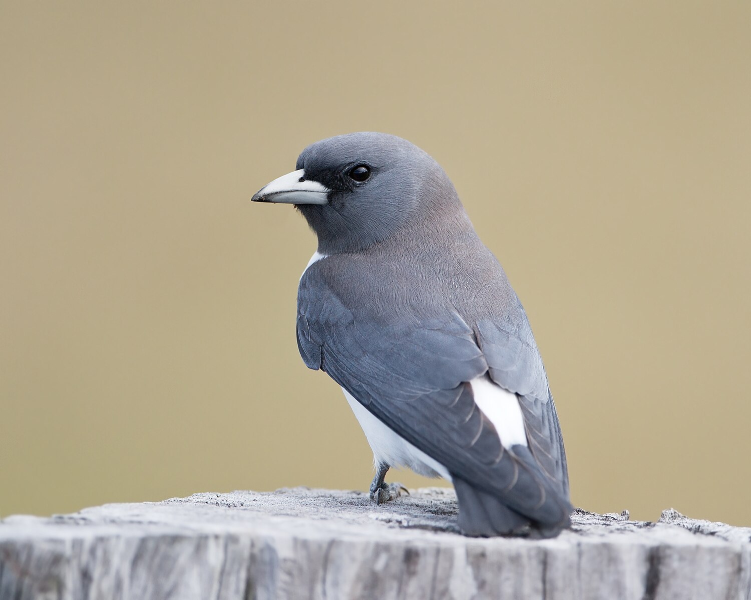
(Image courtesy of Wiki Commons and JJ Harrison)

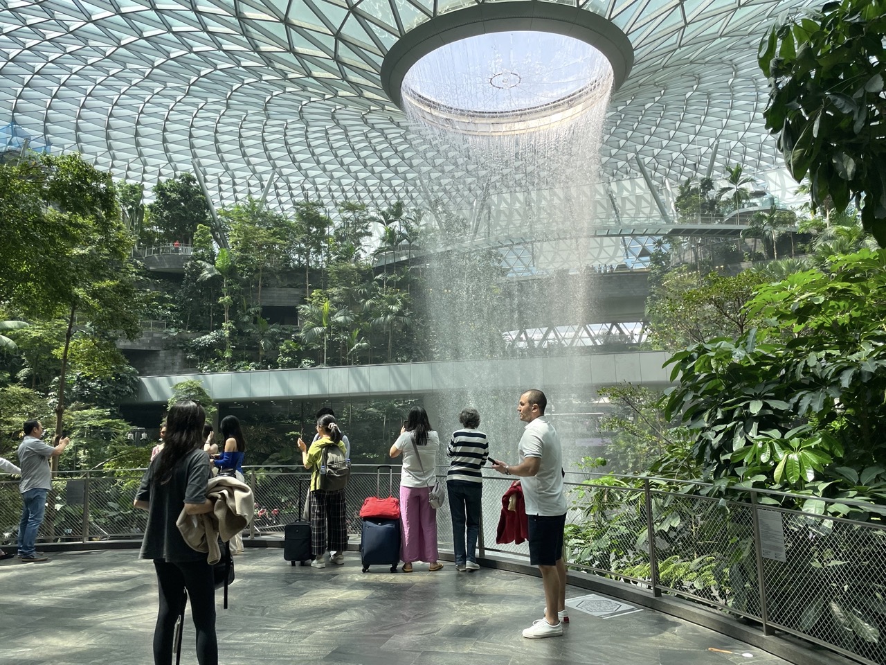
And here is where I imagined some future effort to present the natural heritage in the urban forest might center around banyans, perhaps even some combined presentation of banyans and some of Java’s most famous epiphytes, its native orchids! The city’s banyans might provide unique sites for education about multi-species plant communities. They could even host orchids in outdoor exhibit spaces. A quick run through Singapore’s Changi airport and it’s commercial-garden “The Jewel” should be enough to convince funders there’s a market for orchid gardens and orchid interpretive sites in heavily trafficked, commercial areas .

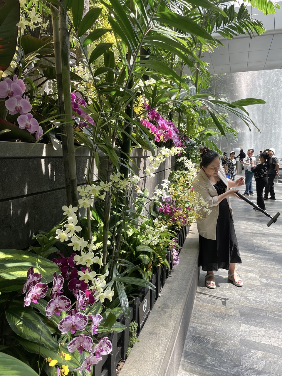
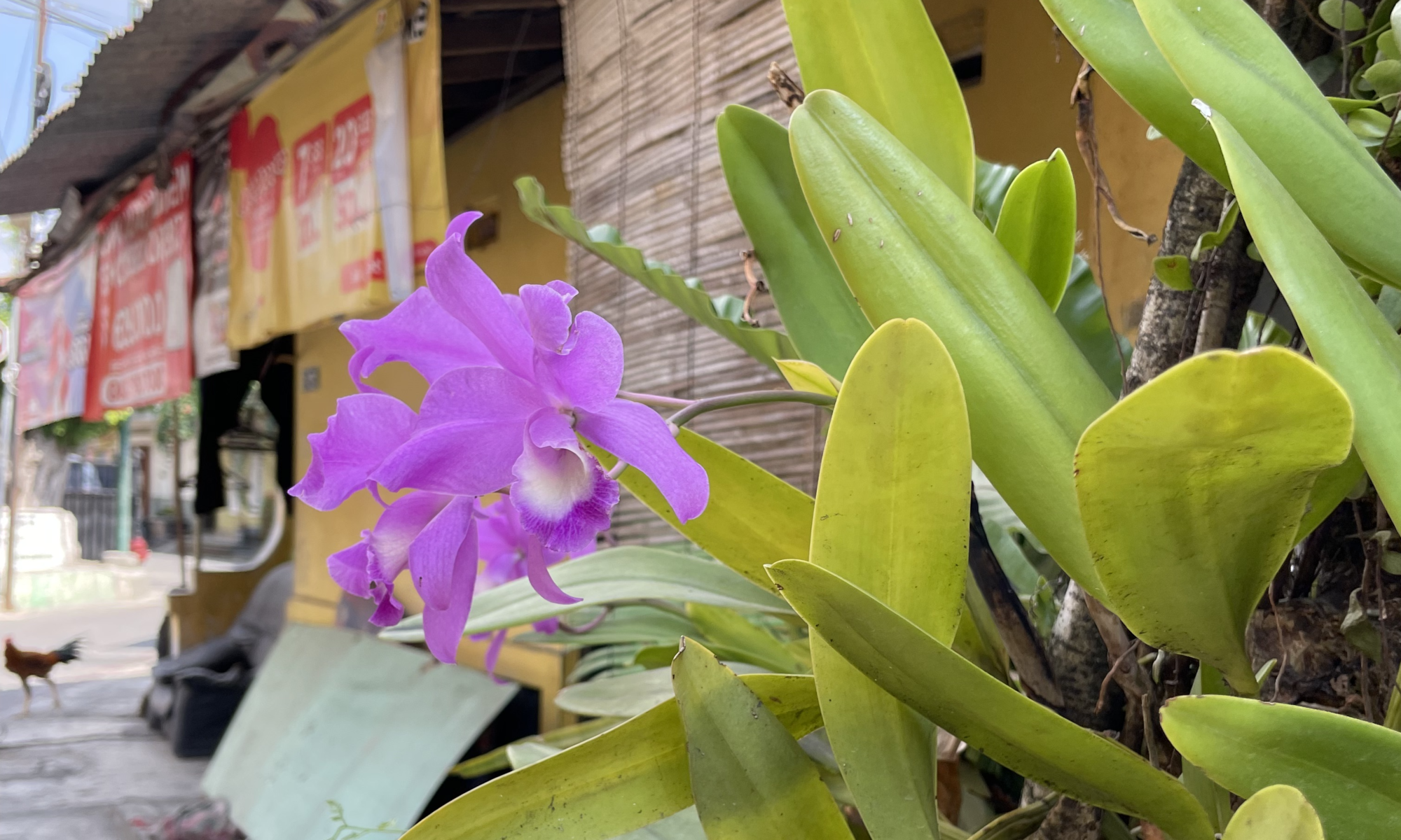
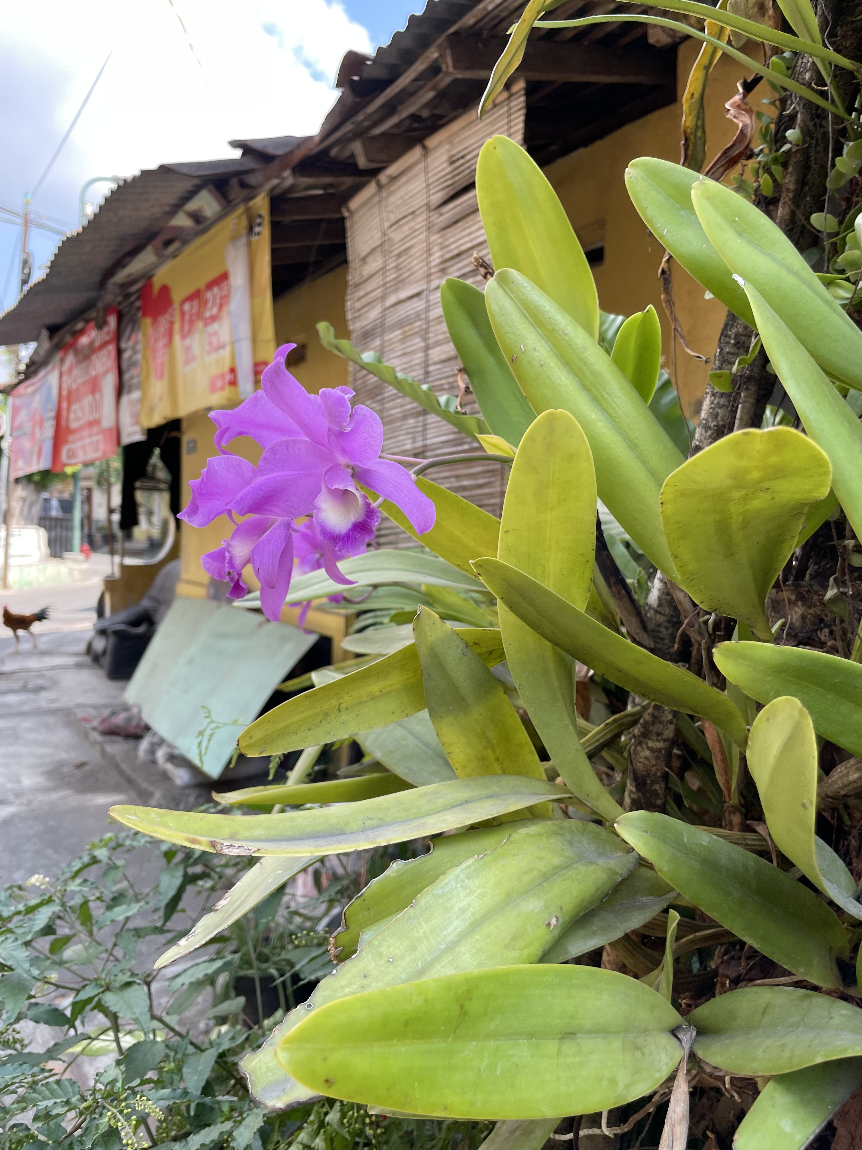
Along Malioboro Street, orchids are already part of the urban garden, present on many alleys and front porches.

Clearly people and neighborhood governments love banyans and orchids! Examining their multi-species communities, surveying native and cultivated, imported life, thinking of them as sites for digital or mixed media interpretation would make for a wonderful exhibit. Trees like banyans as urban sites for interpretation can be fixed with digital or QR codes and tied to urban heritage projects.

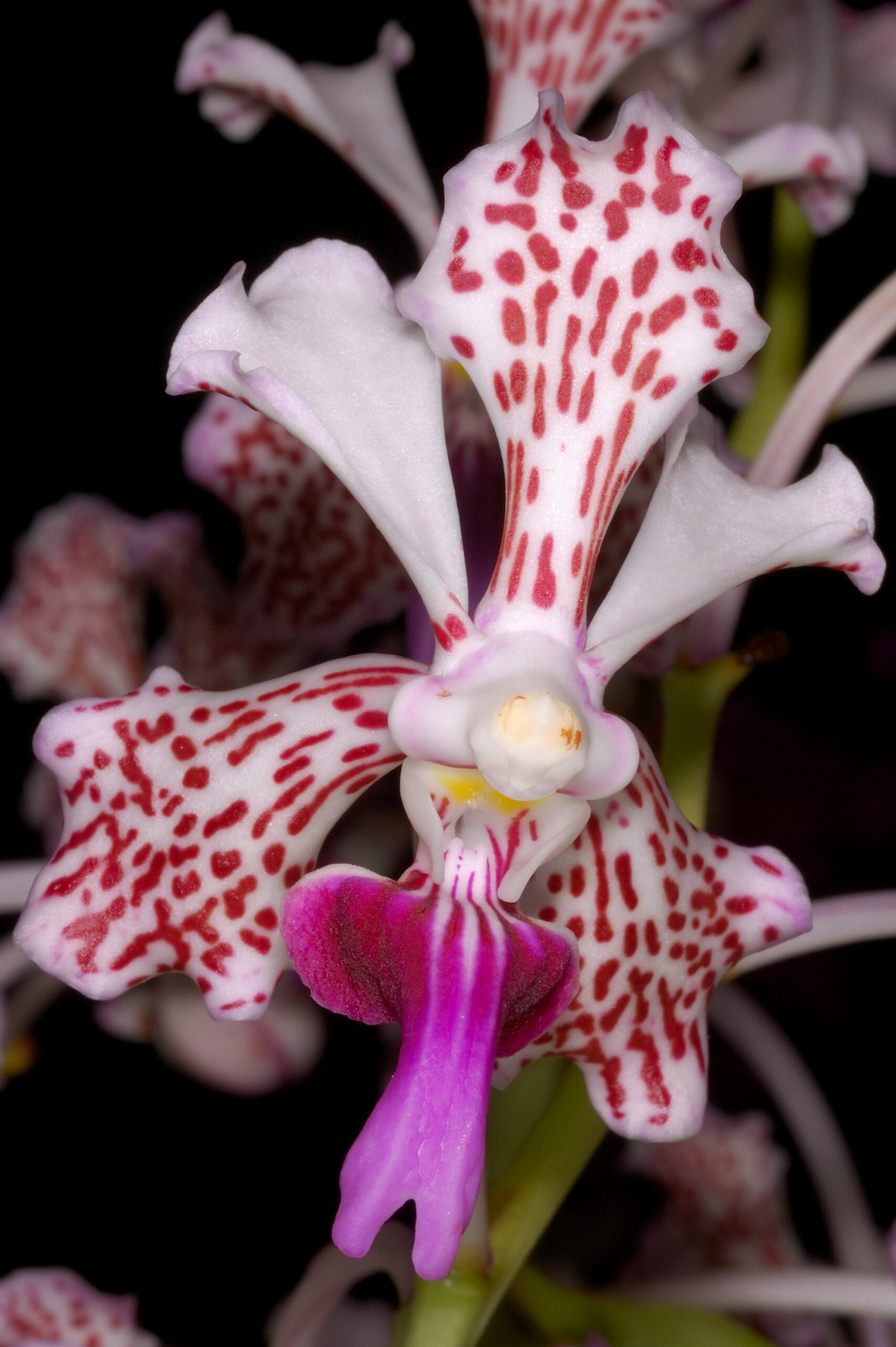
Orchids attract high-rolling sponsors, too, and hybrid cultivars (like tulips and roses) might be named after VIPs. Recently the Netherlands Queen Maxima visited Gadjah Mada University to attend the announcement of a newly cultivated variety of Mt Merapi’s celebrated species, Vanda tricolor such that it was named Vanda tricolor “Queen Maxima.” If royals are into orchids, there seems a ready source for investment into interpretation.

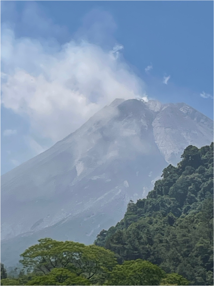
My hometown, Riverside CA, used an app for school kids and amateur birders to photo and geotag pics to a naturalist website showing sightings of birds. Unfortunately, plants cannot fly, so geotagging them opens up the same problems it does for ancient remains:  poachers! Anyway, there are ways to safeguard locations and still present digital images for a sort of citizen science. And Vanda tricolor is but one of hundreds of Mt. Merapi area species – the one most cultivated by commercial nurseries.

Merapi Orchids

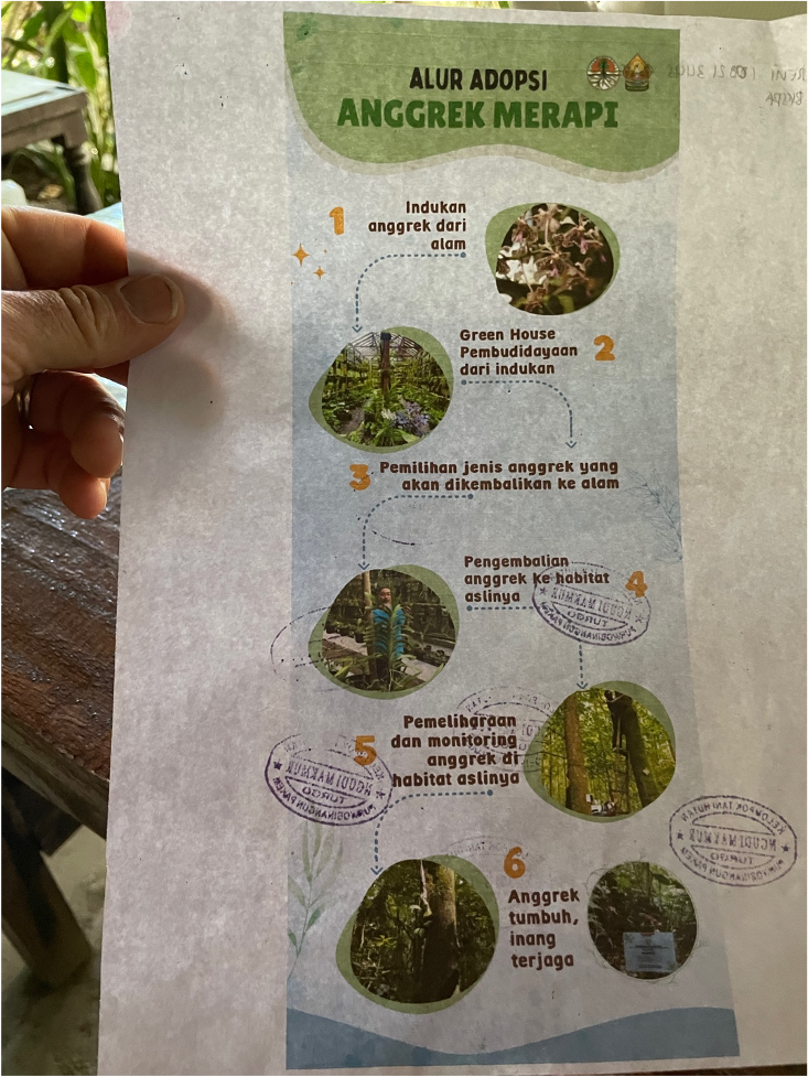
Holding the banyans idea for a sec, let me explain how I stumbled on orchids as one focus for preservation here. Our Day 2 tour to Borobudur was delayed by requirements for timed entry, so we took a detour to Pak Musimin’s orchid conservation nursery on the southern slope of Mt Merapi.

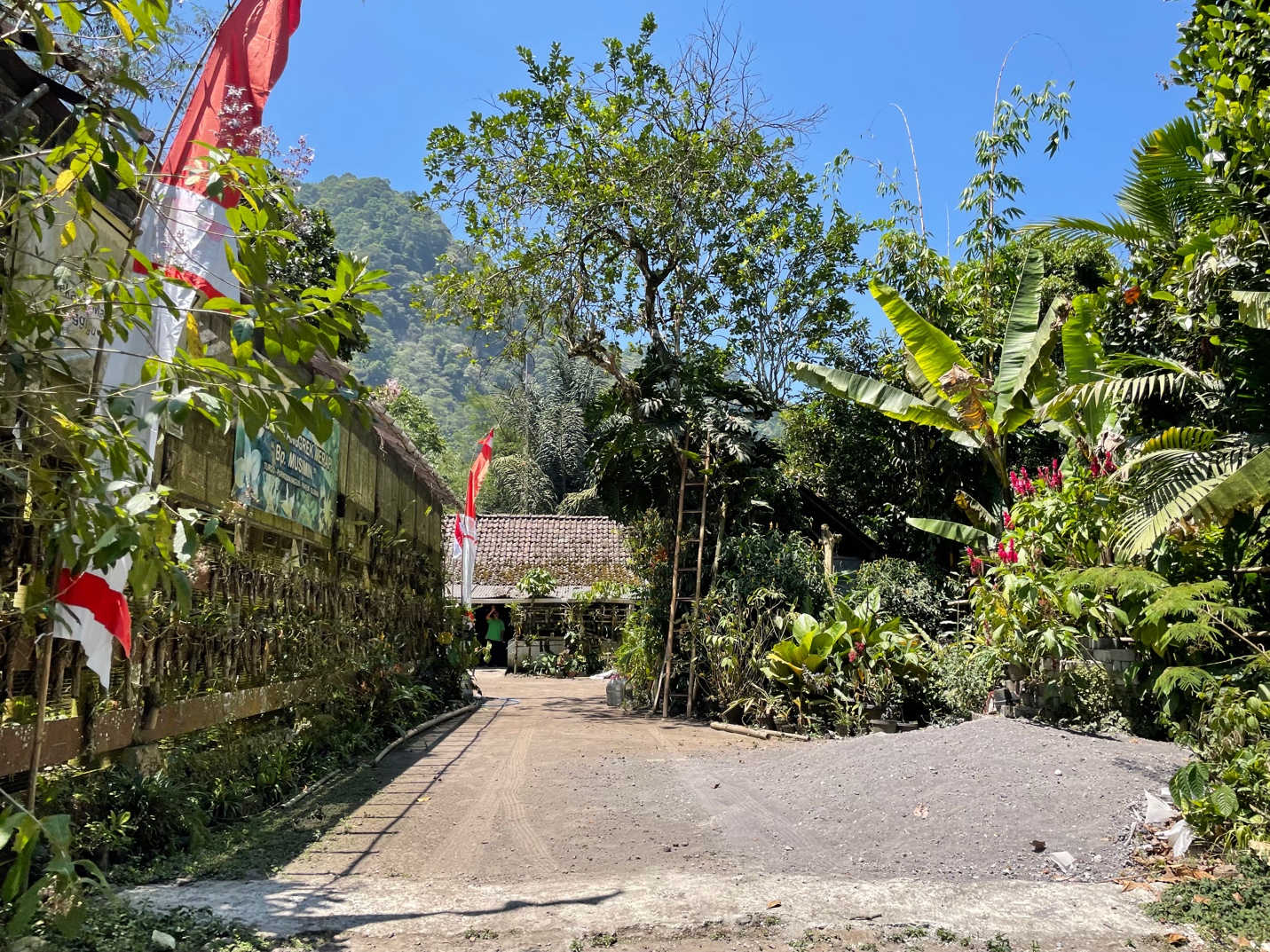
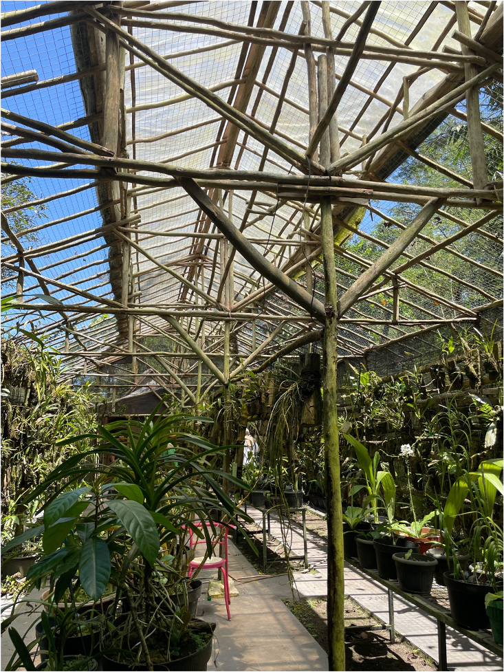
This is a conservation center propagating and re-establishing orchids in Merapi’s forests. Pak Musimin explained how native orchid habitats are under threat from forestry, natural destruction from eruptions and orchid-poaching. For twenty years, he and his wife have worked with Yogya orchid conservation groups to adopt orchids and then, when mature, re-establish them in forest habitats. They even developed a program for city people to adopt them and, once mature, return them to re-establish in the forest.

Mindblowingly cool!!!!! The idea of bringing in an urban community of orchid adopters which builds immediate and deep ties between cityfolk and a specific species and site in the forest. This, I think, is a brilliant strategy for promoting sustainable biodiversity conservation in the city.

On Malioboro Street one could incorporate biodiversity into historic preservation programs. I think the banyans and their human communities might serve as interesting sites for interpretation about native orchids , especially the globally popular (Mt Merapi native) Vanda tricolor.

Species from Southeast Asia Grown by Judy Carney

(image courtesy of Judy Carney)

Perhaps kampong communities connected with banyan trees could participate in orchid adoption, even naming them, and build interpretive panels for visitors on orchid-banyan tours. Protected banyans inside private grounds like mosques and historic sites might try establishing Vanda tricolor — assuming the plant can adapt to these urban trees.

Why are orchids important to history?? Culturally they have been important in Asia for more than 2000 years. There are orchids are found carved in stone at Borubudur and Prambanan, two 9th century monuments. The cut flowers keep for a long time, and they were used by traditional dancers, and the plants are biologically incredible. The can reproduce sexually (seed) and asexually (dividing at roots), they attract bats, birds, bees, other insects, even flies, as pollinators. And they symbolize healthy rhizomal, mycorrhizal communities. There is so much research right now in the roles of fungal communities in rehabilitating forests…and cities! Along with algae and other micro life forms.

So the symbol of Yogya’s official plant on Yogya’s historic banyans…it could serve as an important focal point for studying both the city’s and surrounding area’s multispecies community of life.

One of my favorite anthropological theorists for her multispecies approach is Anna Lowenhaupt Tsing who was trained as a specialist of Indonesia and wrote award-winning books like In the Realm of the Diamond Queen and Friction detailing field experiences in Kalimantan with Dayak peoples and connecting them to more global flows of people and natural products, commerce. I think her work might help to theoretically inform a preservationist project aroung Jogja and Merapi, especially her more recent books including The Mushroom at the End of the World and her collaborative, open-access work Feral Atlas.

Orchids are not only a huge business all over Asia and the Pacific (esp. Hawaii) but their native range matches well with the arc of Indo-Pacific countries connected to the historic Austronesian migration. All across the region stretching from Madagascar to Easter Island are orchid hotspots.

Hawaii’s orchid business is so developed that nurseries sell tourists flowers already packed and certified “clean” to pass border and customs requirements. Like tulips in Holland, they are ready for carry-on!

Perhaps there is an angle with orchids to connect the diverse island peoples and island ecologies where orchids originate, like Merapi’s pockets of diversity high up the slopes, in between lava stone and lahar. There should be possibilities for Yogya-area nurseries to profit from the export of its indigenous biodiversity.

I gather from academic papers in English that Gadjah Mada University’s plant scientists are leaders in the study of Merapi’s orchids, and I imagine there are plenty of experts who could help design orchid conservation, adoption, conservation and sales. I of course have none, just a regional historian’s eye for comparisons and metaphors–perhaps a resource for global or trans-regional comparisons.  But to collaborate on such a project would be a delight!!!!

A newcomer’s fascination with Yogya! 🙂

I’m returning to Riverside for a busy quarter of teaching, including a trial course on modern se asian history through the lens of historic plants — teak, abaca, rubber, pepper, sugar, etc. But next spring I will start a long-planned Fulbright Fellowship at Universiti Sains Malaysia, so possibly from there I can explore this orchid idea…along with a mangrove one, and no doubt others.

Terimah kasi!!!!

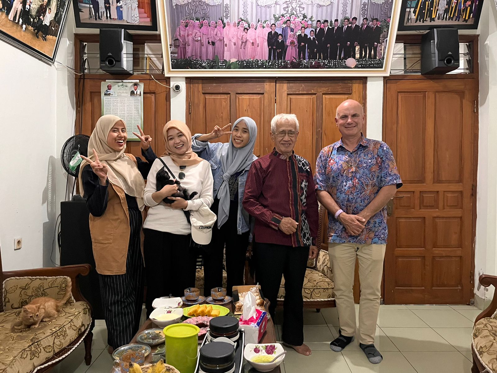
I owe my deepest thanks to the friends and family in Yogya who shared their time and their Yogya lives with me. Thanks to Dila’s parents and sisters for a delightful Saturday night dinner with amazing sweet treats.

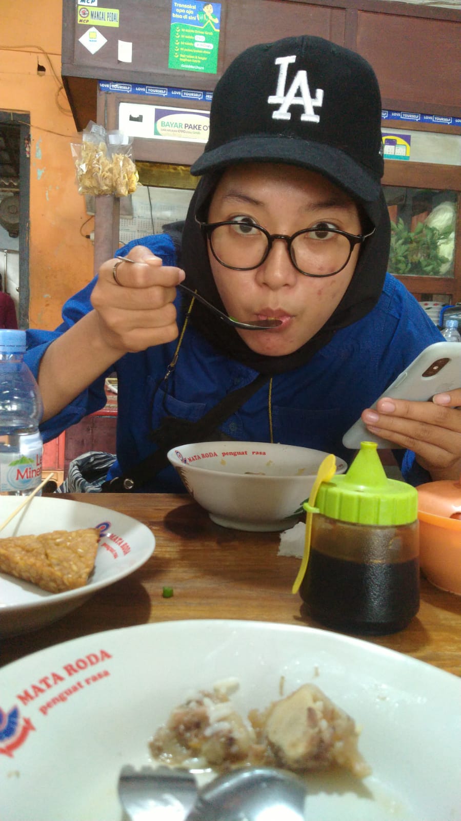
Yogya people have an incredible sense for sweet and varied desserts!!!! Dila’s sister scored a new top hit –  a dish with melon, lime, ice and coconut!!!! Me and my extra kilo thank you!

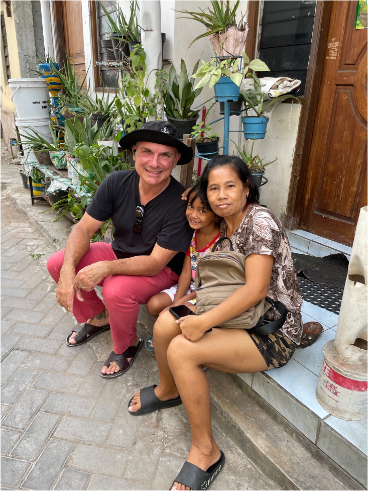
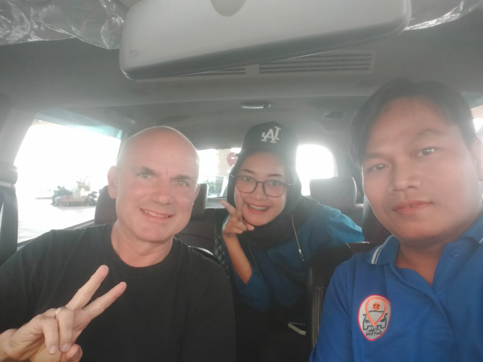
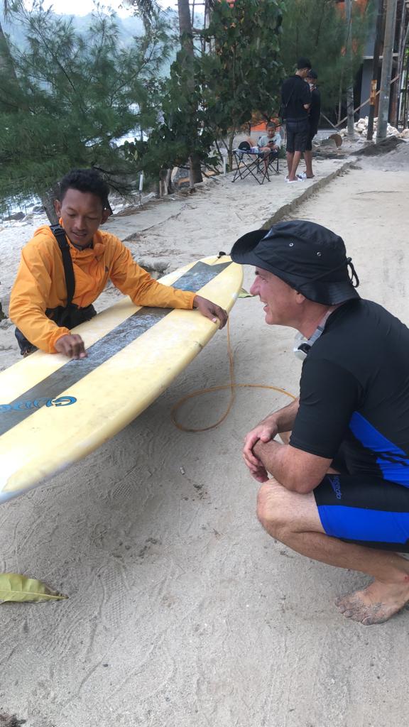
Thanks to driver Yusuf and his niece and interpreter Eggy who joined me for a hilariously fun trip to explore the southern coast of Java, its historic sites and national parks. They also shared about their life in a kampong on the edge of Yogya, about his experiences working in West Java’s steel mills, her experience going to college, working in call centers, and their work in the kampong preserving rich artistic traditions, also on raising kids, hoping for marriage, and many other things — sometimes hilariously mis/translated by Google Translate!

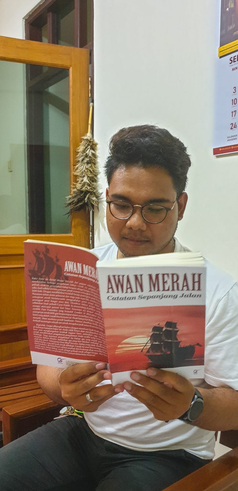
Through my colleague and dear friend, former Fulbright Visiting Prof at Riverside, Baskara Wardaya SJ, I was able to visit his community and learn about his research including a wonderful new book titled Awan Merah (Red Cloud) — that includes his observations from extensive travels in America, including a recent stay in Riverside!

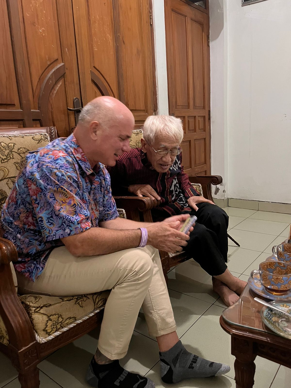
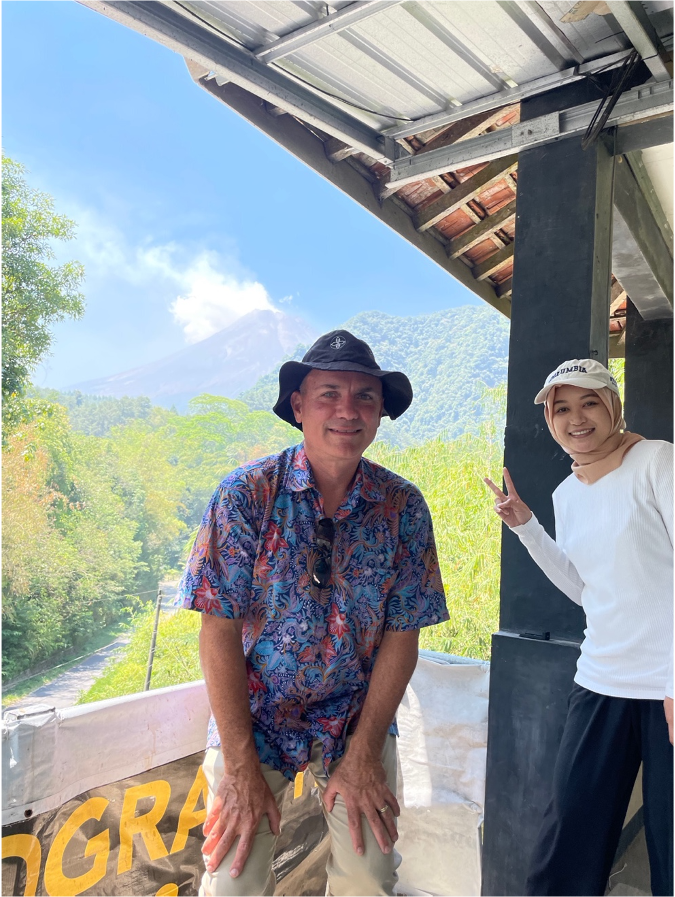
Finally, sincere thanks to Kemuning Adiputri for taking time from her professional work, friends and family for two days of intense touring, long car rides and answering hours of my nonstop questions, helping me learn from local experts and being perfectly brilliant! I felt not that I was talking with a recent graduate but a colleague with decades of observations and life experiences. Best wishes to your family, many thanks, and I look forward to meeting in the future!

To all Yogya friends: I look forward to when you will visit me in California!  You have a friend in Riverside, and if baseball season is happening, plan on a trip to Dodger Stadium’s Top Deck! 🙂 Like here with Ali, Dila, Tam, Linh and their kids!

Finding Historical Imagery – A Quick Approach

Friends have asked me about process in finding historical imagery about a site. Especially for studying historic changes in shorelines, land use, and other features, it’s very useful to look for mid-20th century imagery and maps. While North American and European countries offer up extensive online tools for downloading digital orthoquads, topos, etc., it’s much more difficult in formerly colonized parts of the Global South! Thus researchers have to rely, when possible, on imagery produced either by colonial powers or, esp. in Asia before 1945, by the U.S. military. This demo explores imagery for one study site, Waigeo Island off the northwest coast of West Papua (Irian Jaya).

The first place to go, especially if you want to compare features over large areas, is the incredible collection of declassified, American spy satellite photographs with the top-secret Corona or Keyhole Program. USGS maintains a searchable index on its Earth Explorer platform.

Corona Images of Waigeo

I did some research and the results were no good – all those stereo images, but everything’s covered in clouds! Those were the breaks before infrared scanners. Spies thwarted by clouds!

Searching your site on this platform requires selecting a polygon and then selecting “data sets”. Here you can see the polygon around Waigeo and then the “footprints” of resulting “keyhole” photos, stereo pairs, medium res, on November 13, 1966. The “F” and “A” in each photograph’s code means “fore” and “aft” cameras. If these images were not blanked out by clouds, then one could download these and assemble 3-d pairs. The little thumbnail of each image shows that these frames are totally white, so no use.

Also, the little icon of the red circle with a slash means the frame isn’t already digitized and downloadable. This means, if the frame was clear and gorgeous, you’d have to click the little shopping cart and BUY it at $30/frame. IF these were clear frames, then you’d be spending $360 to get 12 frames for building stereo pairs of the whole island for Nov 13, 1966.

Sadly, at least for us, it was a cloudy day on Waigeo on Nov 13th, 1966 so whatever was happening that day on the ground is lost.

But this isn’t it. For this region, I know that the final year of Allied military campaigns in the “southwest pacific theater” brought bomber squadrons to Papua, so I’m going to shift gears and look for Army Air Force images.

Researching WW2 historic imagery requires a little bit of knowledge about the ways state governments and militaries organized their air photography…but with a little bit of luck…and some good old fashioned word  searches…we might find some imagery.

US Army Air Force Photography

The historic collection of American air photos, including original celluloid roles of 9-“ wide film, is catalogued in Record Group 373 – Defense Intelligence Agency. Yep, you need to go down the rabbit hole of mid-20th century American military spying! (cue the music!)

During WW2 the operation was analogue but highly sophisticated, and in the 1950s it mushroomed into a huge effort to spy on everyone and photograph the entire Earth! One org, the National Photographic Interpretation Center, NPIC, launched under Kennedy in 1961 had an army of photogrammetrists, photo interpreters, and “intel” people pouring over photos like these and the Corona ones to document what everyone else was doing. Since the 1980s, most everything moved to digital scanners in space, think Landsat and secret military satellites. So these collections – film-based, archived – are really special, a 1930s-1970s time capsule compared to the flood of digital information since.

I first googled “army air force photography papua” and my first link turned me here, to this unexpected source at Library of Congress:

What I get from this is that the Army was busy studying key airfields on the northern coast of Papua, they even drew up pretty topographic maps (derived from air photos) in the Army Corps of Engineers standard way (also interesting, this history of Army Corps styles and conventions, line widths, symbols).

Nothing specific to Waigeo but some nice descriptive material about an aerodrome just to the southeast of it. So, a trip to Wikipedia, for more…

A military historian might then look at units assigned here, just to get a sense of the level of activity. Militaries are the ultimate Anthropocene organizations! Studying them is like studying industrial tree plantations or oil and gas pipeline projects. They have what’s called an “Order of Battle” that is a tree-like structure of their organization, and at the larger “trunk” levels, each unit has historians collecting photographs, writing up reports, etc. So they can be useful windows into stuff like SPECIES, esp. fish and trees, in 1944. Here I find a LOT of units:

So, now I want to check out military history records for more descriptive information. The Center for Military History and Defense Technical Information Center (dtic.mil, we love acronyms!) contain MANY useful histories of these units and military air reconnaisance, for ex. Piercing the Fog:

Chapter 5 is an account of that “southwest pacific” area, 1942-45, so worth a read. I’m only familiar with the Ch 6 accounts given that the B29’s were also bombing Vietnam in 1944. Also cool, “Japanese air intelligence.”

I took a side detour and was curious to find more recent USGS-related mapping, using space photography to study retreating Papuan glaciers. Not related to Waigeo, but fun and it draws on those 1942-45 AAF photos.

One pic from loc.gov searching turned up this view of Sansapor, too:

And besides Japan and the US, Aussies were snapping pictures of Papua from the air, but I guess the eastern (British) side:

Moving on to the US National Archives, they have really upgraded their digital offerings. Nice explanations on their “Unwritten Record” blog about their photographic collections, esp. foreign imagery collections that MIGHT include captured Japanese materials post surrender in 1945:

Now for diving into this record group – 373 – Defense Intelligence Agency. That’s the place to call up specific photo series for Army Air Force over Papua. We need to know overlay indexes and  1-degree-square and the NW corner to get to the right place.

At first, I wasn’t sure if it was NW or SW corner, so here:

Clicking on the overlay index, nope, too far north.

The first page for each index should be a 1-degree MAP, but this degree square lacks one, and I think I got the system wrong, so trying 00S130E (south of the equator), I get Waigeo:

Bingo! There’s Waigeo! So now the trick is to figure out if the American military ordered up any pictures on the island. To use it in this digital form, it helps to put a sticky on the screen of the area of interest, say a village on that inlet, and then scroll through each one. Sounds complicated, but when you try it you quickly get the hang of it.

Here’s the index map for 00S130E (south of the equator and 130 degrees east of Greenwich). I’ve highlighted a rectangle (imagine pasting a sticky on your computer screen).

Here’s the index map with “sticky”:

Now here’s a page of an air photo reconnaissance mission, clicking the next frame but keeping my sticky:

This tells me I have a HIT! Probably 25 photographs shot over my study site. We struck gold! However, look at the rest of the island, mostly empty. So it really is hit or miss whether you can find historic imagery completely covering a large study site. Let’s look at the collar info for some more details – if we were requesting this can of photo-negative film, we’d need it the OP(eration) Number.

Besices giving an OP number, penciled in later, the info here tells us that the view was partly cloudy, so beware. Also the date and some other info. Upon requesting the film you may find other issues, too, like the can cannot be found. And upon request, readers have to wait several days for the can to be physically retrieved from a salt mine near St. Louis, flown on a daily flight to Ft. Meade (NSA) and then driven to College Park and the NARA reading room. (For a brief overview of this amazing process, see my piece here.)

Also interesting (to me) is that this index was created in 1957, supporting a global mapping effort during the Cold War.

From here, the search for imagery requires physically going to NARA in College Park and requesting rolls of film (or hiring a very expensive research contractor).

Besides imagery, of course there are historic maps that can also be very useful especially for all of the details mapmakers inscribe as they convert air photographs into simplified information.

Perry Casteñeda Map Library

US military maps, too, can be very informative! One possible source for historic maps of your study area is the Perry Casteñeda collection at University of Texas. Here’s the index page for Indonesia:

With map-research, I think it is always best to start with smaller scale maps, 1:250-000 for ex:

Then, select the one, and if you are uncertain, “Click here for Index Map”. And you get a page like this:

From there, we can find Waigeo up in the northwest corner. And highlighted grid squares mean they exist in this collection.

Isn’t it a beaut! No topography for Waigeo, but TOPONYMS!!!

Here’s Waigeo:

And always read the collars! For map nerds, it’s mildly interesting that the map is based on a polyconic projection. Works better for equatorial locations. But the real info is what sources the mapmakers used.

I haven’t really scratched the surface of Dutch cartography, but I am fairly certain Dutch archives, museums and libraries have made their historical collections of places like West Papua fairly EASY to search.

I hope this tutorial can help you get started in researching imagery for your site!

Map Data: 1960 Security – Upland District

I had a nice skype interview with a grad seminar at my alma mater yesterday, UW in Seattle, and one student very rightly asked me when I was going to upload the map data I’d promised in my book to readers. The answer, friends, is NOW. I am renting some space on this server, 100GB, and I intend to USE IT! I’ll start with an archival map from the Vietnamese National Archives in HCM City from the records of the Cabinet of the First Republic of Vietnam (Đệ Nhất Cộng Hoa or Đ1CH in my notes in the book). The following image is super-cool as an example of American and CIA-inspired choropleth mapping used to describe communist-friendly areas in Southeast Asia. The use of pie charts, for example, with pink for “pinkoes” or “communist sympathizers” and the yellow for Republic of Vietnam loyalists (their flag was yellow with red stripes).

The map georeferenced, overlaying satellite imagery.

Here’s a link to the full-rez, georeferenced (for ArcGIS) FILE. Source info: File 17331, Record Group ĐICH, Vietnam National Archives Center No. 2.

Before I go further, let me just apologize outright to my geographer and GIS friends for providing no metadata on this. Please sympathize, I’m not an agency supplying data but an historian offering up usable files for the few.

Now, what’s cool about this map, especially when overlaying current satellite imagery, is how what was once a jungle clearing, bull-dozed grids of housing blocks and “enemy bases” has grown in the postwar era into a full-fledged town and district called Nam Đồng!

This illustrates a very important point about the communist nation-building effort, that not only were they establishing key strategic nodes in highland areas, but they were continuing a centuries-old program of “cultivating” these highland spaces. This term (giao hóa) suggests a particularly Vietnamese (and Chinese) style of interacting with highland groups. Bringing in highlanders to trade, providing literacy (in Vietnamese), integrating them into an expanding – topological – network of “the state”.

By contrast, the Diệm government, especially his brother Cẩn’s shadowy government ruling the central region, took a more brutalist approach to these highland areas that communists had been “cultivating” since 1947.

So, enjoy the map! Download the file, play with it, and let me know if it says anything more to you.


More info:

Here’s what I write about this map and how it fit into RVN nation-building in 1960, from Footprints of War, pp. 124-5:

“The new military rulers in the uplands of the province introduced new political maps with light and dark pink shadings that conveyed their singular purpose of counterinsurgency. Dark pink described areas that were deeply contested while light pink suggested fading support. While such maps fed into national military planning for the RVN, they also informed American military allies who had for years been drawing up similar maps in neighboring Laos and Thailand. The military authors of this map used dark pink shading to indicate areas still largely under the communists’ control. They used a lighter shade of pink to indicate lighter opposition in the hills west of Hoà Mỹ and southwest of another evacuated area, Khê Trái.

As a cartographic projection of the ARVN’s ambitions in 1960 for mopping up these bases of communist support, the map presented communist-controlled regions in symbolic terms most familiar to American counterinsurgency experts at the time. Small pie charts in each highlands commune showed, via darker shaded sections, the approximate percentage of people who were “Việt Cộng in the region,” still a majority across the hills. Lighter pink shading indicated areas with diminished support, and colored or empty circles indicated villages that supported a particular side or had been abandoned, respectively.

Excerpts of the map showing the map’s deep pink areas, the hills around Nam Đồng and the A Sầu Valley, bear closer inspection, for they show how ecological and political boundaries coincided, often separating ARVN posts from communist base areas by only a few kilometers. Reconstituted self-defense units and communist cells, pushed almost to annihilation during several years of unrelenting police sweeps, extended their political and communications networks to the very tips of streams and tributaries on the highest slopes. ARVN troops could not easily penetrate the dense forests without support from Katus and highland groups while communist partisans retained the older practice of navigating by rivers and mountain ridges with help from native highlanders.”

Back to the Mekong Delta

I had the pleasure of co-leading a group of graduate students to the Mekong Delta after having not been in the region for a good seven years. (My second book is focused on the central coast of Vietnam.) It was fun to revisit old sites and see old friends while traveling with the group. Below are some favorite shots from the trip.

Vinh Te Canal. View looking west from Chau Doc.

I love the above picture for the layers of activity and occupation. Houses on stilts back up into the canal while int he foreground a man fishes from a “ghe tam ban” or three plank canoe. In the distance, a barge approaches us. The water is reddish brown and opaque, almost milky with the fine silt washing down from the Mekong.

Chau Giang Mosque.

The group visited the Cham muslim community’s central mosque. During the visit, one of the imams received our group, and I learned something new.

Imam explaining the mosque and community history.

He corrected me on the history of *his* community and ancestors. They were not Chams who migrated west to the region in the 1700s and later converted to Islam but instead Malays who migrated north and east from Terengganu in Malaysia through Cambodia in the 1700s and finally settled here. Because Cham and Malay are distantly related, Austronesian languages, the Viet chroniclers and imperial officials in the area simply classified them as Cham. The post-1975 Socialist Republic of Vietnam likewise recognizes this community as a Cham ethnic group. One of the students, Nurrhoman from Bandung, Indonesia, communicated some basic phrases with the imam in Malay/Bahasa.

Group at Miếu Bà Chưa Xứ.

We visited a number of important spiritual sites in the region, including this temple dedicated to the Lady of the Realm, a goddess spirit followed especially by ethnic-Chinese inhabitants at a site that, in ancient times (before 6th century CE) was most likely a temple to Siva or Visnu. Allegedly those who pray to the Lady for good fortune who receive it must return to make offerings of thanks. The money from this return traffic then goes to various charities.

Prof. John Agbonifo and Martina van den Haak at Khmer temple, Oc Eo.

One great aspect of the trip was sharing the teaching with two fantastic scholars, John Agbonifo of Osun State in Nigeria and Debjani Bhattacharyya at Drexel University, and the author of the newly published Empire and Ecology in the Mekong Delta. It is a fascinating read!

Prof. Debjani w/ a local official in Can Tho, myself and the group.

We ended our delta trip in Can Tho with several meetings in this booming city. I left it in 2011 at 500,000 people, and now the city has tripled in area with a population of 1.5 million! My favorite meeting there was with an old friend, Ms. Huynh Le, who visited the group and spoke about life in this boomtown.

Huynh Le at her language school.

The trip ended in HCM City on Friday and students gave presentations on Saturday. Thanks to Ms. Hoang for the cute little souvenir! Pictured in the background is “Team Non Lá (Conical Hat)”.

Team Conical Hat

I leave you with a shot from old Saigon, the back of it’s main open air market. I like this shot for the many layers visible here. In the foreground the butcher stalls and flower stands of Ben Thanh. In the background are old facades from the French colonial and post-colonial eras. Then in the way back are the towering spires of recently completed skyscrapers. Farewell until next time, Vietnam!

Ben Thanh Market, Saigon

Book Release – UCR Media

My home institution UCR has really upped its game with media. This summer, they worked with me to develop a youtube video as well as write statements on my research for the alumni magazine. There were some bumps and starts in developing the film, one in particular was (to me) a funny reminder of generation gaps. Some of the Millennials in the video-editing crew thought that buying rights to a clip of “Huey” helicopters in the setting sun from the film “Apocalypse Now” would be a cool scene to start my promo video. (Not cool!) They replaced it with great, real footage. 

The online magazine version includes the film and the bio I wrote, quite like the layout! 

From UCR Magazine

 And the Press tells me the book is finally in stock!

Going Back to the Mekong Delta…

Next week I am excited to be a co-leader for the Leiden-based International Institute for Asian Studies’ In Situ Field School. The topic is “Delta Cities: Rethinking Practices of the Urban. I’ll be joined by two fellow “delta scholars” I very much admire:

Debjani Bhattarchaya – who has just come out with this FANTASTIC new book, Empire and Ecology in the Bengal Delta: The Making of Calcutta

John Agbonifo – who as a sociologist with historian tendencies has produced AMAZING studies on resource conflicts in the Niger Delta. 

Lục Bình (water hyacinth, Eichornia crassipes) on a Mekong Delta canal.
Photo Credit: David McCaskey

Also in tow will be two UCR graduate students from the History program, David McCaskey and Todd Luce. It’s a rare pleasure to share a trip to my study sites with them. Luce is completing a PhD on the water politics and history of the Salton Sea while McCaskey is just beginning his research on fisheries and development in Vietnam.  

UCR Video – The Vietnam War’s Environmental Legacy

I worked with our crackerjack media team this summer to develop this video about my research and my teaching at UCR designed to complement an article and press release on the soon-arriving book. Of interest to some, they wanted a location to shoot this that in some ways reflected connections to Vietnam.  I didn’t really know how closely the nearby March Field Air Museum’s exhibits might relate, but we found that this all-volunteer museum, drawing on contributions from veterans, has reconstructed a Vietnam-era firebase. Pics below capture some of our shooting “on set.”


Dr. Ellsberg and the Importance of Ground Truth

Last Saturday, I had the good fortune to join a book talk organized by professor of U.S. foreign relations Pierre Asselin for Daniel Ellsberg, the former Rand analyst and Pentagon official responsible for leaking the Pentagon Papers in 1972. Ellsberg has a new book, The Doomsday Machine,  published in December 2017. The book is a fascinating-yet-terrifying tour of American nuclear weapons strategies that for most of the fifties and sixties rested on one basic tactic should aggressions break out: total and overwhelming annihilation of the USSR, China and most of Europe. Summing up the book in a nutshell, there was no Plan B; and only after 1961 when American spy satellites confirmed the Soviets had only a handful of missiles did this nuclear planning ratchet down a bit. (See my piece on Corona photography in Vietnam here.) . For those who may not read Doomsday Machine, one other important fact Ellsberg dispels is that of the “football” or what President Trump in his tweets about Kim Jong Un detailed as his bigger “red button.” If readers take nothing else from the book, they should drop this notion that the President of the United States is solely responsible for launching nuclear warheads. Military officials further down the chain of command have had this ability since the early 1950s.  Another bit from the book that may surprise some historians of the 1960s and 70s is that when Ellsberg copied the thousands of pages in the Pentagon Papers taken from his Santa Monica office at Rand, he also copied material beyond it including a secret memo, NSSM-1, detailing Nixon’s strategy to expand the American war into Laos and Cambodia.

Meeting Dan Ellsberg

As an historian who spends most of my research time in the field, studying the places of the war in Vietnam rather than the halls of power that ordered it, I told Dr. Ellsberg how much I admired his principled stance as well as his incredible writing style–not only in these books but also in his now declassified reports such as “Revolutionary Judo: Working Notes on Vietnam No. 10.” I told him that his insights into the conflict put him right up there with another person I met on several occasions, Phạm Xuân Ẩn, a former Reuters and Time correspondent in Sài Gòn who it later turned out was a spy and general in the NLF. (Historian Larry Berman’s Perfect Spy details Ẩn’s story, at least the story Ẩn wanted told.) Like Ellsberg, Ẩn wrote detailed analyses of the situation in Vietnam and he was routinely consulted at the Time office in Saigon by American military and CIA specialists for his “take” on the insurgency. Ellsberg, like Ẩn, was a man who trafficked in secrets.

I managed to get a copy of my forthcoming book, Footprints, into Ellsberg’s hands, curious to get his take on my reading of many now-declassified reports and my perspective as an historian working on the ground in Vietnam today, exploring the rapidly-disappearing ruins of the American war. This is where the sharp-as-a-tack, 88-yr.-old surprised me. “You know, I was in Vietnam on the ground for two years. Read my other book, Secrets.” Ellsberg’s 2002 memoir of his travels to Vietnam and his eventual decision to leak the Pentagon Papers reveals an unexpectedly wild ride. Here was an analyst who not only synthesized reports but ground truthed them by spending time outside Saigon to see conditions for himself.

Ellsberg, mid-30s in the Mekong Delta, from Secrets: A Memoir of Vietnam and the Pentagon Papers

His chapters “Travels with Vann” and “Rach Kien” shocked me. Here was a man in his mid-thirties traveling with the arch druids of American counterinsurgency in Vietnam, Edward Lansdale and John Paul Vann.  He recounts how Vann insisted on not flying via helicopter like almost every other military and State Department observer in those days. Instead he drove Vietnam’s highways in an International Harvester full tilt with weapons at the ready, to see for himself how things were going on the ground.

“Travels with Vann” describes a series of road trips along highways that just months later would be brimming with deadly ambushes on U.S. soldiers.  In “Rach Kien” Ellsberg describes embedding with a U.S. Army infantry unit at a former NLF stronghold in the Mekong Delta south of Sài Gòn. While walking point with the platoon, Ellsberg comes under fire and describes participating in combat despite his official role as a civilian sent down to observe.  Here he considers multiple problems in the larger American military strategy called pacification.

What stands out to me as an historian focused on Vietnam was that Ellsberg was one of a very small number of higher-ranking American officials in Saigon who dared to hop in a car, hit the road and talk to people much less participate in such engagements.

One passage in the book, especially, captures the same fascination that I had for the layered, historic landscapes of conflict especially in central VietnamEllsberg describes driving south of Đà Nẵng on Highway 1 in spring 1966 to survey responses to the Buddhist protests. He notes “an unusual succession of abandoned fortifications, of various constructions, that dated from different periods successively further back in time.” (p. 134). His Vietnamese interpreter notes that one is French and then another series of rounded ones were Japanese. When they reach the crest of a hill, the interpreter points out a pile of rubble that is reputed to be a more ancient fort from a period of resistance to Chinese occupation in the 1400s.

I had a very similar experience when a guide pointed out to me beyond the rubble of the former US Army Phú Bài Combat Base were the ruins of French, Japanese and imperial Vietnamese bases. Ellsberg recounts a feeling that I believe many American soldiers felt as they explored this historic conflict zone:

“I knew we were following the French in Vietnam, who for all their colonialism were our allies in two world wars. But as someone who had grown up on movies of the war in the Pacific, and then on war stories in the Marines, I found it eerie to hear I was walking in the footsteps of Japanese invaders.”   (Secrets, p. 135)

This perfectly captures the metaphor of footprints that I use in my new book. Footprints of War is my attempt to write the history of a place where so many different soldiers have passed, showing how this more grounded perspective conflicts with and challenges the more common aerial views of war zones favored by generals, high-ranking officials and screen-viewing publics today.

Ground Truthers in Vietnam

Wolf Isaac Ladejinsky
Wold Ladejinsky

Of course Ellsberg wasn’t the first to hit the roads of Vietnam and report his findings.  Former OSS officers, US development officials and others repeatedly reported disturbing signs from the ground. A decade earlier, another State Department economist, Wolf Ladejinsky, traveled many of the same highways to report on the “rural situation.” (I describe his forays in my book Quagmire.) Ladejinsky was a child of Russian Jews who fled the communist revolution, and he established his reputation developing policies after 1945 designed to ensure the continuation of private rural economies in Japan and Taiwan. However, as a youth in New York who spoke Russian and worked with the Soviet allies in WW2, Ladejinsky was also a target of McCarthy’s red scare. Eisenhower did what he could to vouch for him, but ultimately Ladejinsky was forced out of his secret clearances and high-ranking posts. He was not fired from government service, however, as the McCarthyites had nothing on him; but he was forced to take a transfer…to Saigon in 1956.

What distinguished Ladejinsky from the moment of his arrival, like Ellsberg a decade later, was that he got out and talked to people. Unlike many Americans holed up at the Embassy or in the many coffee shops and bars, Ladejinsky traveled by road to the farthest corners of the delta. He met with former Viet Minh officials and described rampant corruption in the newly formed Republic of Vietnam. Like Ellsberg, Ladejinsky also wrote fantastic reports!

However, Ladejinsky’s reports for unknown reasons went almost a year before being received in Washington. When they landed, they earned him a lot of friction with peers in the Saigon embassy. This time he was forced to retire, tried in an administrative procedure on a weird, conflict of interest charge from his time in Taiwan later found to have no grounds. Remarkably, Ladejinsky stayed on another year in Saigon as an advisor to South Vietnamese President Diem before leaving to work for the World Bank in Nepal. (Robert McNamara suffered a similar, soft fate in 1968 when he left the White House to serve as the Bank’s president.)

Ground Truthing Today

What strikes me most in Ellsberg’s book and with others like Ladejinsky is how comparatively little reporting regarding American wars today in Afghanistan, Iraq, Syria and Africa is coming from the ground. I’m not sure what new rules in the Patriot Act or other conditions have so thoroughly muzzled reporting from these fronts. C.J. Chivers’ recent essay for the Times War Without End” is a welcome exception though it describes actions from almost a decade ago. What’s vitally missing today in our continuing military conflicts is steady reporting from the ground. Of course, Ellsberg’s reports at the time were classified, so one may at least hope that similar internal reports on these “situations” today will eventually come to light. 

Vietnam: The Chemical War

Next month I’ll be speaking at UNC-Greensboro on October 18th at 7:30pm on the subject of chemicals and the Vietnam War. The talk is part of a year-long series of talks organized to reflect on the 1960s, and I’ll talk about recent research completed as part of my new book Footprints of War: Militarized Landscapes in Vietnam but I’m also hosting a rare film showing from one of Vietnam’s greatest living documentary filmmakers, Trần Văn Thủy. The film we will see is one that received very little attention, “Story from the Corner of a Park” about a war veteran struggling to make a living taking pictures in Hà Nội’s central Lenin Park. Its a wonderful, anachronous piece for two reasons: (1) a growing number of Vietnam War veterans are passing on, leaving only stories and, in some cases, children with illnesses associated to chemical exposures (2) the urban landscapes of Hà Nội have changed so much from this early 2000s film.

For those more familiar with American soldiers’ experiences with the war and especially concerns about Agent Orange, the film is a little-publicized mirror from the Vietnamese side. For details on the pre-talk film showing, please contact Prof. James Anderson at jamie_anderson@uncg.edu.

David Biggs Lecture “Vietnam: the Chemical War”

The talk draws in part from an op-ed in the New York Times that I wrote to address a slightly different issue: the total chemical footprint of the 1960s war extending beyond just the one infamous chemical Agent Orange to  include a host of others such as CS, napalm, now-banned insecticides, carcinogenic solvents, and others. I encouraged reader to check out the “readers pick” comments. Here we see not just the range of emotionally and ethically charged responses from readers but many more detailed comments by former chemical platoon helicopter pilots, doctors performing plastic surgery, policymakers and others. 

Shortly after the op-ed published, an official from the US Embassy in Cambodia emailed me. He’d read the article and wondered if I knew anything about recent Cambodian claims of buried American chemical waste.  I shared my archival data on chemical missions involving CS and even put him in touch with the chemical platoon helicopter pilot who’d commented on the NYTimes site.  The US continued the painstakingly long process of decontaminating sites and working with SE Asian governments to remove unexploded ordnance, contaminated soils, and other remains.

Given the recent discussions about the Syrian government dropping barrel bombs on civilians, I this image from the National Archives shows that they were not the originators of this practice. The image below shows the practice what I think is a “bulk flame drop” – a drop of 55-gallon drums of napalm –  per official U.S. Army photographs. “Bulk smoke drops” of CS involved pushing fused barrels out the cargo bay of the CH-47 “Chinook”. Army Chemical Corps soldiers netted the napalm to hang from below since it was a payload of gelled gasoline (!). The barrels dropped a few thousand feet before jet strafing fire ignited them just over the target, often networks of tunnels or bunkers. The aim was to incinerate or asphyxiate enemy combatants (and anyone else) below.

Source: US National Archives, RG 472, United States Army Vietnam, Chemical Units, 184th Chemical Platoon, Organizational History, 1960 thru 1971, Box 5.