I had a nice skype interview with a grad seminar at my alma mater yesterday, UW in Seattle, and one student very rightly asked me when I was going to upload the map data I’d promised in my book to readers. The answer, friends, is NOW. I am renting some space on this server, 100GB, and I intend to USE IT! I’ll start with an archival map from the Vietnamese National Archives in HCM City from the records of the Cabinet of the First Republic of Vietnam (Đệ Nhất Cộng Hoa or Đ1CH in my notes in the book). The following image is super-cool as an example of American and CIA-inspired choropleth mapping used to describe communist-friendly areas in Southeast Asia. The use of pie charts, for example, with pink for “pinkoes” or “communist sympathizers” and the yellow for Republic of Vietnam loyalists (their flag was yellow with red stripes).
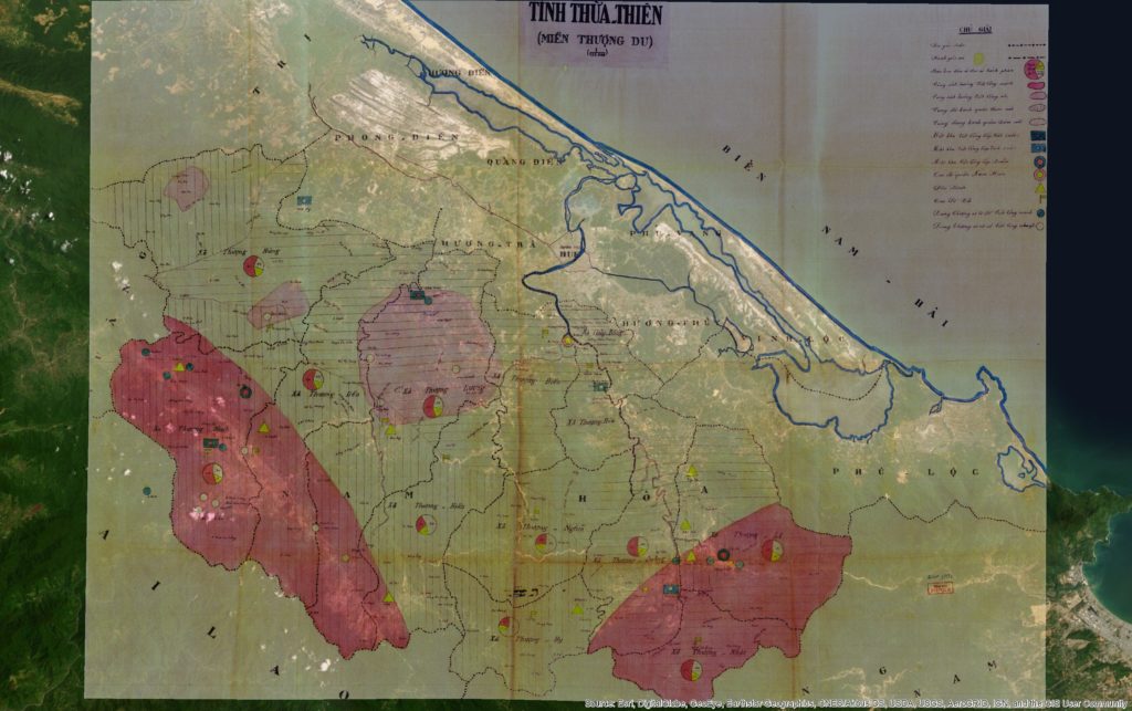
Here’s a link to the full-rez, georeferenced (for ArcGIS) FILE. Source info: File 17331, Record Group ĐICH, Vietnam National Archives Center No. 2.
Before I go further, let me just apologize outright to my geographer and GIS friends for providing no metadata on this. Please sympathize, I’m not an agency supplying data but an historian offering up usable files for the few.
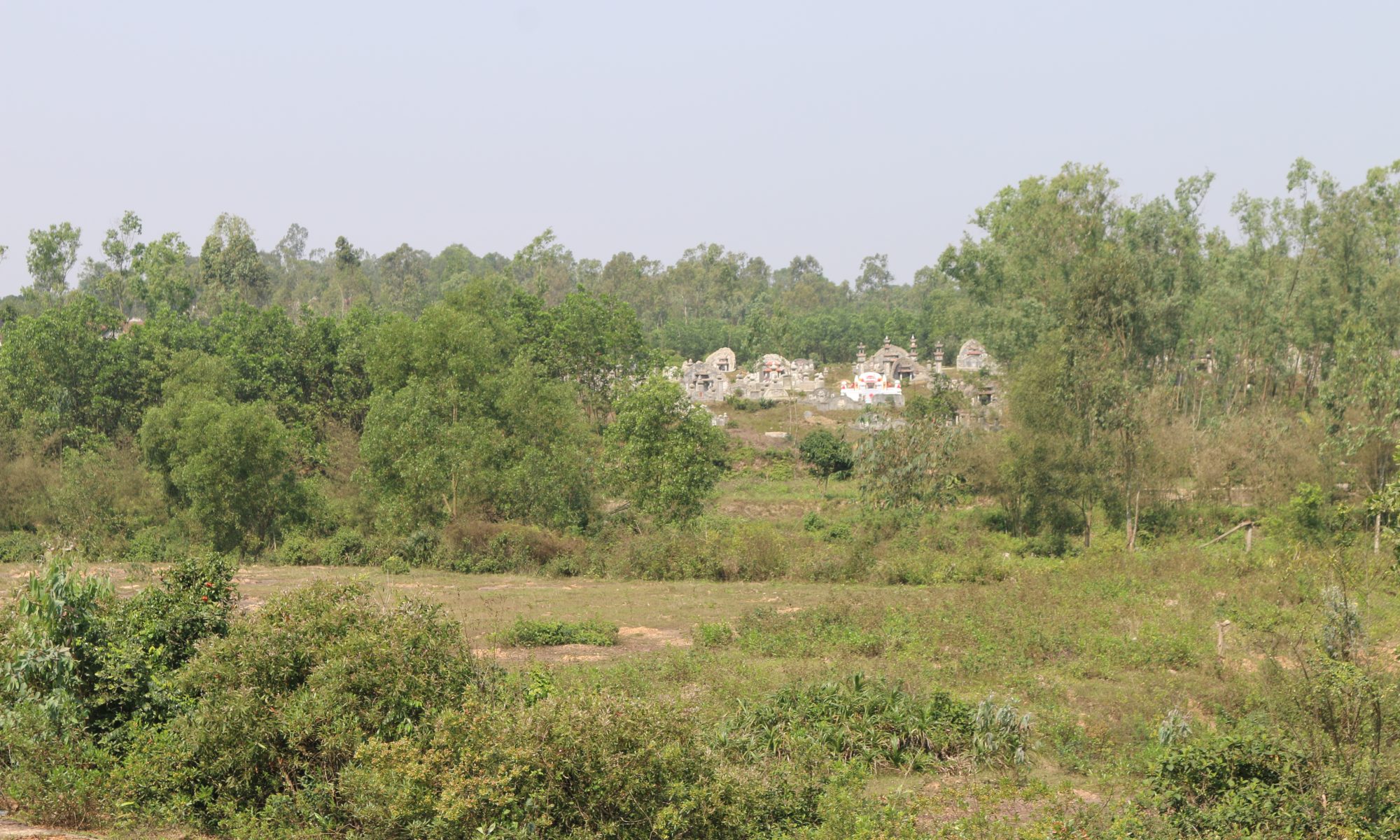
Now, what’s cool about this map, especially when overlaying current satellite imagery, is how what was once a jungle clearing, bull-dozed grids of housing blocks and “enemy bases” has grown in the postwar era into a full-fledged town and district called Nam Đồng!
This illustrates a very important point about the communist nation-building effort, that not only were they establishing key strategic nodes in highland areas, but they were continuing a centuries-old program of “cultivating” these highland spaces. This term (giao hóa) suggests a particularly Vietnamese (and Chinese) style of interacting with highland groups. Bringing in highlanders to trade, providing literacy (in Vietnamese), integrating them into an expanding – topological – network of “the state”.
By contrast, the Diệm government, especially his brother Cẩn’s shadowy government ruling the central region, took a more brutalist approach to these highland areas that communists had been “cultivating” since 1947.
So, enjoy the map! Download the file, play with it, and let me know if it says anything more to you.
More info:
Here’s what I write about this map and how it fit into RVN nation-building in 1960, from Footprints of War, pp. 124-5:
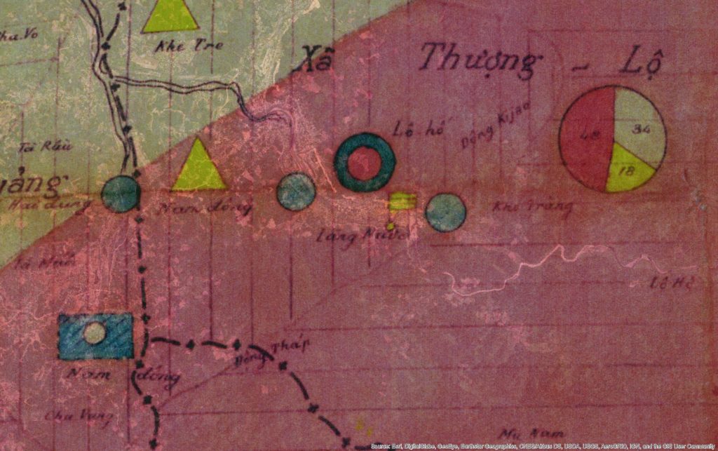
“The new military rulers in the uplands of the province introduced new political maps with light and dark pink shadings that conveyed their singular purpose of counterinsurgency. Dark pink described areas that were deeply contested while light pink suggested fading support. While such maps fed into national military planning for the RVN, they also informed American military allies who had for years been drawing up similar maps in neighboring Laos and Thailand. The military authors of this map used dark pink shading to indicate areas still largely under the communists’ control. They used a lighter shade of pink to indicate lighter opposition in the hills west of Hoà Mỹ and southwest of another evacuated area, Khê Trái.
As a cartographic projection of the ARVN’s ambitions in 1960 for mopping up these bases of communist support, the map presented communist-controlled regions in symbolic terms most familiar to American counterinsurgency experts at the time. Small pie charts in each highlands commune showed, via darker shaded sections, the approximate percentage of people who were “Việt Cộng in the region,” still a majority across the hills. Lighter pink shading indicated areas with diminished support, and colored or empty circles indicated villages that supported a particular side or had been abandoned, respectively.
Excerpts of the map showing the map’s deep pink areas, the hills around Nam Đồng and the A Sầu Valley, bear closer inspection, for they show how ecological and political boundaries coincided, often separating ARVN posts from communist base areas by only a few kilometers. Reconstituted self-defense units and communist cells, pushed almost to annihilation during several years of unrelenting police sweeps, extended their political and communications networks to the very tips of streams and tributaries on the highest slopes. ARVN troops could not easily penetrate the dense forests without support from Katus and highland groups while communist partisans retained the older practice of navigating by rivers and mountain ridges with help from native highlanders.”