Teaching is a privilege and a tremendous opportunity to work out big ideas. At UC Riverside, a large public university serving many first-generation college students, I teach a big course for 500 students on the 20th century world as well smaller courses on SE Asia, environmental history and Vietnam.
One very nice discovery during the pandemic has been finding new ways for students to work collaboratively with each other in their writing and research by using blogs. Years ago I experimented with blogs. They’re not a new thing! For instance, I used it on a study abroad program to Hue, Vietnam as a way for students who were traveling, away from libraries and dorms, to log their writing and share with friends back home.
But this winter term, there’s not really the same motivation. It’s not like we’re traveling to magical lands, meeting amazing, new people, eating wonderful, new foods! 🙂 But still, students want CONNECTION. And perhaps they are taking their digital connection a little more seriously since it is all they have. Last term, I dove down the rabbit hole of a discord server with my 500-student History 20, but discord lacks any real lasting structure, just an endless chat and it tends to foster gamer-style chats, little more.
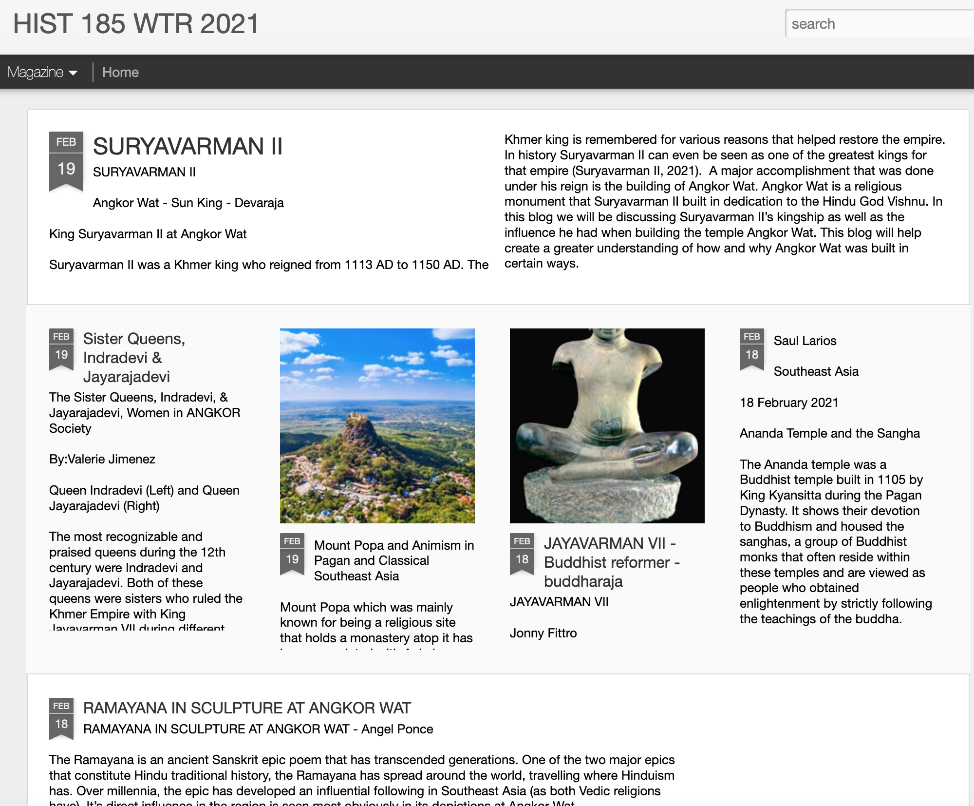
But blogs, and especially commenting and asking students to CITE each others blogs in their papers, this WORKS! I’m teaching an Early SE Asian History course this term, and students are asked to write blogs on a prearranged list of topics:
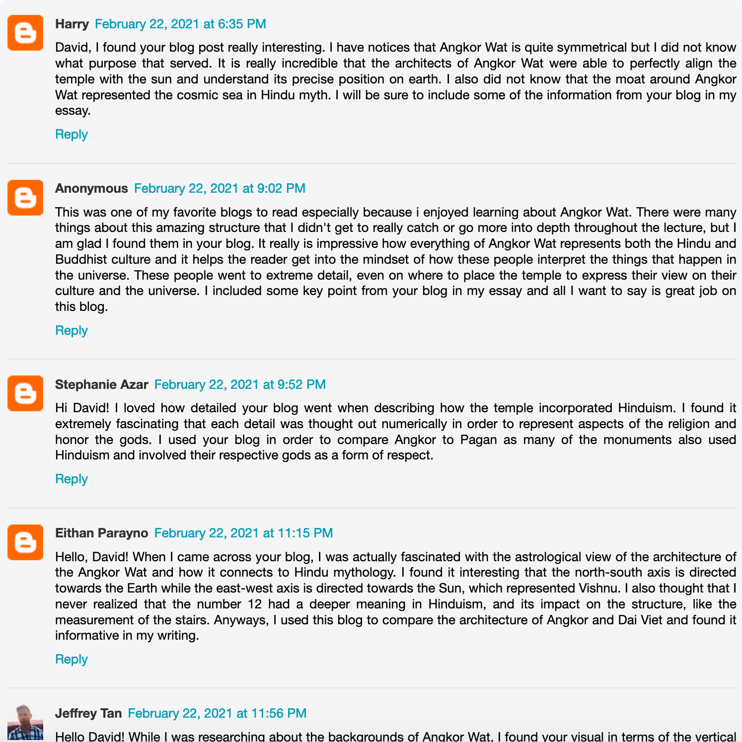
They bring in and cite sources, and then other students writing about Angkor, Pagan, Dai Viet etc. are asked to cite other students’ blogs in developing their take-home essays. And they are required to cite their peers’ blogs and add comments on each one they use. Here’s a sample, student comments on David Baltierra’s blog on the cosmology of Angkor Wat:
By requiring students to build their own arguments from other students’ research, I managed to build in some legit peer review, I think! And I for one really like the public nature of this writing. I tell students that I can refer to their writing in rec letters, and I do, and I think it helps (good writers, good students) on their post-baccalaureate applications. I mean, it’s not a thesis, but for many students at Riverside applying to Cal States for their teacher credentials, it’s something.
Friends have asked me about process in finding historical imagery about a site. Especially for studying historic changes in shorelines, land use, and other features, it’s very useful to look for mid-20th century imagery and maps. While North American and European countries offer up extensive online tools for downloading digital orthoquads, topos, etc., it’s much more difficult in formerly colonized parts of the Global South! Thus researchers have to rely, when possible, on imagery produced either by colonial powers or, esp. in Asia before 1945, by the U.S. military. This demo explores imagery for one study site, Waigeo Island off the northwest coast of West Papua (Irian Jaya).
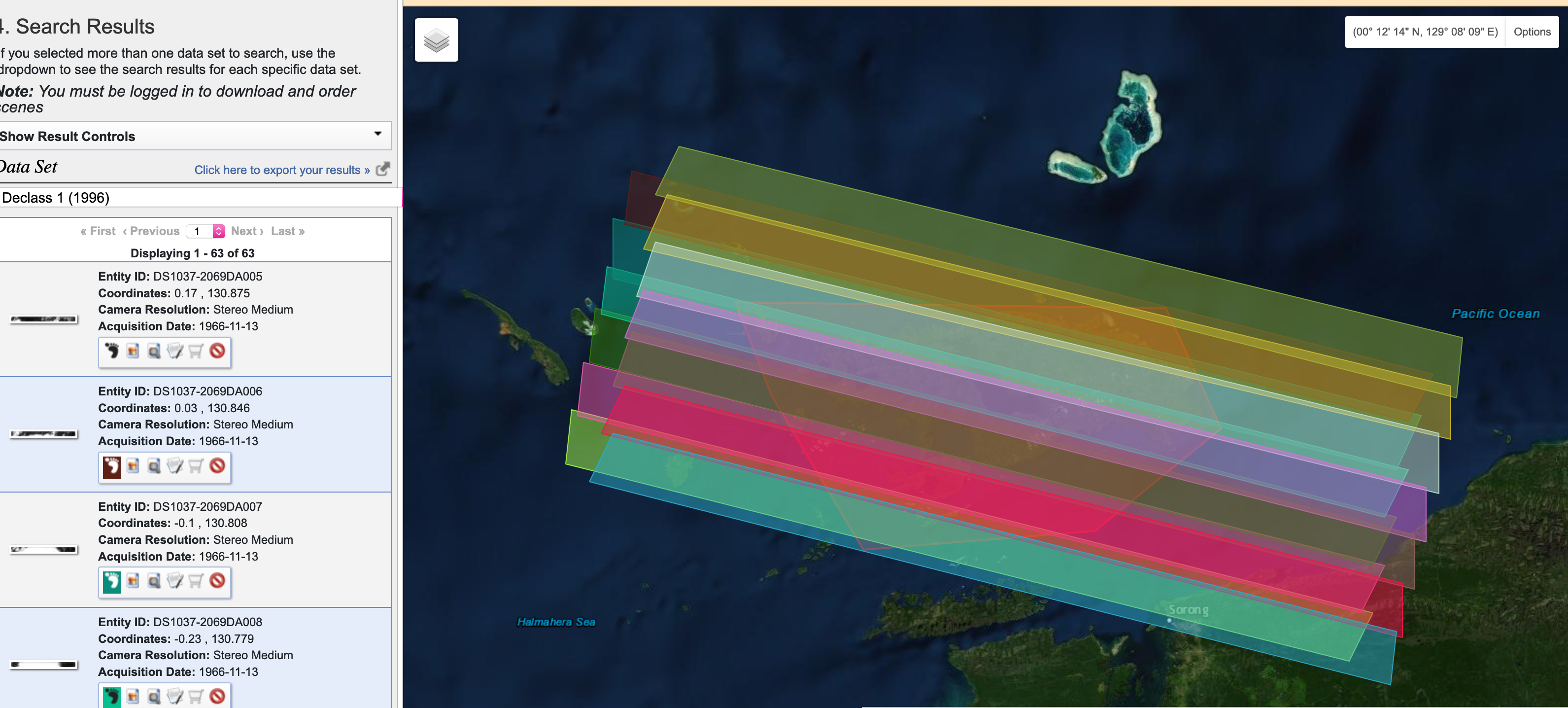
The first place to go, especially if you want to compare features over large areas, is the incredible collection of declassified, American spy satellite photographs with the top-secret Corona or Keyhole Program. USGS maintains a searchable index on its Earth Explorer platform.
Corona Images of Waigeo
I did some research and the results were no good – all those stereo images, but everything’s covered in clouds! Those were the breaks before infrared scanners. Spies thwarted by clouds!
Searching your site on this platform requires selecting a polygon and then selecting “data sets”. Here you can see the polygon around Waigeo and then the “footprints” of resulting “keyhole” photos, stereo pairs, medium res, on November 13, 1966. The “F” and “A” in each photograph’s code means “fore” and “aft” cameras. If these images were not blanked out by clouds, then one could download these and assemble 3-d pairs. The little thumbnail of each image shows that these frames are totally white, so no use.
Also, the little icon of the red circle with a slash means the frame isn’t already digitized and downloadable. This means, if the frame was clear and gorgeous, you’d have to click the little shopping cart and BUY it at $30/frame. IF these were clear frames, then you’d be spending $360 to get 12 frames for building stereo pairs of the whole island for Nov 13, 1966.
Sadly, at least for us, it was a cloudy day on Waigeo on Nov 13th, 1966 so whatever was happening that day on the ground is lost.
But this isn’t it. For this region, I know that the final year of Allied military campaigns in the “southwest pacific theater” brought bomber squadrons to Papua, so I’m going to shift gears and look for Army Air Force images.
Researching WW2 historic imagery requires a little bit of knowledge about the ways state governments and militaries organized their air photography…but with a little bit of luck…and some good old fashioned word searches…we might find some imagery.
US Army Air Force Photography
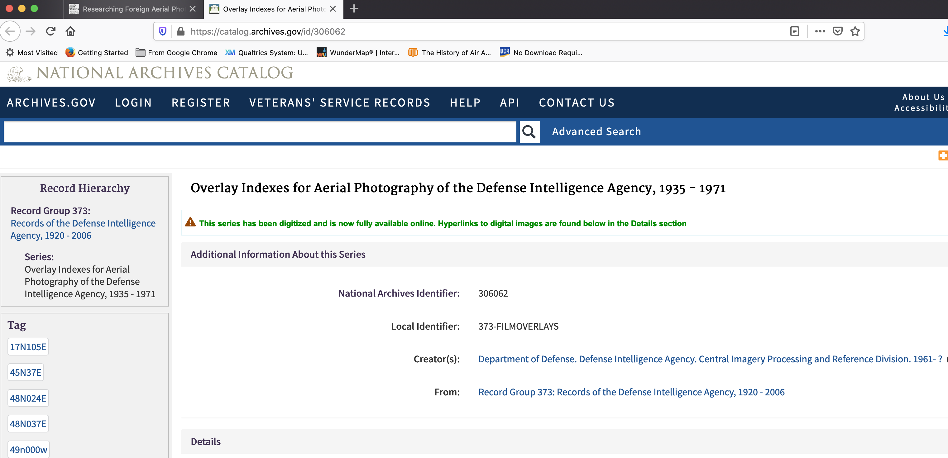
The historic collection of American air photos, including original celluloid roles of 9-“ wide film, is catalogued in Record Group 373 – Defense Intelligence Agency. Yep, you need to go down the rabbit hole of mid-20th century American military spying! (cue the music!)
During WW2 the operation was analogue but highly sophisticated, and in the 1950s it mushroomed into a huge effort to spy on everyone and photograph the entire Earth! One org, the National Photographic Interpretation Center, NPIC, launched under Kennedy in 1961 had an army of photogrammetrists, photo interpreters, and “intel” people pouring over photos like these and the Corona ones to document what everyone else was doing. Since the 1980s, most everything moved to digital scanners in space, think Landsat and secret military satellites. So these collections – film-based, archived – are really special, a 1930s-1970s time capsule compared to the flood of digital information since.
I first googled “army air force photography papua” and my first link turned me here, to this unexpected source at Library of Congress:
What I get from this is that the Army was busy studying key airfields on the northern coast of Papua, they even drew up pretty topographic maps (derived from air photos) in the Army Corps of Engineers standard way (also interesting, this history of Army Corps styles and conventions, line widths, symbols).
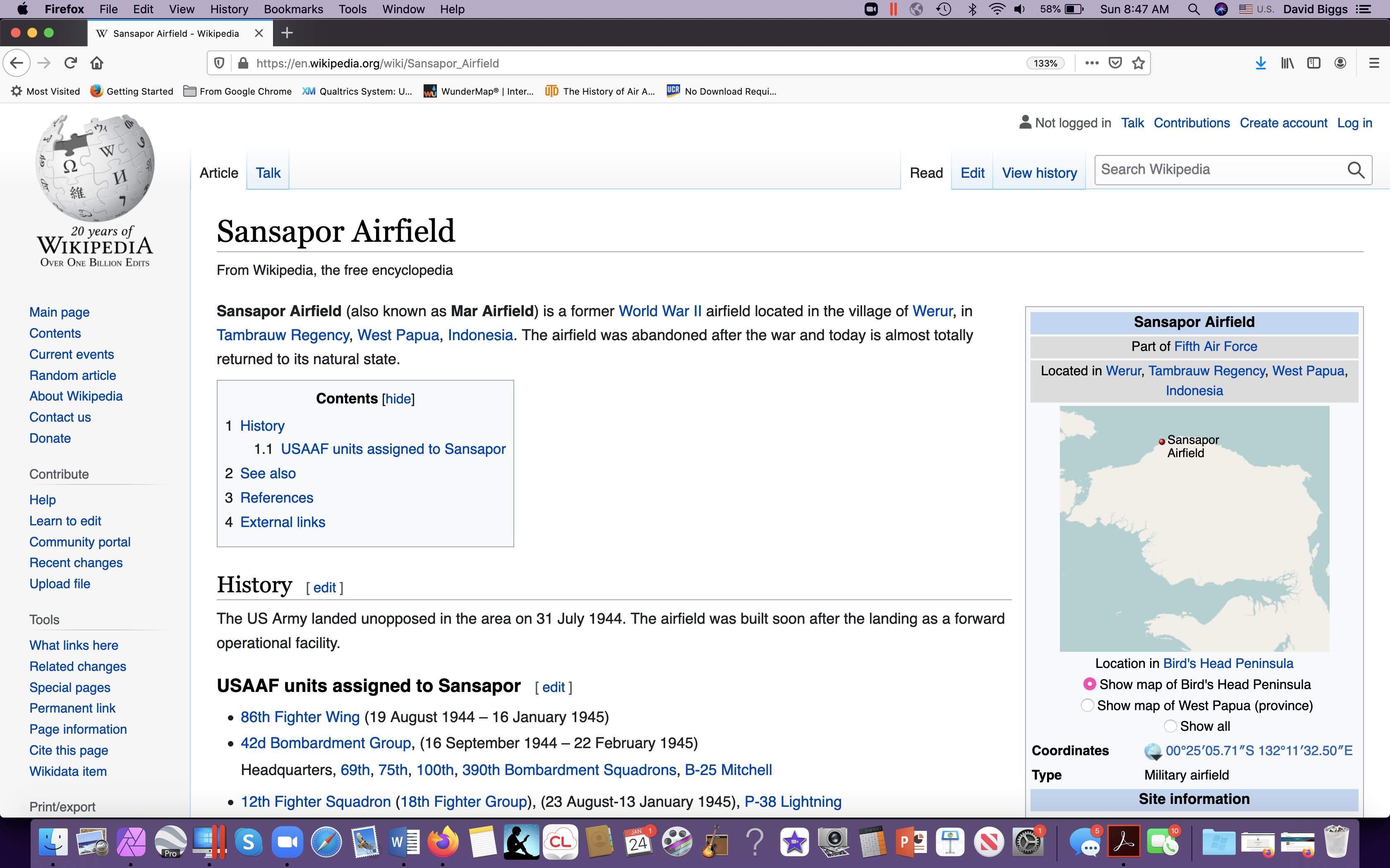
Nothing specific to Waigeo but some nice descriptive material about an aerodrome just to the southeast of it. So, a trip to Wikipedia, for more…
A military historian might then look at units assigned here, just to get a sense of the level of activity. Militaries are the ultimate Anthropocene organizations! Studying them is like studying industrial tree plantations or oil and gas pipeline projects. They have what’s called an “Order of Battle” that is a tree-like structure of their organization, and at the larger “trunk” levels, each unit has historians collecting photographs, writing up reports, etc. So they can be useful windows into stuff like SPECIES, esp. fish and trees, in 1944. Here I find a LOT of units:
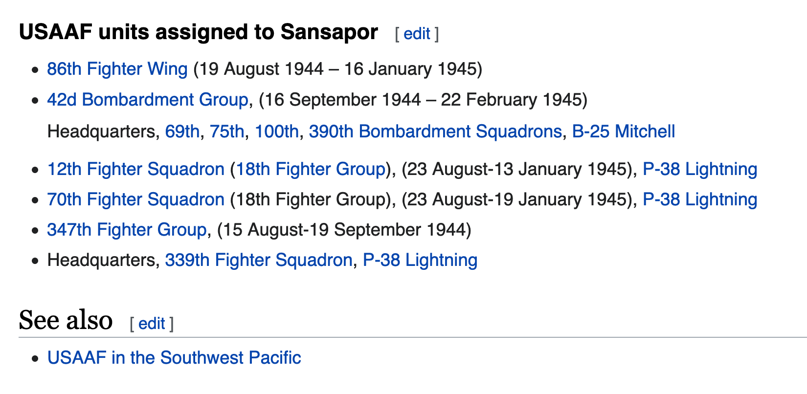
So, now I want to check out military history records for more descriptive information. The Center for Military History and Defense Technical Information Center (dtic.mil, we love acronyms!) contain MANY useful histories of these units and military air reconnaisance, for ex. Piercing the Fog:
Chapter 5 is an account of that “southwest pacific” area, 1942-45, so worth a read. I’m only familiar with the Ch 6 accounts given that the B29’s were also bombing Vietnam in 1944. Also cool, “Japanese air intelligence.”
I took a side detour and was curious to find more recent USGS-related mapping, using space photography to study retreating Papuan glaciers. Not related to Waigeo, but fun and it draws on those 1942-45 AAF photos.
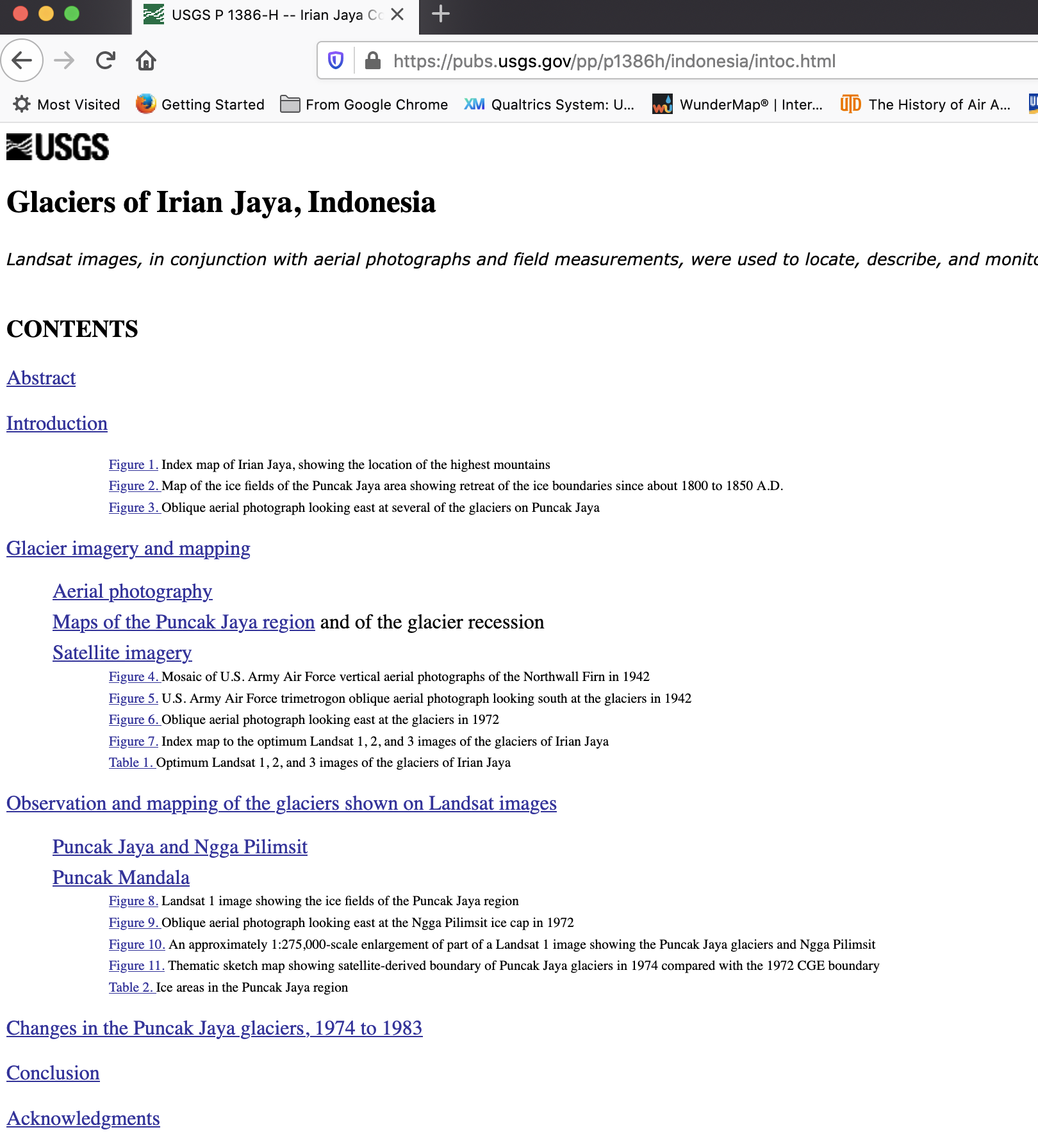
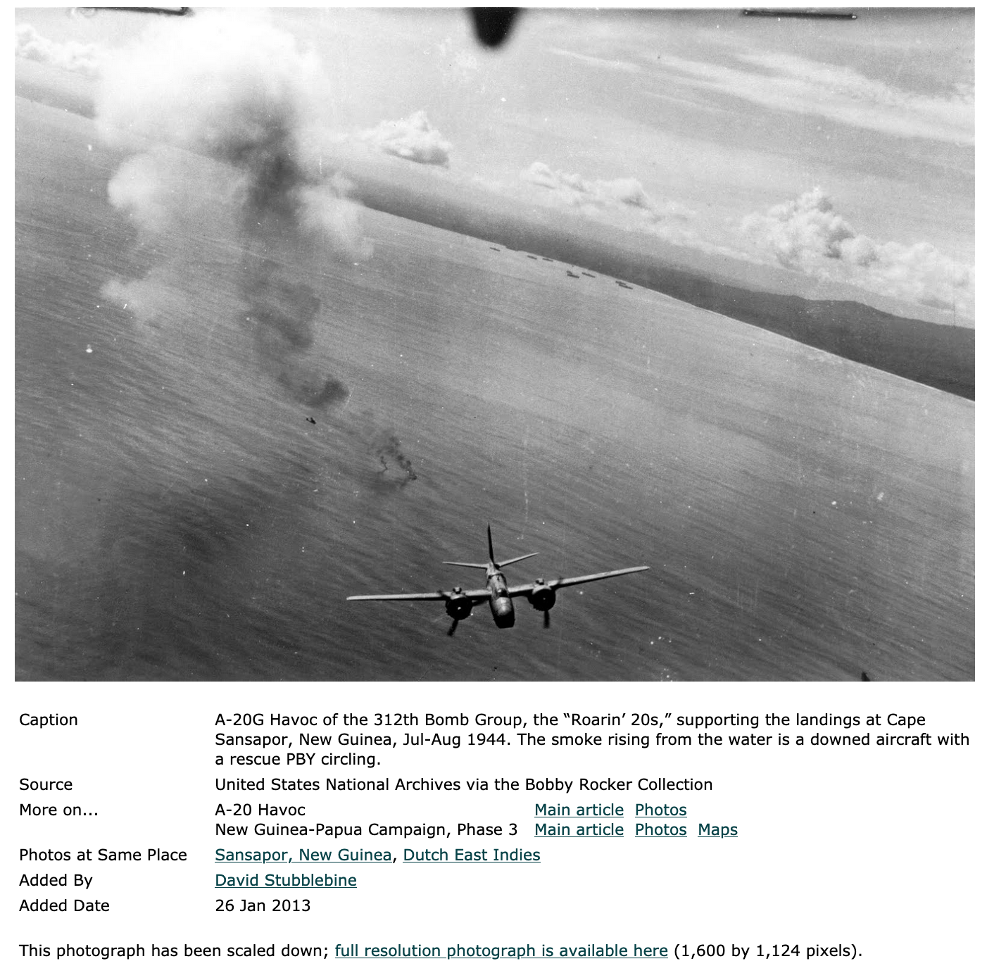
One pic from loc.gov searching turned up this view of Sansapor, too:
And besides Japan and the US, Aussies were snapping pictures of Papua from the air, but I guess the eastern (British) side:
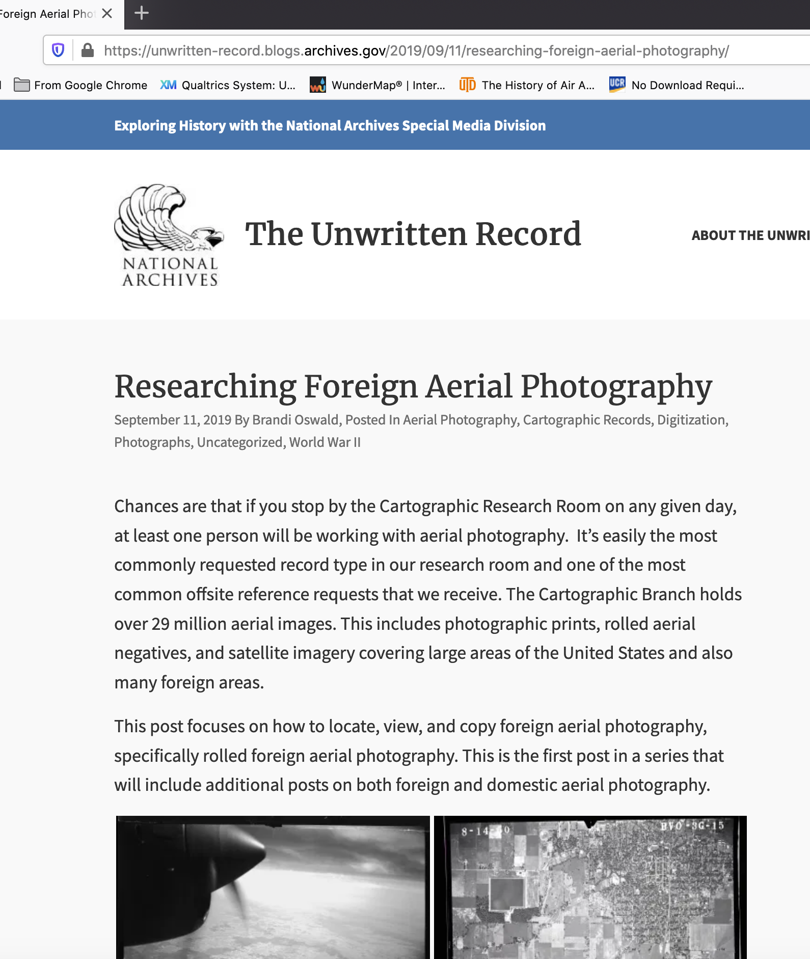
Moving on to the US National Archives, they have really upgraded their digital offerings. Nice explanations on their “Unwritten Record” blog about their photographic collections, esp. foreign imagery collections that MIGHT include captured Japanese materials post surrender in 1945:
At first, I wasn’t sure if it was NW or SW corner, so here:
Clicking on the overlay index, nope, too far north.
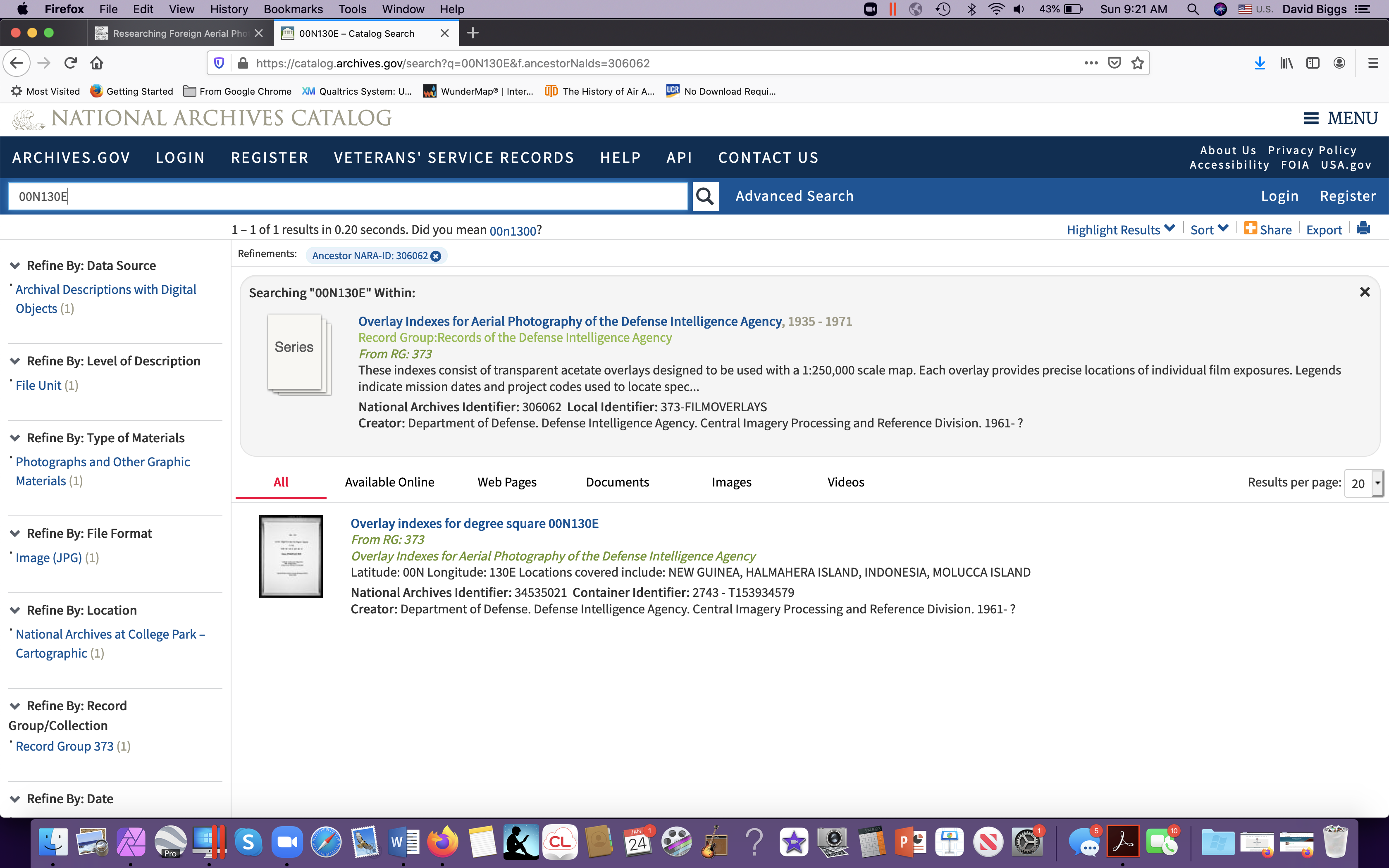
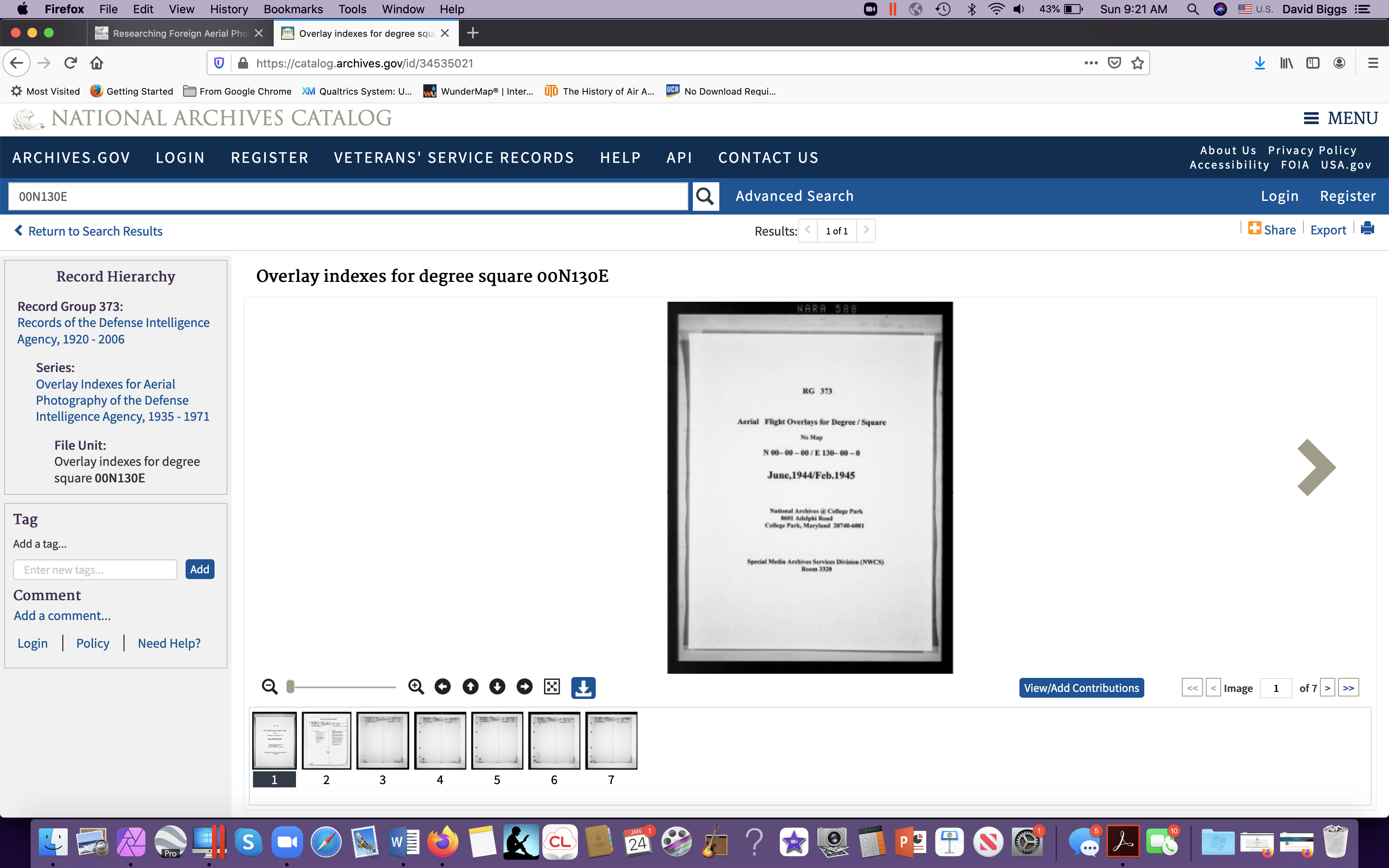
The first page for each index should be a 1-degree MAP, but this degree square lacks one, and I think I got the system wrong, so trying 00S130E (south of the equator), I get Waigeo:
Bingo! There’s Waigeo! So now the trick is to figure out if the American military ordered up any pictures on the island. To use it in this digital form, it helps to put a sticky on the screen of the area of interest, say a village on that inlet, and then scroll through each one. Sounds complicated, but when you try it you quickly get the hang of it.
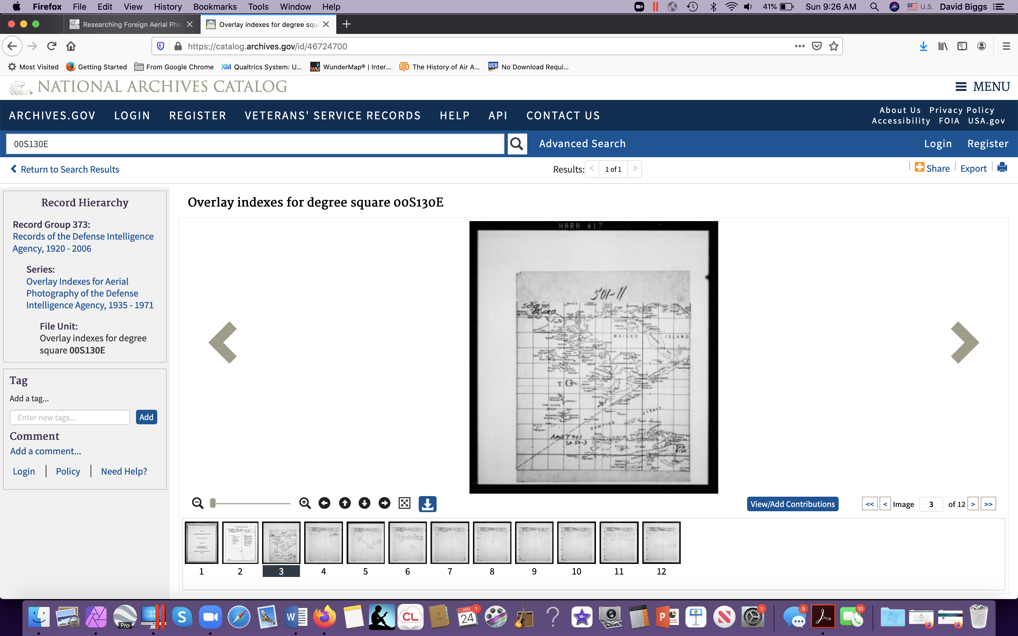
Here’s the index map for 00S130E (south of the equator and 130 degrees east of Greenwich). I’ve highlighted a rectangle (imagine pasting a sticky on your computer screen).
Here’s the index map with “sticky”:
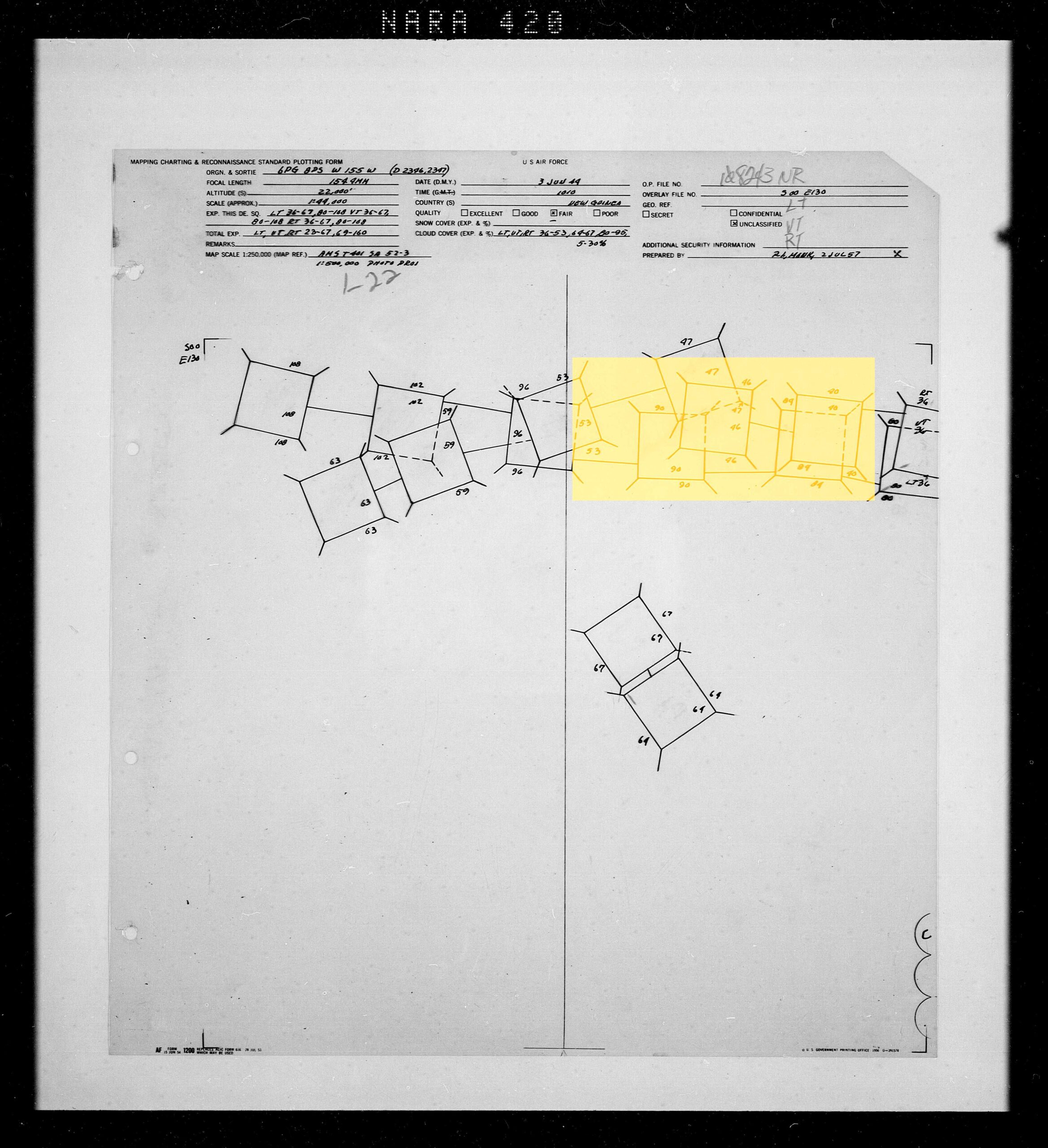
Now here’s a page of an air photo reconnaissance mission, clicking the next frame but keeping my sticky:
This tells me I have a HIT! Probably 25 photographs shot over my study site. We struck gold! However, look at the rest of the island, mostly empty. So it really is hit or miss whether you can find historic imagery completely covering a large study site. Let’s look at the collar info for some more details – if we were requesting this can of photo-negative film, we’d need it the OP(eration) Number.
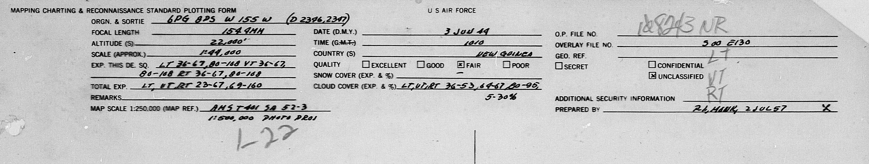
Besices giving an OP number, penciled in later, the info here tells us that the view was partly cloudy, so beware. Also the date and some other info. Upon requesting the film you may find other issues, too, like the can cannot be found. And upon request, readers have to wait several days for the can to be physically retrieved from a salt mine near St. Louis, flown on a daily flight to Ft. Meade (NSA) and then driven to College Park and the NARA reading room. (For a brief overview of this amazing process, see my piece here.)
Also interesting (to me) is that this index was created in 1957, supporting a global mapping effort during the Cold War.
From here, the search for imagery requires physically going to NARA in College Park and requesting rolls of film (or hiring a very expensive research contractor).
Besides imagery, of course there are historic maps that can also be very useful especially for all of the details mapmakers inscribe as they convert air photographs into simplified information.
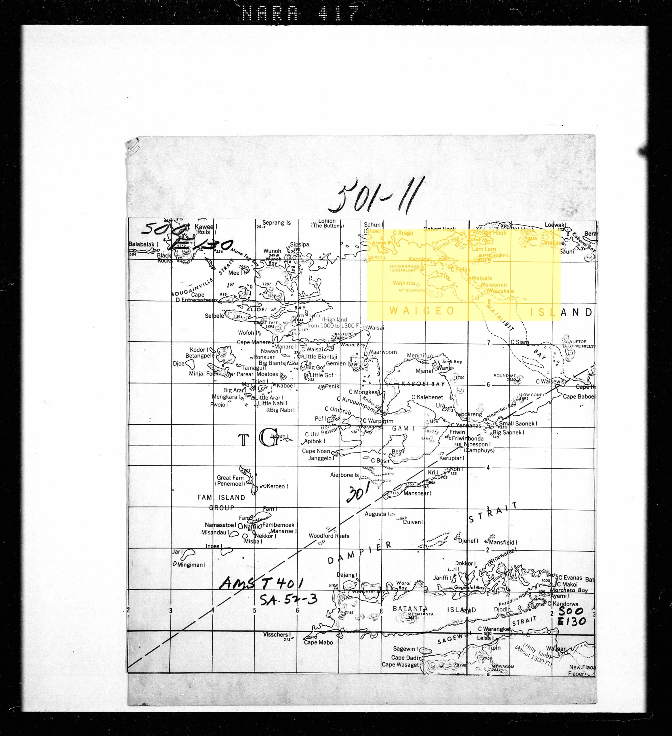
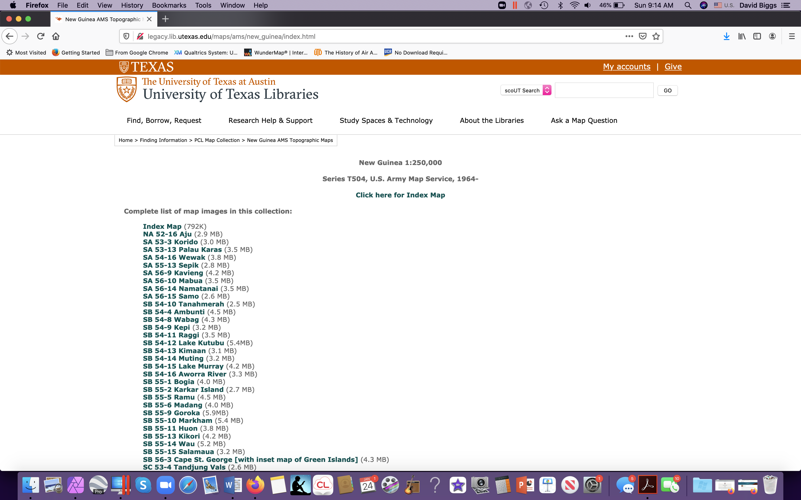
US military maps, too, can be very informative! One possible source for historic maps of your study area is the Perry Casteñeda collection at University of Texas. Here’s the index page for Indonesia:
With map-research, I think it is always best to start with smaller scale maps, 1:250-000 for ex:
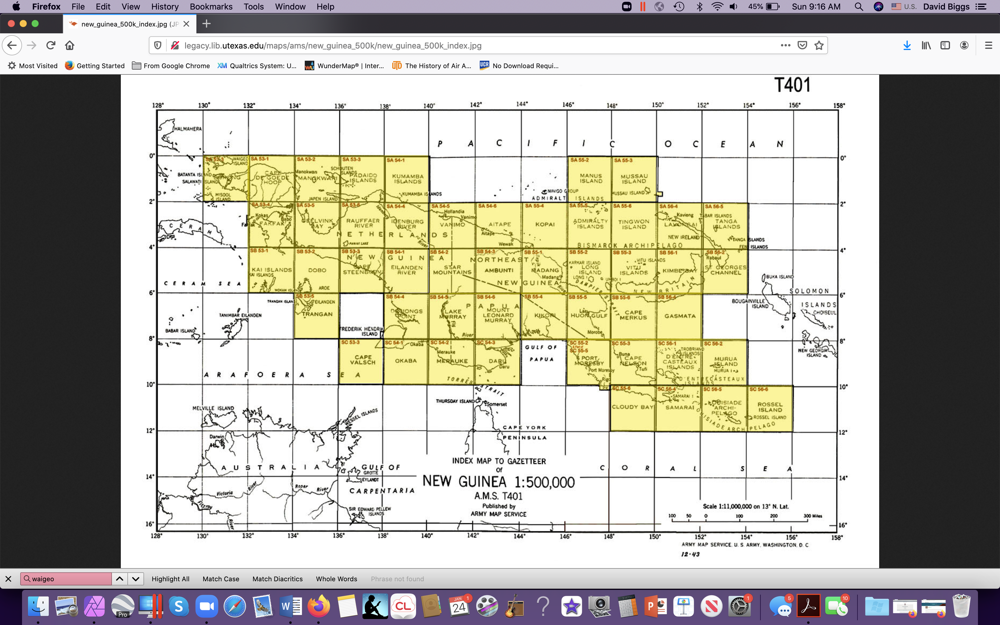
Then, select the one, and if you are uncertain, “Click here for Index Map”. And you get a page like this:
From there, we can find Waigeo up in the northwest corner. And highlighted grid squares mean they exist in this collection.
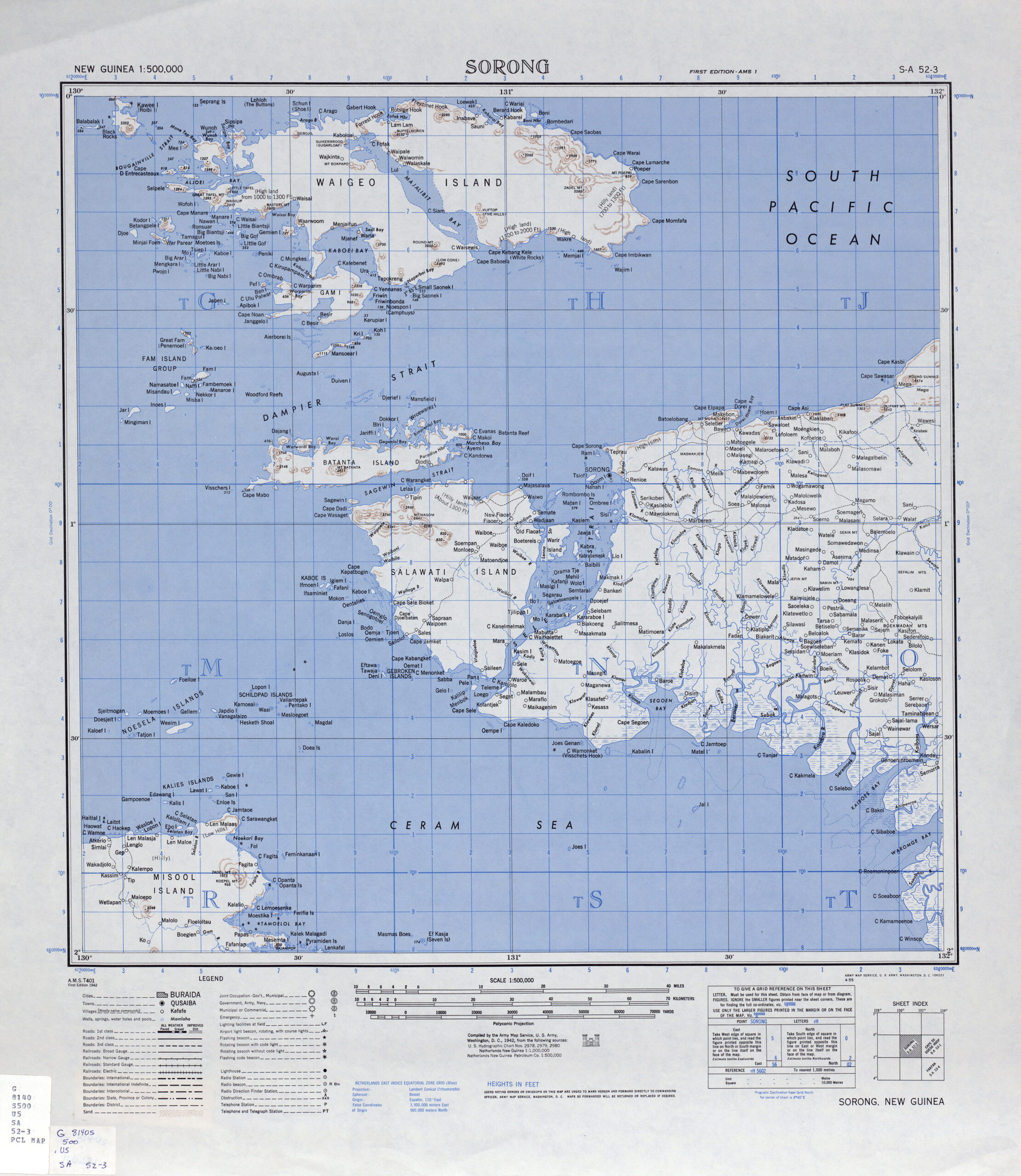
Isn’t it a beaut! No topography for Waigeo, but TOPONYMS!!!
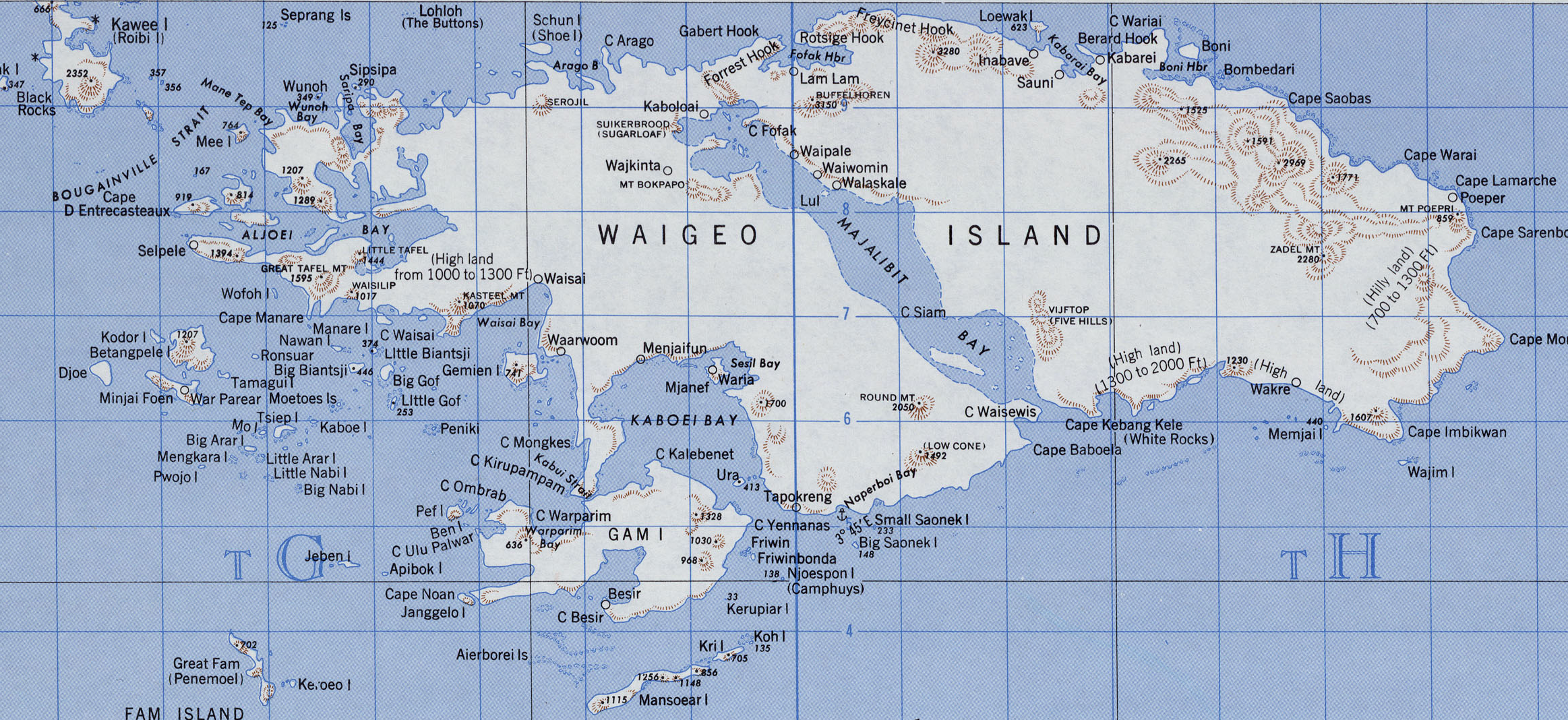
Here’s Waigeo:
And always read the collars! For map nerds, it’s mildly interesting that the map is based on a polyconic projection. Works better for equatorial locations. But the real info is what sources the mapmakers used.
I haven’t really scratched the surface of Dutch cartography, but I am fairly certain Dutch archives, museums and libraries have made their historical collections of places like West Papua fairly EASY to search.
I hope this tutorial can help you get started in researching imagery for your site!
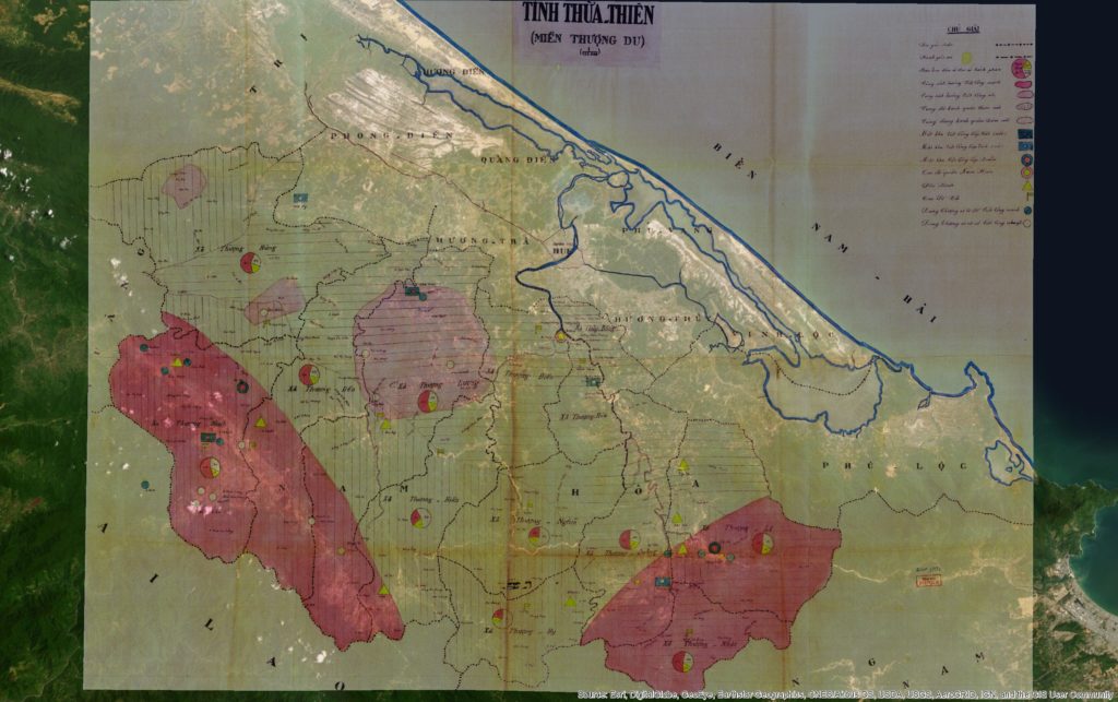
I had a nice skype interview with a grad seminar at my alma mater yesterday, UW in Seattle, and one student very rightly asked me when I was going to upload the map data I’d promised in my book to readers. The answer, friends, is NOW. I am renting some space on this server, 100GB, and I intend to USE IT! I’ll start with an archival map from the Vietnamese National Archives in HCM City from the records of the Cabinet of the First Republic of Vietnam (Đệ Nhất Cộng Hoa or Đ1CH in my notes in the book). The following image is super-cool as an example of American and CIA-inspired choropleth mapping used to describe communist-friendly areas in Southeast Asia. The use of pie charts, for example, with pink for “pinkoes” or “communist sympathizers” and the yellow for Republic of Vietnam loyalists (their flag was yellow with red stripes).
The map georeferenced, overlaying satellite imagery.
Here’s a link to the full-rez, georeferenced (for ArcGIS) FILE. Source info: File 17331, Record Group ĐICH, Vietnam National Archives Center No. 2.
Before I go further, let me just apologize outright to my geographer and GIS friends for providing no metadata on this. Please sympathize, I’m not an agency supplying data but an historian offering up usable files for the few.
Now, what’s cool about this map, especially when overlaying current satellite imagery, is how what was once a jungle clearing, bull-dozed grids of housing blocks and “enemy bases” has grown in the postwar era into a full-fledged town and district called Nam Đồng!
This illustrates a very important point about the communist nation-building effort, that not only were they establishing key strategic nodes in highland areas, but they were continuing a centuries-old program of “cultivating” these highland spaces. This term (giao hóa) suggests a particularly Vietnamese (and Chinese) style of interacting with highland groups. Bringing in highlanders to trade, providing literacy (in Vietnamese), integrating them into an expanding – topological – network of “the state”.
By contrast, the Diệm government, especially his brother Cẩn’s shadowy government ruling the central region, took a more brutalist approach to these highland areas that communists had been “cultivating” since 1947.
So, enjoy the map! Download the file, play with it, and let me know if it says anything more to you.
More info:
Here’s what I write about this map and how it fit into RVN nation-building in 1960, from Footprints of War, pp. 124-5:
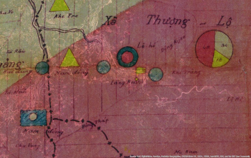
“The new military rulers in the uplands of the province introduced new political maps with light and dark pink shadings that conveyed their singular purpose of counterinsurgency. Dark pink described areas that were deeply contested while light pink suggested fading support. While such maps fed into national military planning for the RVN, they also informed American military allies who had for years been drawing up similar maps in neighboring Laos and Thailand. The military authors of this map used dark pink shading to indicate areas still largely under the communists’ control. They used a lighter shade of pink to indicate lighter opposition in the hills west of Hoà Mỹ and southwest of another evacuated area, Khê Trái.
As a cartographic projection of the ARVN’s ambitions in 1960 for mopping up these bases of communist support, the map presented communist-controlled regions in symbolic terms most familiar to American counterinsurgency experts at the time. Small pie charts in each highlands commune showed, via darker shaded sections, the approximate percentage of people who were “Việt Cộng in the region,” still a majority across the hills. Lighter pink shading indicated areas with diminished support, and colored or empty circles indicated villages that supported a particular side or had been abandoned, respectively.
Excerpts of the map showing the map’s deep pink areas, the hills around Nam Đồng and the A Sầu Valley, bear closer inspection, for they show how ecological and political boundaries coincided, often separating ARVN posts from communist base areas by only a few kilometers. Reconstituted self-defense units and communist cells, pushed almost to annihilation during several years of unrelenting police sweeps, extended their political and communications networks to the very tips of streams and tributaries on the highest slopes. ARVN troops could not easily penetrate the dense forests without support from Katus and highland groups while communist partisans retained the older practice of navigating by rivers and mountain ridges with help from native highlanders.”
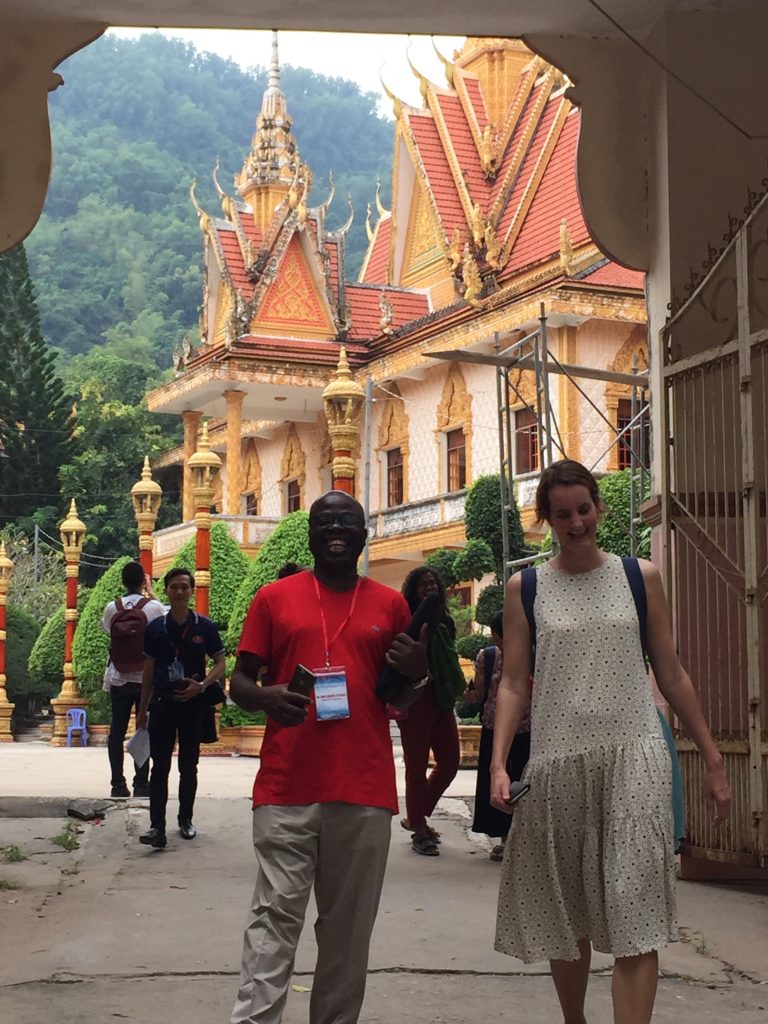
I had the pleasure of co-leading a group of graduate students to the Mekong Delta after having not been in the region for a good seven years. (My second book is focused on the central coast of Vietnam.) It was fun to revisit old sites and see old friends while traveling with the group. Below are some favorite shots from the trip.
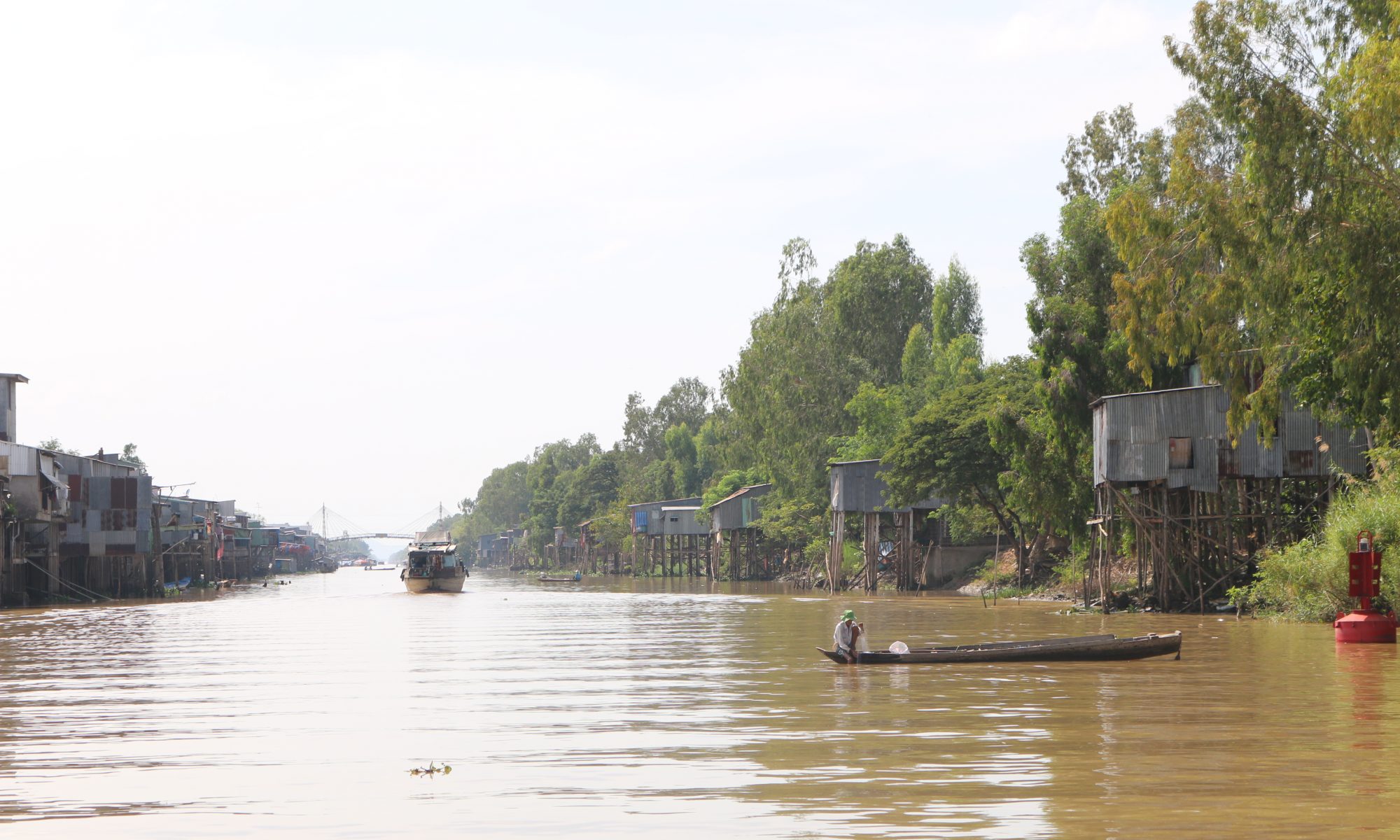
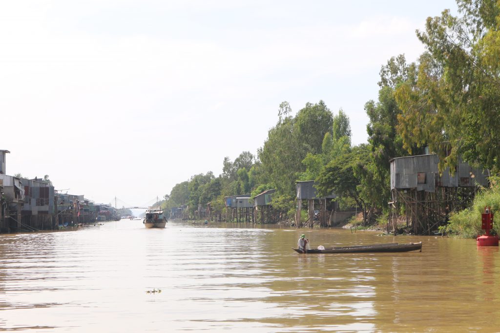
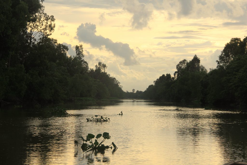
Vinh Te Canal. View looking west from Chau Doc.
I love the above picture for the layers of activity and occupation. Houses on stilts back up into the canal while int he foreground a man fishes from a “ghe tam ban” or three plank canoe. In the distance, a barge approaches us. The water is reddish brown and opaque, almost milky with the fine silt washing down from the Mekong.
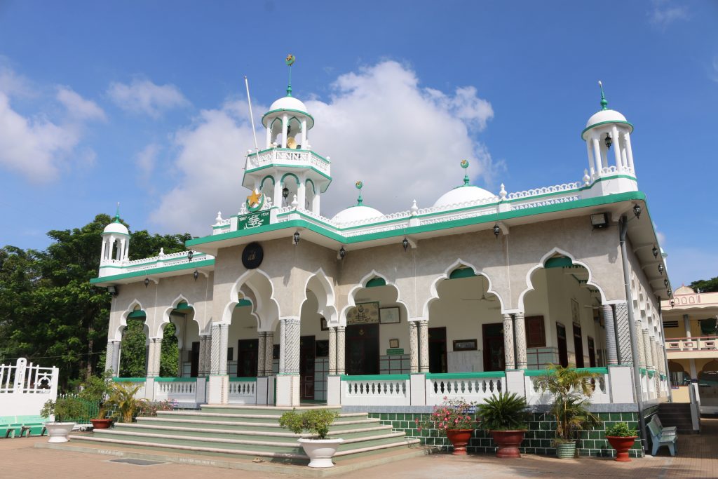
Chau Giang Mosque.
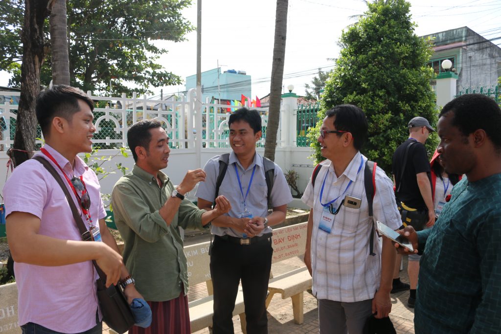
The group visited the Cham muslim community’s central mosque. During the visit, one of the imams received our group, and I learned something new.
Imam explaining the mosque and community history.
He corrected me on the history of *his* community and ancestors. They were not Chams who migrated west to the region in the 1700s and later converted to Islam but instead Malays who migrated north and east from Terengganu in Malaysia through Cambodia in the 1700s and finally settled here. Because Cham and Malay are distantly related, Austronesian languages, the Viet chroniclers and imperial officials in the area simply classified them as Cham. The post-1975 Socialist Republic of Vietnam likewise recognizes this community as a Cham ethnic group. One of the students, Nurrhoman from Bandung, Indonesia, communicated some basic phrases with the imam in Malay/Bahasa.
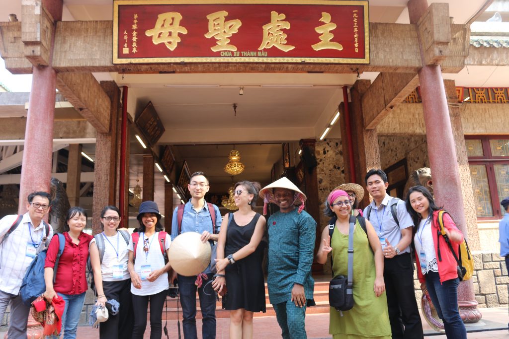
Group at Miếu Bà Chưa Xứ.
We visited a number of important spiritual sites in the region, including this temple dedicated to the Lady of the Realm, a goddess spirit followed especially by ethnic-Chinese inhabitants at a site that, in ancient times (before 6th century CE) was most likely a temple to Siva or Visnu. Allegedly those who pray to the Lady for good fortune who receive it must return to make offerings of thanks. The money from this return traffic then goes to various charities.
Prof. John Agbonifo and Martina van den Haak at Khmer temple, Oc Eo.
One great aspect of the trip was sharing the teaching with two fantastic scholars, John Agbonifo of Osun State in Nigeria and Debjani Bhattacharyya at Drexel University, and the author of the newly published Empire and Ecology in the Mekong Delta. It is a fascinating read!
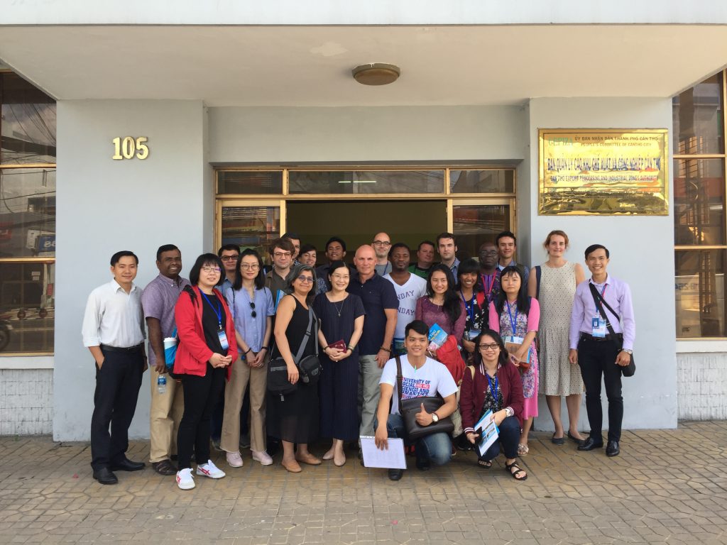
Prof. Debjani w/ a local official in Can Tho, myself and the group.
We ended our delta trip in Can Tho with several meetings in this booming city. I left it in 2011 at 500,000 people, and now the city has tripled in area with a population of 1.5 million! My favorite meeting there was with an old friend, Ms. Huynh Le, who visited the group and spoke about life in this boomtown.
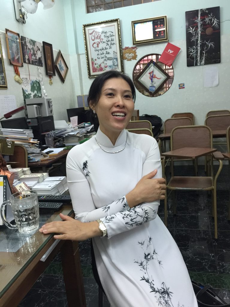
Huynh Le at her language school.
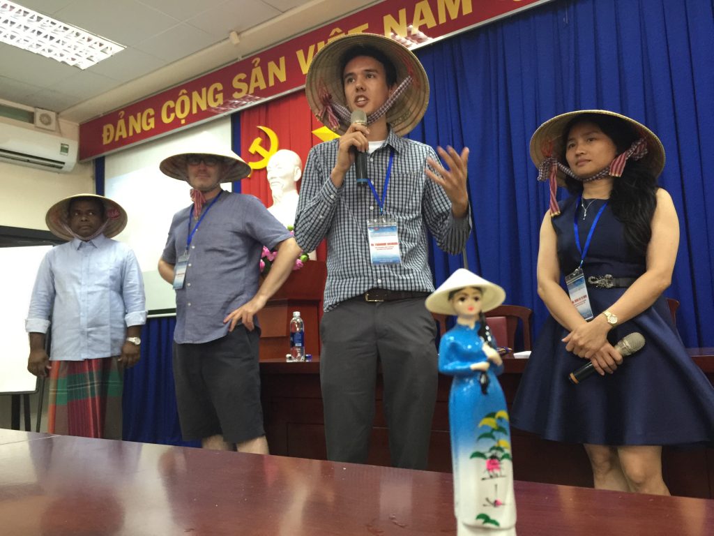
The trip ended in HCM City on Friday and students gave presentations on Saturday. Thanks to Ms. Hoang for the cute little souvenir! Pictured in the background is “Team Non Lá (Conical Hat)”.
Team Conical Hat
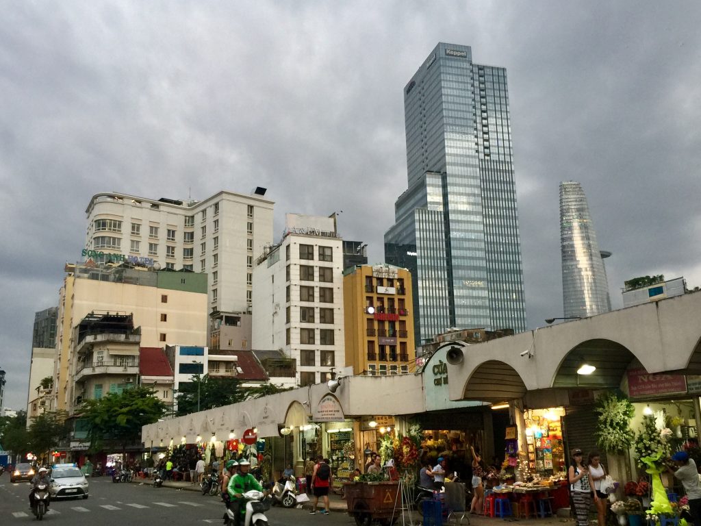
I leave you with a shot from old Saigon, the back of it’s main open air market. I like this shot for the many layers visible here. In the foreground the butcher stalls and flower stands of Ben Thanh. In the background are old facades from the French colonial and post-colonial eras. Then in the way back are the towering spires of recently completed skyscrapers. Farewell until next time, Vietnam!
Next week I am excited to be a co-leader for the Leiden-based International Institute for Asian Studies’ In Situ Field School. The topic is “Delta Cities: Rethinking Practices of the Urban. I’ll be joined by two fellow “delta scholars” I very much admire:
Debjani Bhattarchaya – who has just come out with this FANTASTIC new book, Empire and Ecology in the Bengal Delta: The Making of Calcutta.
John Agbonifo – who as a sociologist with historian tendencies has produced AMAZING studies on resource conflicts in the Niger Delta.
Lục Bình (water hyacinth, Eichornia crassipes) on a Mekong Delta canal. Photo Credit: David McCaskey
Also in tow will be two UCR graduate students from the History program, David McCaskey and Todd Luce. It’s a rare pleasure to share a trip to my study sites with them. Luce is completing a PhD on the water politics and history of the Salton Sea while McCaskey is just beginning his research on fisheries and development in Vietnam.
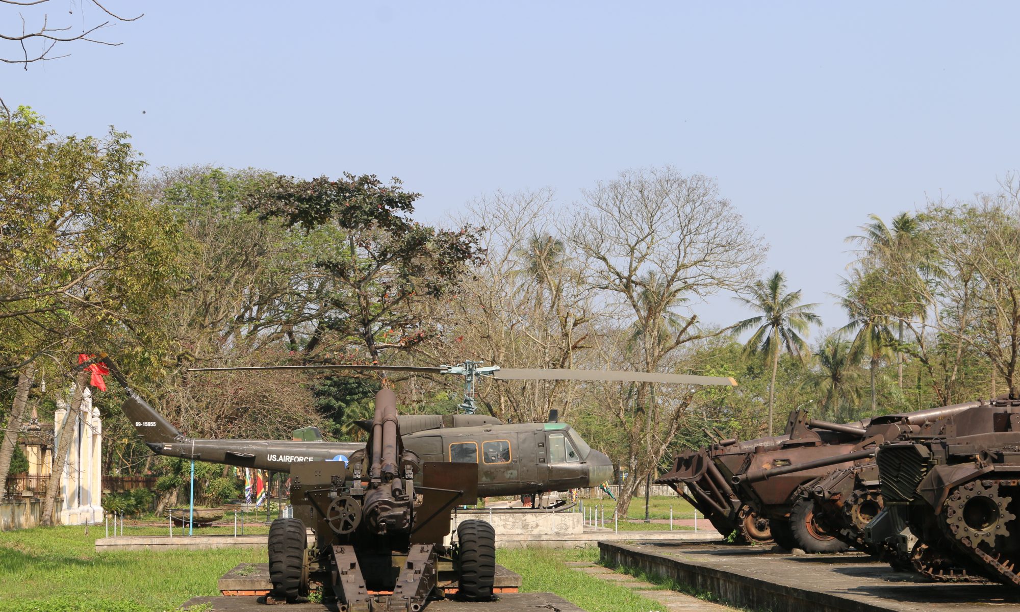
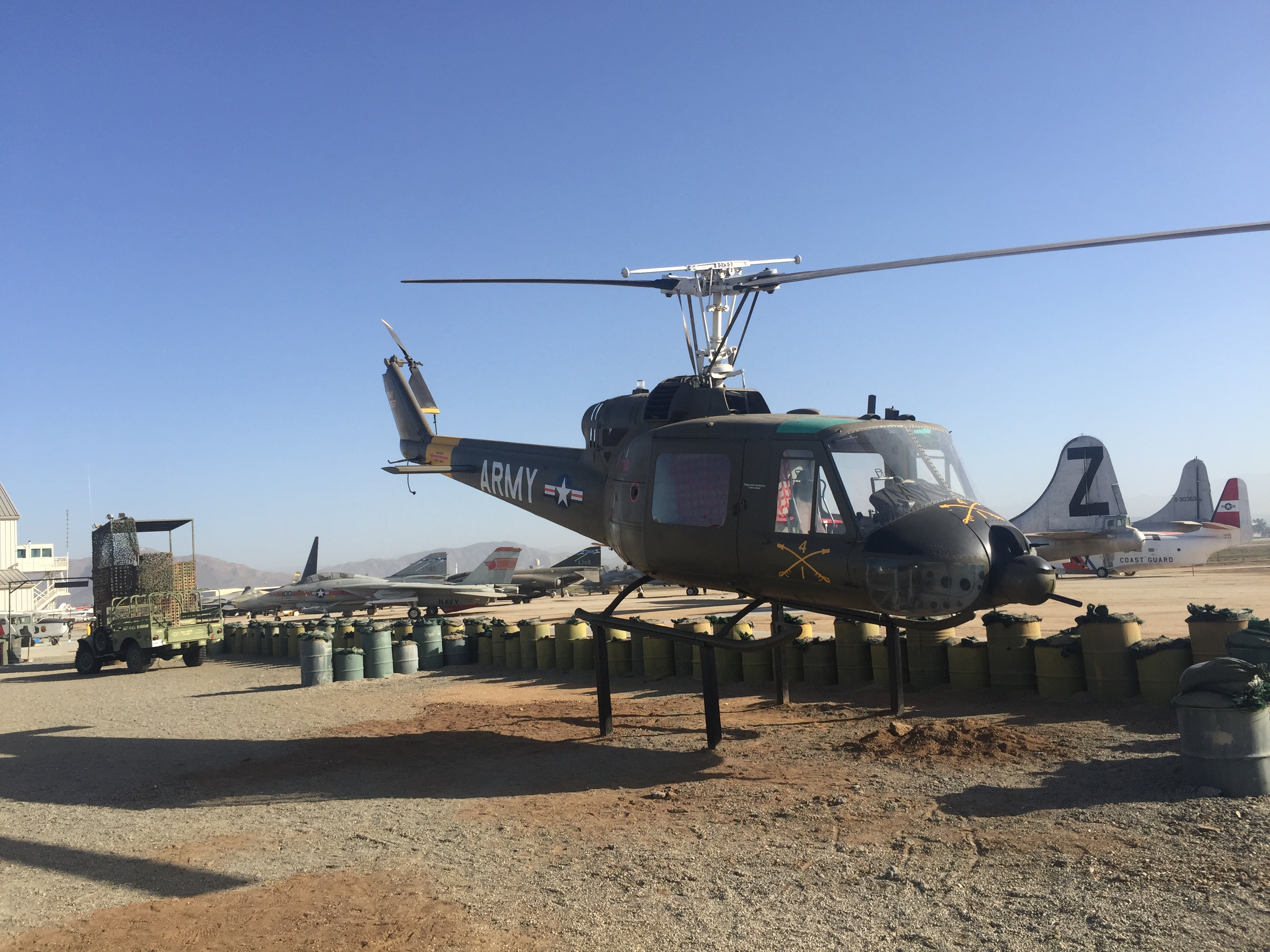
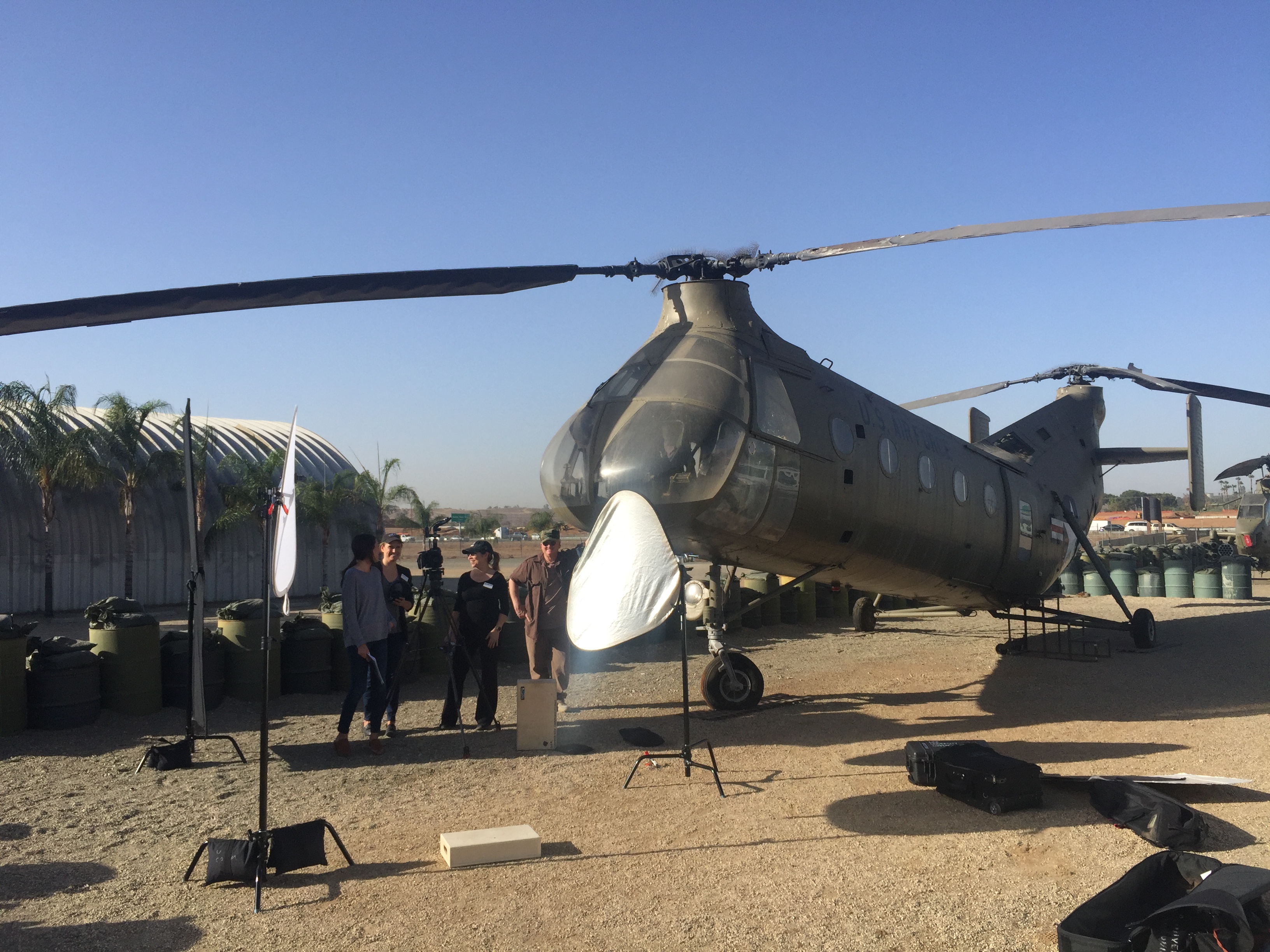
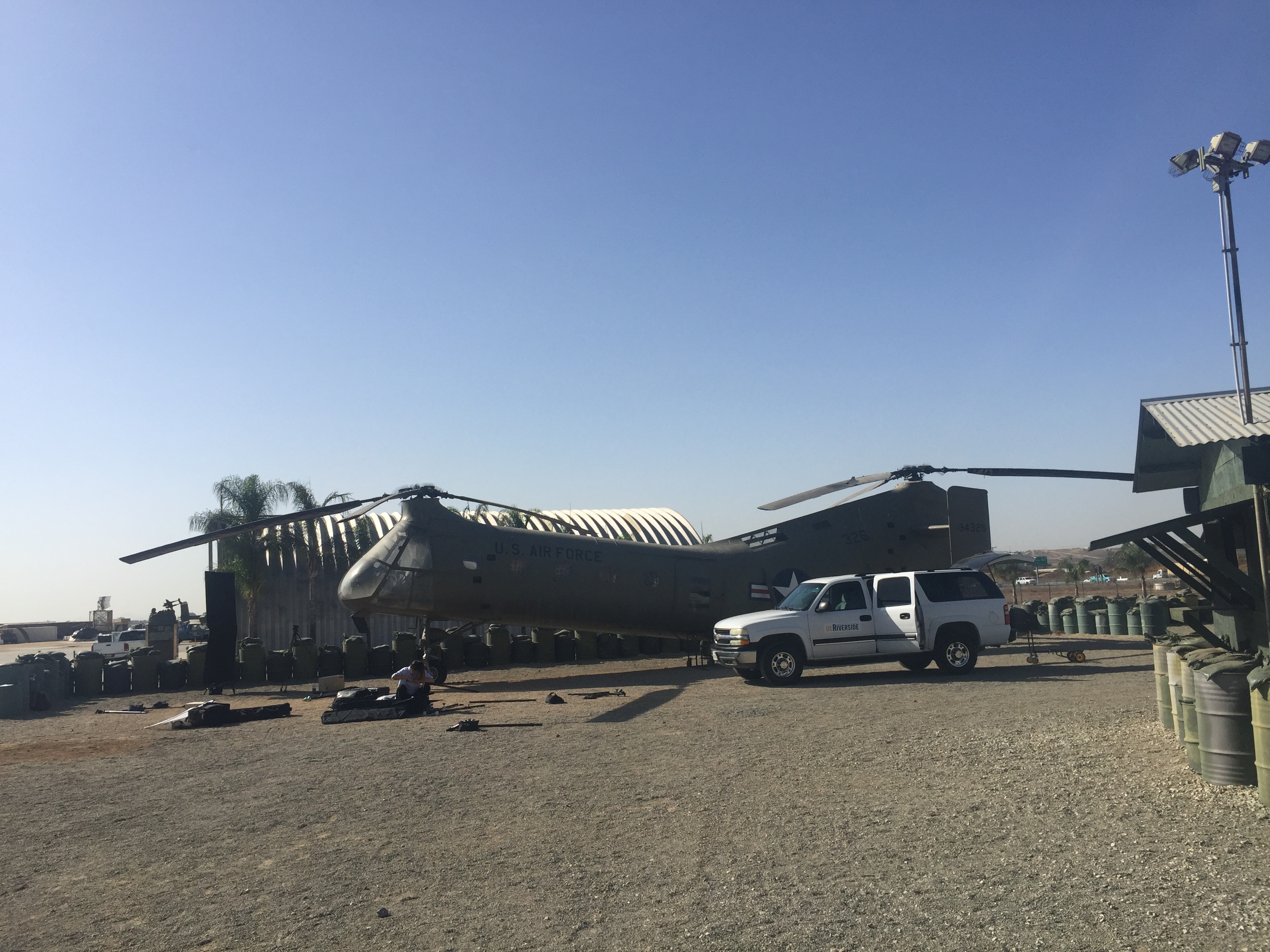
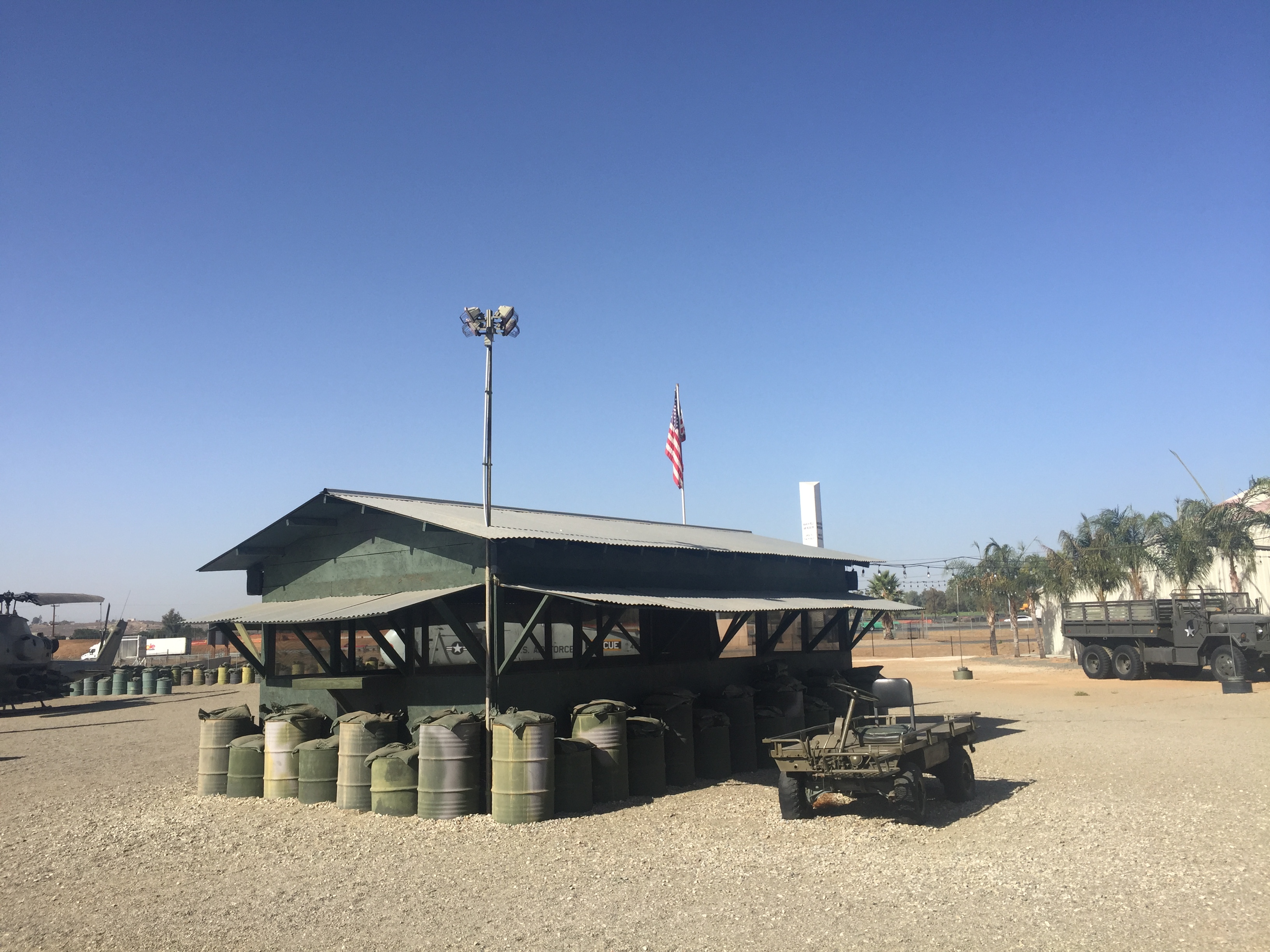
I worked with our crackerjack media team this summer to develop this video about my research and my teaching at UCR designed to complement an article and press release on the soon-arriving book. Of interest to some, they wanted a location to shoot this that in some ways reflected connections to Vietnam. I didn’t really know how closely the nearby March Field Air Museum’s exhibits might relate, but we found that this all-volunteer museum, drawing on contributions from veterans, has reconstructed a Vietnam-era firebase. Pics below capture some of our shooting “on set.”
This autumn I get to teach one of my favorite survey courses at UCRiverside, a survey of early history in Southeast Asia. As a specialist on the twentieth century, the ancient past here offers me a return to the kinds of vacation-in-the-past adventures that sparked my childhood interests in studying history that led me here.
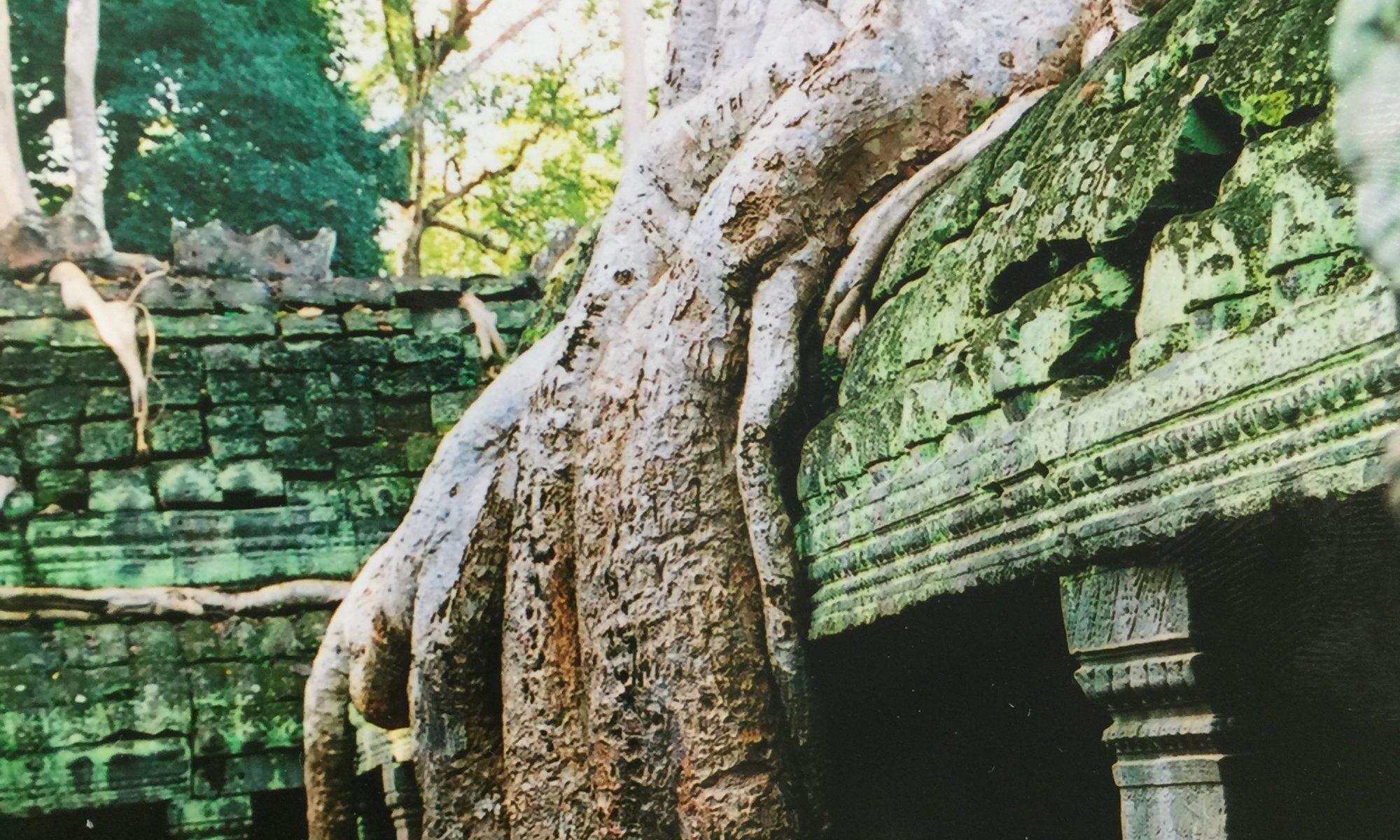
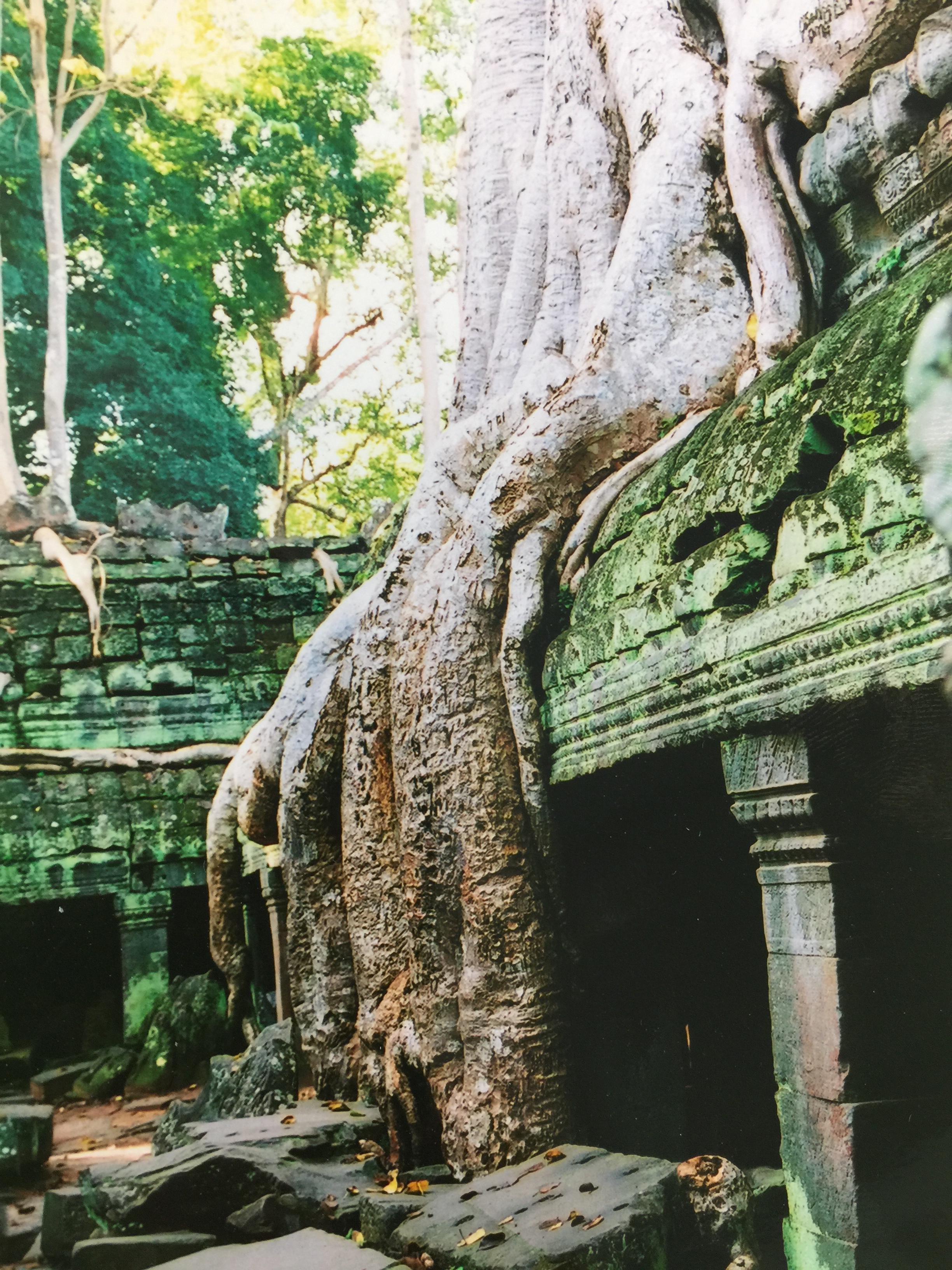
Ta Prohm Temple, 2005
I know that as a professional historian I should frown upon the romantic fascination with ruins or at least throw in a footnote. But I nevertheless remain captivated by sites like this, a purposefully-left, crumbling temple at Angkor Wat. These places, their multi-layered, material histories and even the ways they figure into the politics of the present fascinate me.
During my research in the Mekong Delta as a graduate student, I had the good fortune to visit Dr. Pierre-Yves Manguin‘s archeological dig at Oc Eo, a site important to an ancient kingdom of waterways and a city of warehouses built on wooden pilings known widely as “Funan”. Dr. Manguin’s research includes topics in my dream list of projects, the History of Boats in Island SE Asia.
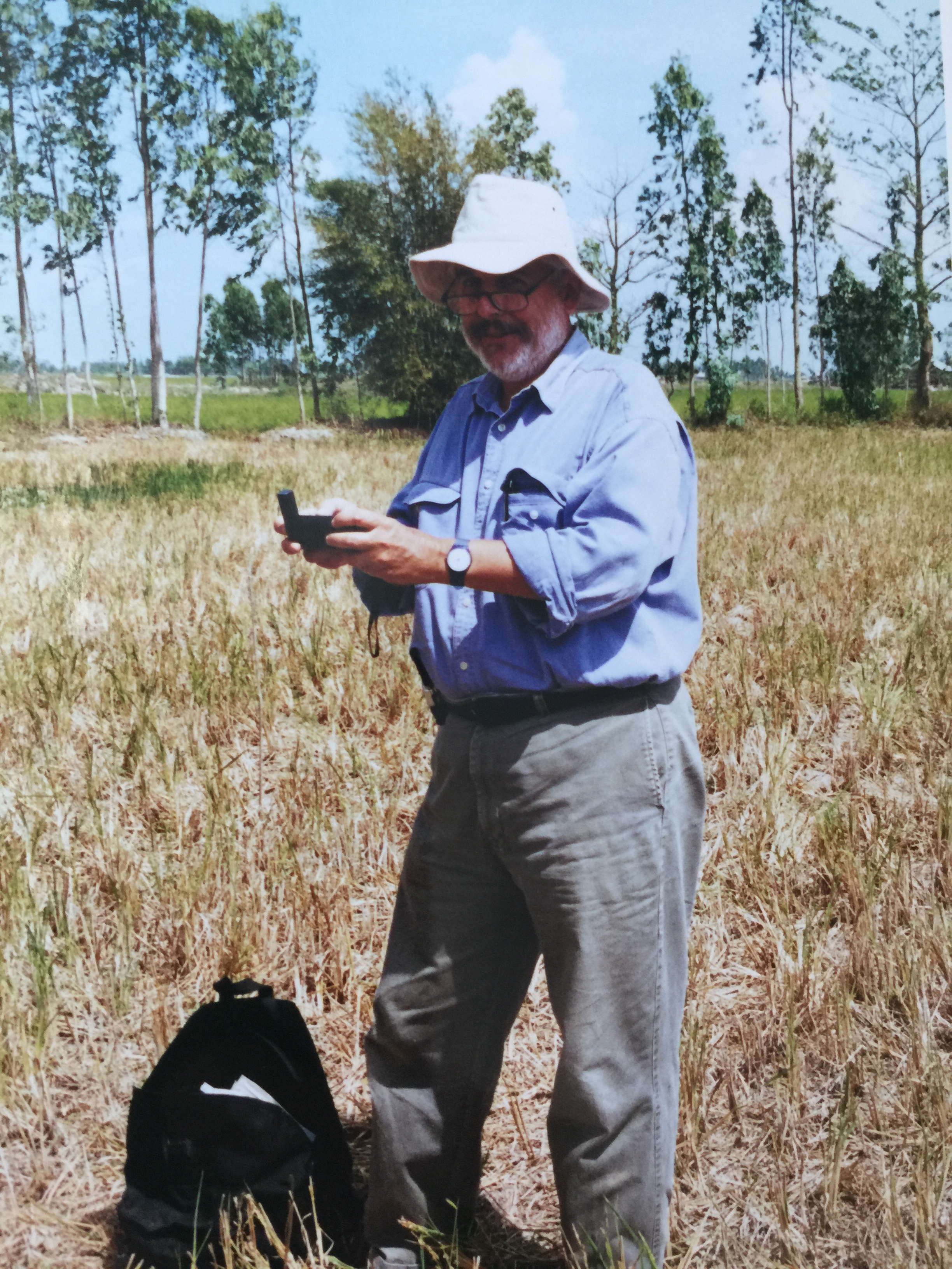
2002. Re-surveying Malleret’s 1944 dig site at Oc Eo, Kien Giang, Vietnam
Through Pierre-Yves and a fantastic staff of archeologists and ceramacists affiliated with the French School of the Far East (EFEO), I was able to witness not only a fascinating excavation of ancient baths and a newly excavated pilgrimage site but also the scholarly diplomacy of a French organization working closely with Vietnamese institutions, scholars and agencies.
I hope I can bring some of this escapist fascination with Southeast Asia’s ancient past to the enthusiastic young students at Riverside this fall. The materials are all nestled within our campus platforms, but I share my syllabus here.
We are finally going again! Next summer Hồng Anh and I will lead the UC Exchange Abroad Program to Vietnam in Huế for five weeks. Unfortunately the program is only open now to UC students, but it will be good to return with the family! If you know of students interested in going, let me know.
One nice souvenir from past trips is the blog “Hue Stories” that the American and Vietnamese students produce. Following here is a one story I particularly enjoyed – Boy with a Camera – by UCR student Phong Hong about his Vietnamese student partner Nhat Hao Tran Dinh.